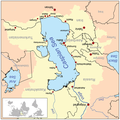
ચિત્ર:Caspianseamap.png

આ પૂર્વાવલોકનનું કદ: ૫૯૮ × ૬૦૦ પિક્સેલ. અન્ય આવર્તનો: ૨૩૯ × ૨૪૦ પિક્સેલ | ૬૦૦ × ૬૦૨ પિક્સેલ.
મૂળભુત ફાઇલ (૬૦૦ × ૬૦૨ પીક્સલ, ફાઇલનું કદ: ૧૯૬ KB, MIME પ્રકાર: image/png)
ફાઇલનો ઇતિહાસ
તારીખ/સમય ઉપર ક્લિક કરવાથી તે સમયે ફાઇલ કેવી હતી તે જોવા મળશે.
| તારીખ/સમય | લઘુચિત્ર | પરિમાણો | સભ્ય | ટિપ્પણી | |
|---|---|---|---|---|---|
| વર્તમાન | ૦૭:૩૦, ૨૦ ઓગસ્ટ ૨૦૧૮ |  | ૬૦૦ × ૬૦૨ (૧૯૬ KB) | SteinsplitterBot | Bot: Image rotated by 180° |
| ૧૫:૩૧, ૧૯ ઓગસ્ટ ૨૦૧૮ |  | ૬૦૦ × ૬૦૨ (૧૯૬ KB) | SteinsplitterBot | Bot: Image rotated by 180° | |
| ૦૨:૧૦, ૯ જાન્યુઆરી ૨૦૦૭ |  | ૬૦૦ × ૬૦૨ (૧૯૯ KB) | Kmusser | ||
| ૦૧:૫૩, ૯ જાન્યુઆરી ૨૦૦૭ |  | ૬૦૦ × ૬૦૨ (૨૧૨ KB) | Kmusser | ||
| ૦૧:૪૪, ૯ જાન્યુઆરી ૨૦૦૭ |  | ૬૦૦ × ૬૦૨ (૨૧૨ KB) | Kmusser | This is a map of the Caspian Sea including a small locator map. The drainage basin of the Caspian Sea is in yellow. The map is based on USGS and Digital Chart of the World data. Note t |
ફાઇલનો વપરાશ
આ ફાઇલ માં નીચેનું પાનું વપરાયેલું છે:
ફાઇલનો વ્યાપક ઉપયોગ
નીચેની બીજી વિકિઓ આ ફાઈલ વાપરે છે:
- af.wikipedia.org પર વપરાશ
- am.wikipedia.org પર વપરાશ
- an.wikipedia.org પર વપરાશ
- ar.wikipedia.org પર વપરાશ
- az.wikipedia.org પર વપરાશ
- az.wiktionary.org પર વપરાશ
- ba.wikipedia.org પર વપરાશ
- be.wikipedia.org પર વપરાશ
- br.wikipedia.org પર વપરાશ
- ca.wikipedia.org પર વપરાશ
- csb.wikipedia.org પર વપરાશ
- cs.wikipedia.org પર વપરાશ
- cv.wikipedia.org પર વપરાશ
- de.wikipedia.org પર વપરાશ
- en.wikipedia.org પર વપરાશ
- en.wikivoyage.org પર વપરાશ
- eo.wikipedia.org પર વપરાશ
- es.wikipedia.org પર વપરાશ
- eu.wikipedia.org પર વપરાશ
- fa.wikipedia.org પર વપરાશ
- fa.wikibooks.org પર વપરાશ
- fi.wikipedia.org પર વપરાશ
- fo.wikipedia.org પર વપરાશ
- fr.wikipedia.org પર વપરાશ
- gan.wikipedia.org પર વપરાશ
- gd.wikipedia.org પર વપરાશ
- he.wikipedia.org પર વપરાશ
આ ફાઇલના વધુ વૈશ્વિક વપરાશ જુઓ.


