
ચિત્ર:Dardanelles map.png
આ પૂર્વાવલોકનનું કદ: ૬૨૪ × ૬૦૦ પિક્સેલ. અન્ય આવર્તનો: ૨૫૦ × ૨૪૦ પિક્સેલ | ૫૦૦ × ૪૮૦ પિક્સેલ | ૧,૦૨૦ × ૯૮૦ પિક્સેલ.
મૂળભુત ફાઇલ (૧,૦૨૦ × ૯૮૦ પીક્સલ, ફાઇલનું કદ: ૨૧૯ KB, MIME પ્રકાર: image/png)
સારાંશ:
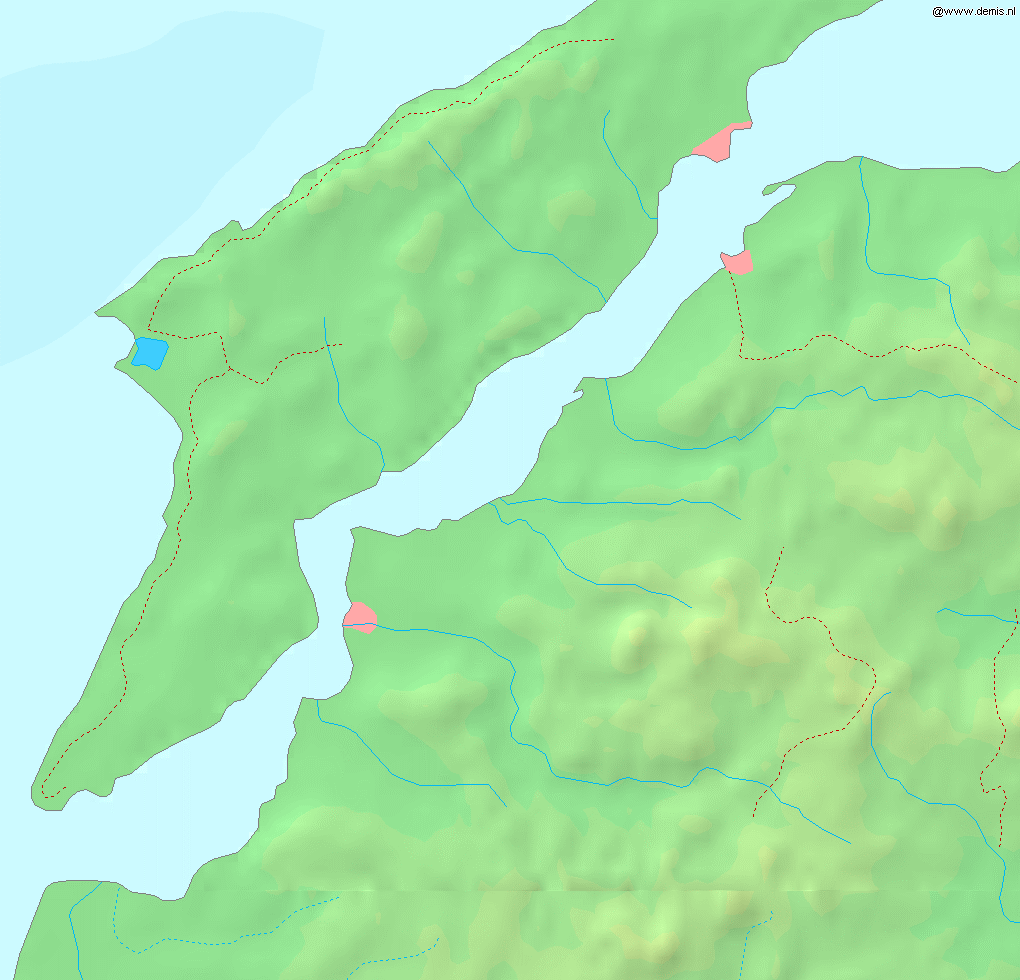
Map of the w:en:Dardanelles strait.
Bounding box West 26.15°, South 39.95°, East 26.9°, North 40.5°.
This image is in the public domain because it came from the site https://www.demis.nl/products/web-map-server/examples/ and was released by the copyright holder. Permission is granted to copy, distribute and/or modify this map since it is based on free of copyright images from: www.demis.nl. See also approval email on de.wp and its clarification.
|
| This work has been released into the public domain by its copyright holder, www.demis.nl. This applies worldwide. અમુક દેશોમાં કાયદેસર રીતે તે શક્ય નથી, જો તેમ હોય તો : www.demis.nl દ્વારા કોઈને પણ કોઈપણ વપરાશ, કોઇ પણ શરત વગર, માટે આ રચના વાપરવાની છૂટ આપાઈ છે સિવાયકે તે શરતો કાયદેસર જરૂરી હોય.
|
પરવાના
| હું, આ રચનાઓ પ્રકાશન અધિકાર ધારક, આ રચનાને public domain પર પ્રકાશિત કરું છું. આ સમગ્ર વિશ્વમઆં કાર્યરત રહેશે. અમુક દેશોમાં કાયદેસર રીતે તે શક્ય નથી, જો તેમ હોય તો : કો કોઈને પણ કોઈપણ વપરાશ, કોઇ પણ શરત વગર, માટે આ રચના વાપરવાની છૂટ આપું છું સિવાયકે તે શરતો કાયદેસર જરૂરી હોય. |
ફાઇલનો ઇતિહાસ
તારીખ/સમય ઉપર ક્લિક કરવાથી તે સમયે ફાઇલ કેવી હતી તે જોવા મળશે.
| તારીખ/સમય | લઘુચિત્ર | પરિમાણો | સભ્ય | ટિપ્પણી | |
|---|---|---|---|---|---|
| વર્તમાન | ૨૩:૨૩, ૬ સપ્ટેમ્બર ૨૦૦૫ | | ૧,૦૨૦ × ૯૮૦ (૨૧૯ KB) | Mats Halldin~commonswiki | Map of the w:en:Dardanelles strait. Bounding box West 26.15°, South 39.95°, East 26.9°, North 40.5°. {{demis-pd}} category:maps of Turkey |
ફાઇલનો વપરાશ
આ ફાઇલને કોઇ પાનાં વાપરતા નથી.
ફાઇલનો વ્યાપક ઉપયોગ
નીચેની બીજી વિકિઓ આ ફાઈલ વાપરે છે:
- eo.wikipedia.org પર વપરાશ
- fr.wikipedia.org પર વપરાશ
- sv.wikipedia.org પર વપરાશ