
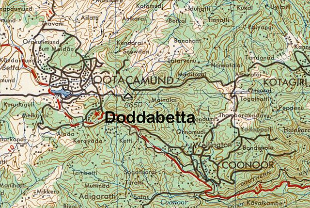
ચિત્ર:Doddabetta Peak.jpg

આ પૂર્વાવલોકનનું કદ: ૮૦૦ × ૫૩૬ પિક્સેલ. અન્ય આવર્તનો: ૩૨૦ × ૨૧૪ પિક્સેલ | ૬૪૦ × ૪૨૯ પિક્સેલ | ૧,૦૦૦ × ૬૭૦ પિક્સેલ.
મૂળભુત ફાઇલ (૧,૦૦૦ × ૬૭૦ પીક્સલ, ફાઇલનું કદ: ૭૯૫ KB, MIME પ્રકાર: image/jpeg)
સારાંશ:
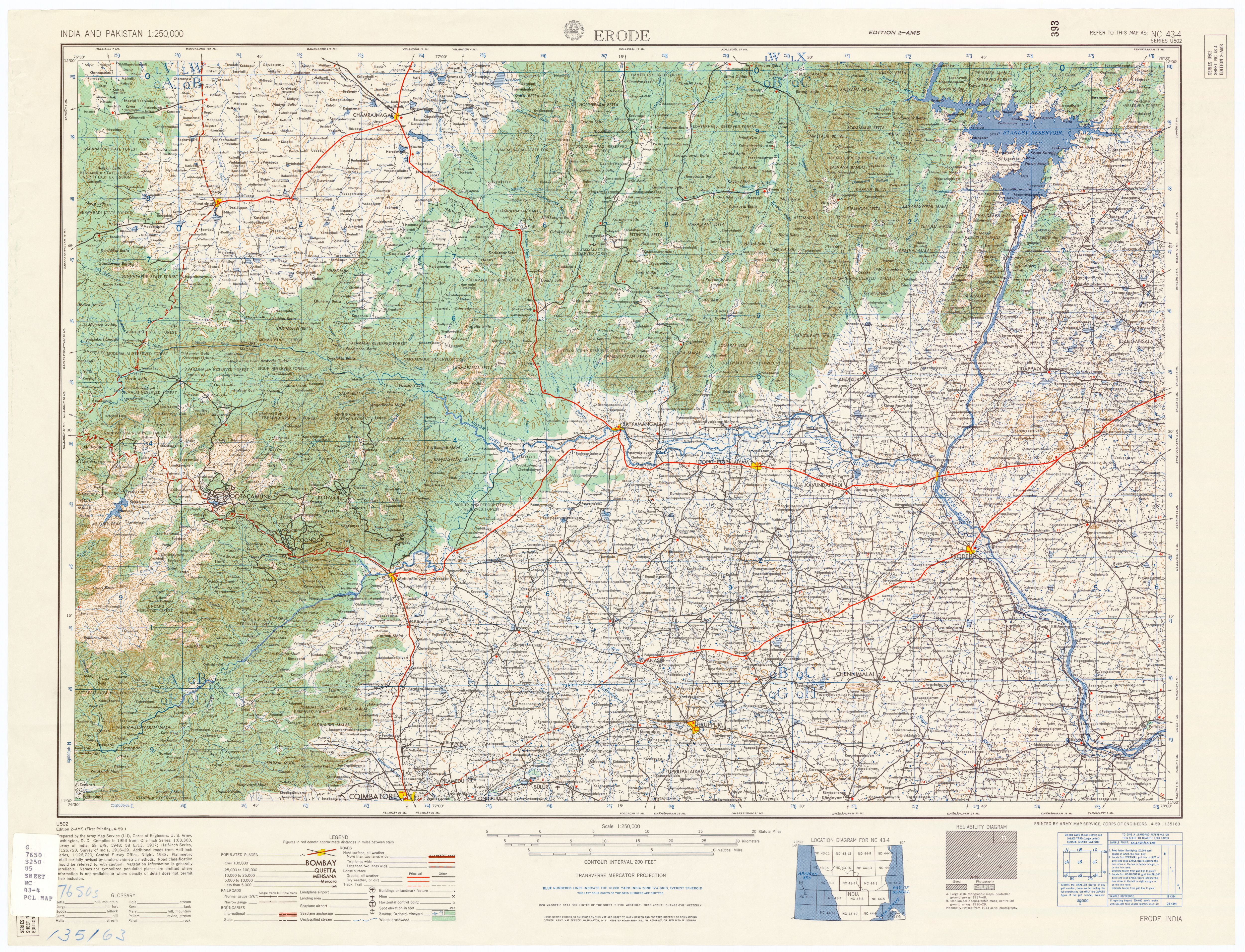
| વર્ણન | Topo Map, Doddabetta Peak, Tamil Nadu, India. |
| તારીખ | |
| સ્રોત | U.S. Army Topology Command, Erode India, sheet NC 43-4 |
| લેખક | U.S. Army Map Service, cropped by Marcus 9/1/2007 |
| પરવાનગી (આ ફાઈલનો ફરી ઉપયોગ) |
Public Domain |
| અન્ય આવૃત્તિઓ | utexas.edu/maps/ams/india/nc-43-04.jpg |
પરવાના
This work is in the public domain in the United States because it is a work prepared by an officer or employee of the United States Government as part of that person’s official duties under the terms of Title 17, Chapter 1, Section 105 of the US Code.
Note: This only applies to original works of the Federal Government and not to the work of any individual U.S. state, territory, commonwealth, county, municipality, or any other subdivision. This template also does not apply to postage stamp designs published by the United States Postal Service since 1978. (See § 313.6(C)(1) of Compendium of U.S. Copyright Office Practices). It also does not apply to certain US coins; see The US Mint Terms of Use.
|
 | |
| પ્રકાશન કાયદા હેઠળ અને તેને મળતા આવતાં આ ફાઈલ ને મુક્ત ગણાઈ છે | ||
ફાઇલનો ઇતિહાસ
તારીખ/સમય ઉપર ક્લિક કરવાથી તે સમયે ફાઇલ કેવી હતી તે જોવા મળશે.
| તારીખ/સમય | લઘુચિત્ર | પરિમાણો | સભ્ય | ટિપ્પણી | |
|---|---|---|---|---|---|
| વર્તમાન | ૨૦:૨૪, ૧ સપ્ટેમ્બર ૨૦૦૭ | | ૧,૦૦૦ × ૬૭૦ (૭૯૫ KB) | Marcus334 | {{Information |Description=Topo Map, Doddabetta Peak, Tamil Nadu, India. |Source=U.S. Army Topology Command, Erode India, sheet NC 43-4 |Date=1953 |Author=U.S. Army Map Service, cropped by Marcus 9/1/2007 |Permission=Public Domain |other_versions=[http:// |
ફાઇલનો વપરાશ
આ ફાઇલ માં નીચેનું પાનું વપરાયેલું છે:
ફાઇલનો વ્યાપક ઉપયોગ
નીચેની બીજી વિકિઓ આ ફાઈલ વાપરે છે:
- en.wikipedia.org પર વપરાશ
- es.wikipedia.org પર વપરાશ
- it.wikipedia.org પર વપરાશ
- ja.wikipedia.org પર વપરાશ
- kn.wikipedia.org પર વપરાશ
- pl.wikipedia.org પર વપરાશ
- pt.wikipedia.org પર વપરાશ
- ta.wikipedia.org પર વપરાશ
- te.wikipedia.org પર વપરાશ