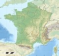
ચિત્ર:France relief location map.jpg

આ પૂર્વાવલોકનનું કદ: ૬૨૪ × ૬૦૦ પિક્સેલ. અન્ય આવર્તનો: ૨૫૦ × ૨૪૦ પિક્સેલ | ૪૯૯ × ૪૮૦ પિક્સેલ | ૭૯૯ × ૭૬૮ પિક્સેલ | ૧,૦૬૬ × ૧,૦૨૪ પિક્સેલ | ૨,૦૦૦ × ૧,૯૨૨ પિક્સેલ.
મૂળભુત ફાઇલ (૨,૦૦૦ × ૧,૯૨૨ પીક્સલ, ફાઇલનું કદ: ૯૦૭ KB, MIME પ્રકાર: image/jpeg)
ફાઇલનો ઇતિહાસ
તારીખ/સમય ઉપર ક્લિક કરવાથી તે સમયે ફાઇલ કેવી હતી તે જોવા મળશે.
| તારીખ/સમય | લઘુચિત્ર | પરિમાણો | સભ્ય | ટિપ્પણી | |
|---|---|---|---|---|---|
| વર્તમાન | ૨૦:૩૧, ૧૯ ઓક્ટોબર ૨૦૧૭ |  | ૨,૦૦૦ × ૧,૯૨૨ (૯૦૭ KB) | Sting | No borders over the Lake of Constance |
| ૧૪:૧૪, ૩ જાન્યુઆરી ૨૦૧૬ |  | ૨,૦૦૦ × ૧,૯૨૨ (૮૮૮ KB) | Jack ma | updated new administrative region boundaries 1/1/2016 | |
| ૧૮:૦૧, ૨ ઓક્ટોબર ૨૦૧૨ |  | ૨,૦૦૦ × ૧,૯૨૨ (૮૧૪ KB) | Palosirkka | Reverted to version as of 22:20, 17 July 2010 Location maps must remain very accurate | |
| ૧૪:૪૪, ૨ ઓક્ટોબર ૨૦૧૨ |  | ૨,૦૦૦ × ૧,૯૨૨ (૭૯૭ KB) | Palosirkka | Optimized with http://trimage.org | |
| ૦૩:૫૦, ૧૮ જુલાઇ ૨૦૧૦ |  | ૨,૦૦૦ × ૧,૯૨૨ (૮૧૪ KB) | Sting | Color profile | |
| ૧૯:૪૫, ૧૭ નવેમ્બર ૨૦૦૯ |  | ૨,૦૦૦ × ૧,૯૨૨ (૮૨૨ KB) | Sting | Embedded sRGB profile | |
| ૧૮:૫૯, ૭ નવેમ્બર ૨૦૦૮ |  | ૨,૦૦૦ × ૧,૯૨૨ (૮૦૧ KB) | Sting | + boundary for Channel Islands ; - canals | |
| ૨૨:૧૧, ૨૩ ઓગસ્ટ ૨૦૦૮ |  | ૨,૦૦૦ × ૧,૯૨૨ (૮૦૩ KB) | Sting | Larger strokes for boundaries | |
| ૨૩:૨૮, ૨૫ જુલાઇ ૨૦૦૮ |  | ૨,૦૦૦ × ૧,૯૨૨ (૮૧૫ KB) | Sting | Variable scale | |
| ૨૦:૧૬, ૨૫ જુલાઇ ૨૦૦૮ |  | ૨,૦૦૦ × ૧,૯૨૨ (૮૧૪ KB) | Sting | - border |
ફાઇલનો વપરાશ
આ ફાઇલ માં 4 નીચેનાં પાનાઓ વપરાયેલાં છે:
ફાઇલનો વ્યાપક ઉપયોગ
નીચેની બીજી વિકિઓ આ ફાઈલ વાપરે છે:
- als.wikipedia.org પર વપરાશ
- Grosser Belchen
- Donon
- Vorlage:Positionskarte Frankreich
- Planche des Belles Filles
- Vorlage:Positionskarte Frankreich Haut-Rhin
- Vorlage:Positionskarte Frankreich Bas-Rhin
- Vorlage:Positionskarte Frankreich Saône-et-Loire
- Vorlage:Positionskarte Frankreich Paris
- Vorlage:Positionskarte Frankreich Territoire de Belfort
- Vorlage:Positionskarte Frankreich Essonne
- Vorlage:Positionskarte Frankreich Pyrénées-Orientales
- Vorlage:Positionskarte Frankreich Pas-de-Calais
- Vorlage:Positionskarte Frankreich Normandie
- Vorlage:Positionskarte Frankreich Orne
- Vorlage:Positionskarte Frankreich Île-de-France
- Vorlage:Positionskarte Frankreich Nord
- Vorlage:Positionskarte Frankreich Moselle
- Vorlage:Positionskarte Frankreich Morbihan
- Vorlage:Positionskarte Frankreich Maine-et-Loire
- Vorlage:Positionskarte Frankreich Pays de la Loire
- Vorlage:Positionskarte Frankreich Loire-Atlantique
- Vorlage:Positionskarte Frankreich Isère
- Vorlage:Positionskarte Frankreich Ille-et-Vilaine
- Vorlage:Positionskarte Frankreich Okzitanien
- Vorlage:Positionskarte Frankreich Gard
- Vorlage:Positionskarte Frankreich Korsika
- Vorlage:Positionskarte Frankreich Corse-du-Sud
- Vorlage:Positionskarte Frankreich Nouvelle-Aquitaine
- Vorlage:Positionskarte Frankreich Dordogne
- Vorlage:Positionskarte Frankreich Bretagne
- Vorlage:Positionskarte Frankreich Finistère
- Vorlage:Positionskarte Frankreich Côtes-d’Armor
- Vorlage:Positionskarte Frankreich Bourgogne-Franche-Comté
- Vorlage:Positionskarte Frankreich Alpes-Maritimes
- Vorlage:Positionskarte Frankreich Provence-Alpes-Côte d’Azur
- Vorlage:Positionskarte Frankreich Alpes-de-Haute-Provence
- Vorlage:Positionskarte Frankreich Allier
- Vorlage:Positionskarte Frankreich Hauts-de-France
- Vorlage:Positionskarte Frankreich Aisne
- Vorlage:Positionskarte Frankreich Auvergne-Rhône-Alpes
- Vorlage:Positionskarte Frankreich Ain
- Vorlage:Positionskarte Frankreich Grand Est
- Vorlage:Positionskarte Frankreich Ardèche
- Vorlage:Positionskarte Frankreich Calvados
- Vorlage:Positionskarte Frankreich Cantal
- Vorlage:Positionskarte Frankreich Charente
- Vorlage:Positionskarte Frankreich Centre-Val de Loire
- Vorlage:Positionskarte Frankreich Charente-Maritime
- Vorlage:Positionskarte Frankreich Haute-Corse
- Vorlage:Positionskarte Frankreich Eure
આ ફાઇલના વધુ વૈશ્વિક વપરાશ જુઓ.


