
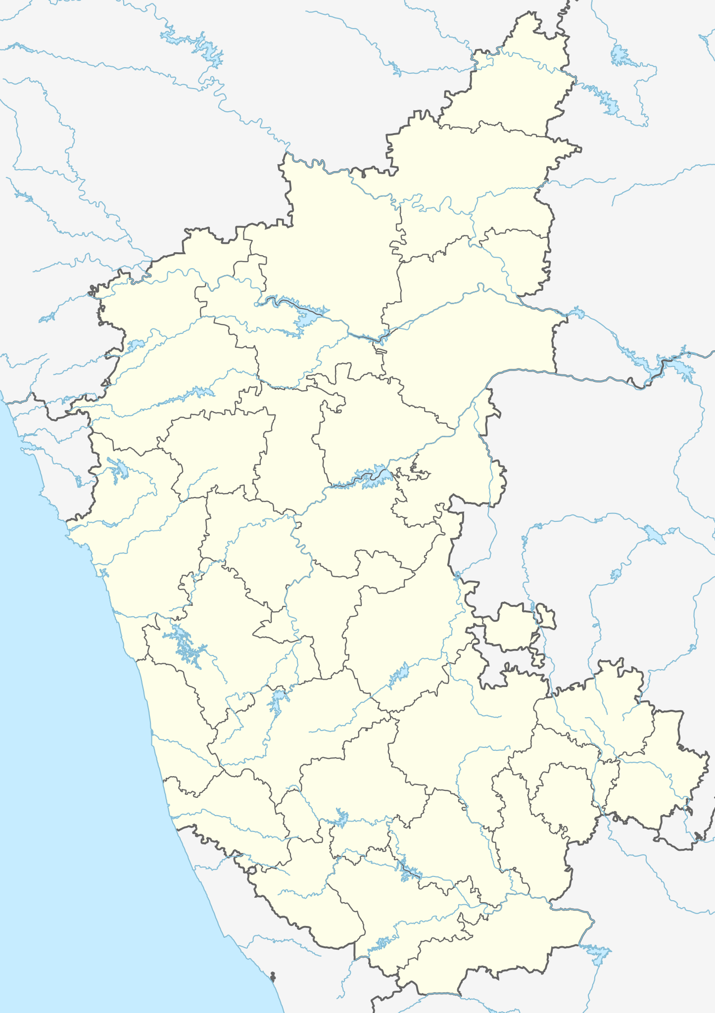
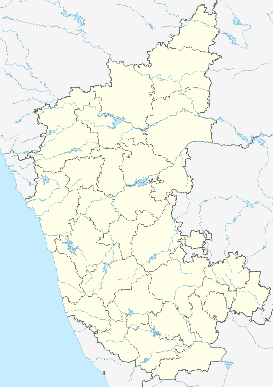
ચિત્ર:India Karnataka location map.svg

Size of this PNG preview of this SVG file: ૪૨૩ × ૬૦૦ પિક્સેલ. અન્ય આવર્તનો: ૧૬૯ × ૨૪૦ પિક્સેલ | ૩૩૮ × ૪૮૦ પિક્સેલ | ૫૪૨ × ૭૬૮ પિક્સેલ | ૭૨૨ × ૧,૦૨૪ પિક્સેલ | ૧,૪૪૫ × ૨,૦૪૮ પિક્સેલ | ૮૯૮ × ૧,૨૭૩ પિક્સેલ.
મૂળભુત ફાઇલ (SVG ફાઇલ, માત્ર ૮૯૮ × ૧,૨૭૩ પીક્સલ, ફાઇલનું કદ: ૭૫૯ KB)
| વર્ણન |
Location map of Karnataka Geographic limits of the map:
|
| તારીખ | (UTC) |
| સ્રોત | |
| લેખક |
|
| અન્ય આવૃત્તિઓ |
Derivative works of this file: |
| This is a retouched picture, which means that it has been digitally altered from its original version. Modifications: Created 3 new districts Chikkaballapur, Ramanagara and Yadgir. Changed conventions per WP:WPMAP. The original can be viewed here: Karnataka locator map.svg:
|
આ ફાઈલ વપરાશની પરવાનગી : Creative Commons Attribution-Share Alike 3.0 Unported license.
- તમે મુક્ત છો:
- વહેંચવા – નકલ કરવા, વિતરણ કરવા અને રચનાઓ મોકલવા
- રીમિક્સ કરવા કે મઠારવા – રચના અપનાવવા
- નીચેની શરત હેઠળ:
- આરોપણ – તમારે આ રચનાનો ઉપયોગ કરવા માટે લેખક કે પ્રકાશન અધિકાર ધારકની યોગ્ય માહિતી, પરવાનગી (લાયસન્સ)ની કડી અને તેમાં ફેરફાર કર્યો હોય તો તેનો ઉલ્લેખ કરવો જ પડશે. તમે આ સત્તા અનુસાર જ આ રચનાનો પ્રયોગ થવો જોઈએ, પણ તેઓ તમને અથવા તમારા ઉપયોગ સાથે સંમત થાય છે તે રીતે નહીં.
- શેર- અલાઈક (બિન ભેદભાવ વહેંચણી) – તમે જો આ રચનાને બદલશો, તેમાં ફેરફાર કરશો અથવા તેના પર આધારિત કોઇ કાર્ય બનાવશો તો તમારે પરિણામી કાર્યને તે જ અથવા અનુરૂપ પરવાનગી હેઠળ જ પ્રકાશિત કરવું પડશે.
અસલ - મૂળ અપલોડનો લોગ
This image is a derivative work of the following images:
- File:Karnataka_locator_map.svg licensed with Cc-by-sa-3.0
- 2007-05-06T13:55:02Z Planemad 1630x2356 (231773 Bytes) {{WikiProject_India_Maps |Title=Karnataka locator Map |Description=Map of [[w:Karnataka]] with road and rail lines |Source= [http://aquarium.lipetsk.ru/discovery/India2004/karnataka-map.jpg Karnataka Map], [http://www.indianr
Uploaded with derivativeFX
ફાઇલનો ઇતિહાસ
તારીખ/સમય ઉપર ક્લિક કરવાથી તે સમયે ફાઇલ કેવી હતી તે જોવા મળશે.
| તારીખ/સમય | લઘુચિત્ર | પરિમાણો | સભ્ય | ટિપ્પણી | |
|---|---|---|---|---|---|
| વર્તમાન | ૦૮:૪૦, ૧૬ જૂન ૨૦૨૩ | | ૮૯૮ × ૧,૨૭૩ (૭૫૯ KB) | C1MM | c Vijayanagara district |
| ૧૦:૧૧, ૧૩ ઓગસ્ટ ૨૦૨૧ |  | ૮૫૧ × ૧,૨૧૧ (૫૮૨ KB) | C1MM | Added more rivers | |
| ૦૯:૦૩, ૧૬ જુલાઇ ૨૦૨૧ |  | ૮૫૧ × ૧,૨૧૧ (૫૬૧ KB) | C1MM | Added more accurate district boundaries | |
| ૦૫:૧૧, ૧૫ ડિસેમ્બર ૨૦૨૦ |  | ૧,૬૩૪ × ૨,૩૬૭ (૩૪૧ KB) | C1MM | Fixed boundaries of Vijayanagara district | |
| ૦૩:૪૦, ૧૫ ડિસેમ્બર ૨૦૨૦ |  | ૧,૬૩૪ × ૨,૩૬૭ (૩૪૫ KB) | C1MM | Added boundaries of AP/Telangana and rivers | |
| ૦૦:૫૬, ૧૪ ડિસેમ્બર ૨૦૨૦ |  | ૧,૬૩૪ × ૨,૩૬૭ (૩૪૨ KB) | C1MM | Fixed district boundaries of Ballari and added Vijayanagara district | |
| ૦૯:૨૩, ૨૧ એપ્રિલ ૨૦૨૦ |  | ૧,૬૩૪ × ૨,૩૬૭ (૨૮૯ KB) | C1MM | Added rivers | |
| ૨૧:૨૦, ૧૫ નવેમ્બર ૨૦૧૦ |  | ૧,૬૩૦ × ૨,૩૫૬ (૨૦૭ KB) | Nayvik | Changed background color | |
| ૨૧:૦૪, ૧૫ નવેમ્બર ૨૦૧૦ |  | ૧,૬૩૦ × ૨,૩૫૬ (૨૦૬ KB) | Nayvik | {{Information |Description=Location map of Karnataka Geographic limits of the map: * 18.5°N * 11.0°N * 73.6°E * 78.7°E |Source=*File:Karnataka_locator_map.svg, [http://www.censusindia.gov.in/2011-Images/ADMINI2011.jpg Census In |
ફાઇલનો વપરાશ
આ ફાઇલ માં 5 નીચેનાં પાનાઓ વપરાયેલાં છે:
ફાઇલનો વ્યાપક ઉપયોગ
નીચેની બીજી વિકિઓ આ ફાઈલ વાપરે છે:
- ar.wikipedia.org પર વપરાશ
- as.wikipedia.org પર વપરાશ
- azb.wikipedia.org પર વપરાશ
- تومکور
- بنقلور
- عباسی، کارناتاکا
- اودقولام
- پیکلیهال
- اوداجی (هیندوستان)
- اوچیلا, اودوپی دیستریکت
- اوچاواد
- او خاناپور
- ویراهانوماکاناپالیا
- فاجیر (هیندوستان)
- پتالور (هیندوستان)
- پت آماپور
- ویراکامبا
- ویراپور
- وانور (هیندوستان)
- ساتیجری
- ساتانور, ماقادی
- ساتانور, بانقالور
- ساسالاتی
- سارقور
- ساراواد
- ساراپادی
- ساپتاساقار
- سانتور
- سانتکاسالاجر
- مایاکوندا
- ساناتی
- ماویناکر
- ماوالی
- ماتیواد
- کالادکا
- سانیکاتا
- کالکونت
- کالکری
- ماتماری
- سانقاناهالا
- کالجی (هیندوستان)
- سانقامشوارا, کالاقاتاجی
- ماتاداکوروباراهاتی
- ماستیهولی
- کالاسا, کوندقول
- ماسارکال
- ماسابینال
આ ફાઇલના વધુ વૈશ્વિક વપરાશ જુઓ.