
ચિત્ર:India relief location map ganges highlighted.jpg

આ પૂર્વાવલોકનનું કદ: ૫૫૭ × ૬૦૦ પિક્સેલ. અન્ય આવર્તનો: ૨૨૩ × ૨૪૦ પિક્સેલ | ૪૪૬ × ૪૮૦ પિક્સેલ | ૭૧૩ × ૭૬૮ પિક્સેલ | ૯૫૧ × ૧,૦૨૪ પિક્સેલ | ૧,૫૦૦ × ૧,૬૧૫ પિક્સેલ.
મૂળભુત ફાઇલ (૧,૫૦૦ × ૧,૬૧૫ પીક્સલ, ફાઇલનું કદ: ૬૧૭ KB, MIME પ્રકાર: image/jpeg)
સારાંશ:
| વર્ણન |
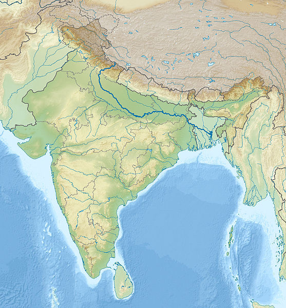
English: Location map of India with the Ganges highlighted. This can be an alternative map to be used with Template:Location map India. Equirectangular projection. Geographic limits of the map: top=37.5, bottom=5.0, left=67.0, right=99.0 |
| તારીખ | (UTC) |
| સ્રોત | |
| લેખક |
|
| This is a retouched picture, which means that it has been digitally altered from its original version. The original can be viewed here: India relief location map.jpg:
|
પરવાના
હું, આ કાર્યનો પ્રકાશનાધિકાર ધારક, તેને નીચેના પરવાનાઓ હેઠળ અહીં પ્રકાશીત કરૂં છું:
આ ફાઈલ વપરાશની પરવાનગી : Creative Commons Attribution-Share Alike 3.0 Unported license.
- તમે મુક્ત છો:
- વહેંચવા – નકલ કરવા, વિતરણ કરવા અને રચનાઓ મોકલવા
- રીમિક્સ કરવા કે મઠારવા – રચના અપનાવવા
- નીચેની શરત હેઠળ:
- આરોપણ – તમારે આ રચનાનો ઉપયોગ કરવા માટે લેખક કે પ્રકાશન અધિકાર ધારકની યોગ્ય માહિતી, પરવાનગી (લાયસન્સ)ની કડી અને તેમાં ફેરફાર કર્યો હોય તો તેનો ઉલ્લેખ કરવો જ પડશે. તમે આ સત્તા અનુસાર જ આ રચનાનો પ્રયોગ થવો જોઈએ, પણ તેઓ તમને અથવા તમારા ઉપયોગ સાથે સંમત થાય છે તે રીતે નહીં.
- શેર- અલાઈક (બિન ભેદભાવ વહેંચણી) – તમે જો આ રચનાને બદલશો, તેમાં ફેરફાર કરશો અથવા તેના પર આધારિત કોઇ કાર્ય બનાવશો તો તમારે પરિણામી કાર્યને તે જ અથવા અનુરૂપ પરવાનગી હેઠળ જ પ્રકાશિત કરવું પડશે.

|
આ રચનાની નકલ કરવા, વિતરણ અને સુધારો કરવા માટે GNU Free Documentation License, આવૃત્તિ 1.2 કે અન્ય આગળની આવૃત્તિ Free Software Foundation હેઠળ પરવાનગી છે; જેમાં કોઈ Invariant Sections, no Front-Cover Texts, and no Back-Cover Texts નથી. આ પરવાનાની પ્રત GNU Free Documentation License વિભાગમાં છે. |
તમે તમારી પસંદગીનો પરવાનો પસંદ કરી શકો છો.
અસલ - મૂળ અપલોડનો લોગ
This image is a derivative work of the following images:
- File:India_relief_location_map.jpg licensed with Cc-by-sa-3.0, GFDL
- 2010-04-23T15:31:11Z Uwe Dedering 1500x1615 (2100573 Bytes) {{Information |Description={{en|1=Location map of India. Equirectangular projection. Strechted by 106.0%. Geographic limits of the map: * N: 37.5° N * S: 5.0° N * W: 67.0° E * E: 99.0° E Made with Natural Earth. Free vect
Uploaded with derivativeFX
ફાઇલનો ઇતિહાસ
તારીખ/સમય ઉપર ક્લિક કરવાથી તે સમયે ફાઇલ કેવી હતી તે જોવા મળશે.
| તારીખ/સમય | લઘુચિત્ર | પરિમાણો | સભ્ય | ટિપ્પણી | |
|---|---|---|---|---|---|
| વર્તમાન | ૦૦:૩૨, ૧૮ નવેમ્બર ૨૦૧૦ | | ૧,૫૦૦ × ૧,૬૧૫ (૬૧૭ KB) | 배우는사람 | {{Information |Description={{en|1=Location map of India with the Ganges highlighted. This can be an alternative map to be used with Template:Location map India.}} |Source=*File:India_relief_location_map.jpg |Dat |
ફાઇલનો વપરાશ
આ ફાઇલ માં નીચેનું પાનું વપરાયેલું છે:
ફાઇલનો વ્યાપક ઉપયોગ
નીચેની બીજી વિકિઓ આ ફાઈલ વાપરે છે:
- ace.wikipedia.org પર વપરાશ
- ar.wikipedia.org પર વપરાશ
- azb.wikipedia.org પર વપરાશ
- bn.wikipedia.org પર વપરાશ
- bs.wikipedia.org પર વપરાશ
- bug.wikipedia.org પર વપરાશ
- ceb.wikipedia.org પર વપરાશ
- ckb.wikipedia.org પર વપરાશ
- diq.wikipedia.org પર વપરાશ
- dty.wikipedia.org પર વપરાશ
- dv.wikipedia.org પર વપરાશ
- el.wikipedia.org પર વપરાશ
- en.wikipedia.org પર વપરાશ
- eo.wikipedia.org પર વપરાશ
- Kolkato
- Nov-Delhio
- Mumbajo
- Taĝ-Mahalo
- Delhio
- Sentinelanoj
- Dezerto Tar
- Agra
- Prajagraĝo
- Kanpur
- Gaziabad
- Ĉandigaro
- Ŝablono:Geokesto lokumilo Barato
- Novmumbajo
- Gvalior
- Maduraj
- Hubli
- Ĝalandar
- Salem (Barato)
- Aligor
- Kota (Raĝastano)
- Barejli
- Tiruĉirapali
- Moradabad
- Gorakhpur
- Ĝamŝedpur
- Bikaner
- Koĉi (Barato)
- Raĝpur Sonarpur
- Siliguri
- Kolhapur
- Sangli
- Aĝmer
આ ફાઇલના વધુ વૈશ્વિક વપરાશ જુઓ.