
ચિત્ર:Map of the Western Cape with Cape Town highlighted (2016).svg

Size of this PNG preview of this SVG file: ૭૫૩ × ૬૦૦ પિક્સેલ. અન્ય આવર્તનો: ૩૦૨ × ૨૪૦ પિક્સેલ | ૬૦૩ × ૪૮૦ પિક્સેલ | ૯૬૫ × ૭૬૮ પિક્સેલ | ૧,૨૮૦ × ૧,૦૧૯ પિક્સેલ | ૨,૫૬૦ × ૨,૦૩૮ પિક્સેલ | ૮૪૯ × ૬૭૬ પિક્સેલ.
મૂળભુત ફાઇલ (SVG ફાઇલ, માત્ર ૮૪૯ × ૬૭૬ પીક્સલ, ફાઇલનું કદ: ૪૭૮ KB)
.svg)
સારાંશ:
| વર્ણન |
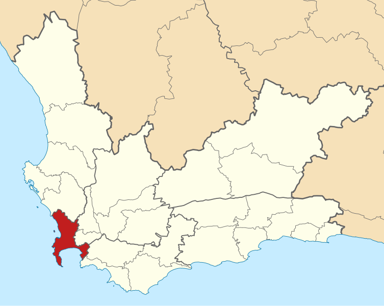
English: Map of municipal boundaries in the Western Cape, as they are after the municipal elections of 3 August 2016, with the City of Cape Town Metropolitan Municipality highlighted in red. Based on File:Map of the Western Cape with municipalities blank (2016).svg. |
| તારીખ | |
| સ્રોત | પોતાની રચના |
| લેખક | Htonl |
.svg)
પરવાના
હું, આ કાર્યનો પ્રકાશનાધિકાર ધારક, તેને નીચેના પરવાનાઓ હેઠળ અહીં પ્રકાશીત કરૂં છું:

|
આ રચનાની નકલ કરવા, વિતરણ અને સુધારો કરવા માટે GNU Free Documentation License, આવૃત્તિ 1.2 કે અન્ય આગળની આવૃત્તિ Free Software Foundation હેઠળ પરવાનગી છે; જેમાં કોઈ Invariant Sections, no Front-Cover Texts, and no Back-Cover Texts નથી. આ પરવાનાની પ્રત GNU Free Documentation License વિભાગમાં છે. |
This file is licensed under the Creative Commons Attribution-Share Alike 4.0 International, 3.0 Unported, 2.5 Generic, 2.0 Generic and 1.0 Generic license.
- તમે મુક્ત છો:
- વહેંચવા – નકલ કરવા, વિતરણ કરવા અને રચનાઓ મોકલવા
- રીમિક્સ કરવા કે મઠારવા – રચના અપનાવવા
- નીચેની શરત હેઠળ:
- આરોપણ – તમારે આ રચનાનો ઉપયોગ કરવા માટે લેખક કે પ્રકાશન અધિકાર ધારકની યોગ્ય માહિતી, પરવાનગી (લાયસન્સ)ની કડી અને તેમાં ફેરફાર કર્યો હોય તો તેનો ઉલ્લેખ કરવો જ પડશે. તમે આ સત્તા અનુસાર જ આ રચનાનો પ્રયોગ થવો જોઈએ, પણ તેઓ તમને અથવા તમારા ઉપયોગ સાથે સંમત થાય છે તે રીતે નહીં.
- શેર- અલાઈક (બિન ભેદભાવ વહેંચણી) – તમે જો આ રચનાને બદલશો, તેમાં ફેરફાર કરશો અથવા તેના પર આધારિત કોઇ કાર્ય બનાવશો તો તમારે પરિણામી કાર્યને તે જ અથવા અનુરૂપ પરવાનગી હેઠળ જ પ્રકાશિત કરવું પડશે.
તમે તમારી પસંદગીનો પરવાનો પસંદ કરી શકો છો.
ફાઇલનો ઇતિહાસ
તારીખ/સમય ઉપર ક્લિક કરવાથી તે સમયે ફાઇલ કેવી હતી તે જોવા મળશે.
| તારીખ/સમય | લઘુચિત્ર | પરિમાણો | સભ્ય | ટિપ્પણી | |
|---|---|---|---|---|---|
| વર્તમાન | ૨૧:૧૪, ૧૧ સપ્ટેમ્બર ૨૦૧૬ | | ૮૪૯ × ૬૭૬ (૪૭૮ KB) | Htonl | == {{int:filedesc}} == {{Information |Description ={{en|1=Map of municipal boundaries in the w:Western Cape, as they are after the municipal elections of 3 August 2016, with the [[w:City of Cape Town... |
ફાઇલનો વપરાશ
આ ફાઇલ માં નીચેનું પાનું વપરાયેલું છે:
ફાઇલનો વ્યાપક ઉપયોગ
નીચેની બીજી વિકિઓ આ ફાઈલ વાપરે છે:
- af.wikipedia.org પર વપરાશ
- als.wikipedia.org પર વપરાશ
- da.wikipedia.org પર વપરાશ
- de.wikipedia.org પર વપરાશ
- de.wikivoyage.org પર વપરાશ
- en.wikipedia.org પર વપરાશ
- eu.wikipedia.org પર વપરાશ
- fo.wikipedia.org પર વપરાશ
- fr.wikipedia.org પર વપરાશ
- fy.wikipedia.org પર વપરાશ
- hr.wikipedia.org પર વપરાશ
- it.wikipedia.org પર વપરાશ
- ja.wikipedia.org પર વપરાશ
- jv.wikipedia.org પર વપરાશ
- lad.wikipedia.org પર વપરાશ
- ms.wikipedia.org પર વપરાશ
- nl.wikipedia.org પર વપરાશ
- pt.wikipedia.org પર વપરાશ
- roa-tara.wikipedia.org પર વપરાશ
- ru.wikipedia.org પર વપરાશ
- sl.wikipedia.org પર વપરાશ
- smn.wikipedia.org પર વપરાશ
- www.wikidata.org પર વપરાશ
- zh-min-nan.wikipedia.org પર વપરાશ
- zh.wikipedia.org પર વપરાશ
.svg)