
ચિત્ર:Adyar estuary broken bridge panorama.jpg
આ પૂર્વાવલોકનનું કદ: ૭૯૯ × ૧૪૯ પિક્સેલ. અન્ય આવર્તનો: ૩૨૦ × ૬૦ પિક્સેલ | ૬૪૦ × ૧૧૯ પિક્સેલ | ૧,૦૨૪ × ૧૯૧ પિક્સેલ | ૧,૨૮૦ × ૨૩૯ પિક્સેલ | ૬,૦૦૦ × ૧,૧૨૦ પિક્સેલ.
મૂળભુત ફાઇલ (૬,૦૦૦ × ૧,૧૨૦ પીક્સલ, ફાઇલનું કદ: ૧.૨૫ MB, MIME પ્રકાર: image/jpeg)
સારાંશ:
| વર્ણન |
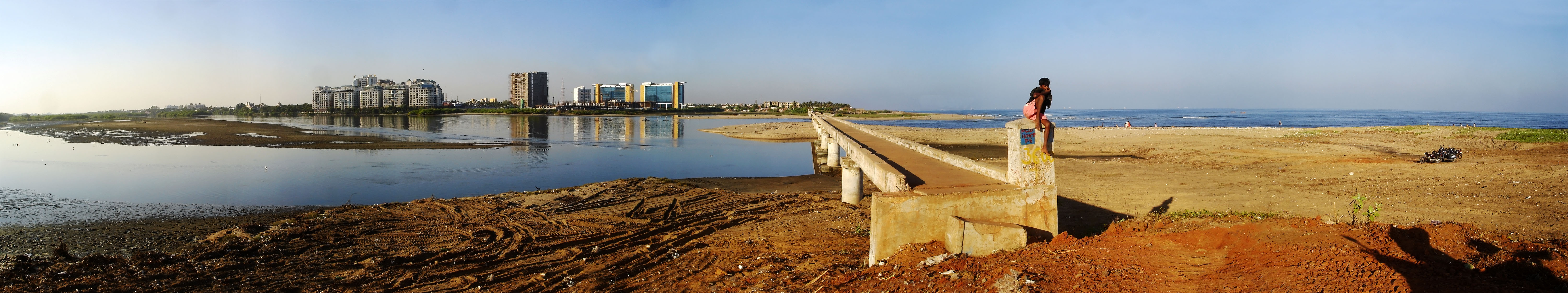
English: A panoramic view of en:Adyar River estuary and the Broken Bridge. Across the river is en:MRC Nagar |
||
| તારીખ | 1 Jan 09 | ||
| સ્રોત | પોતાની રચના | ||
| લેખક |
|
||
| પરવાનગી (આ ફાઈલનો ફરી ઉપયોગ) |
Own Work. See below for license. |
પરવાના
હું, આ કાર્યનો પ્રકાશનાધિકાર ધારક, તેને નીચેના પરવાના હેઠળ અહીં પ્રકાશીત કરૂં છું:
આ ફાઈલ વપરાશની પરવાનગી : Creative Commons Attribution-Share Alike 3.0 Unported license.
- તમે મુક્ત છો:
- વહેંચવા – નકલ કરવા, વિતરણ કરવા અને રચનાઓ મોકલવા
- રીમિક્સ કરવા કે મઠારવા – રચના અપનાવવા
- નીચેની શરત હેઠળ:
- આરોપણ – તમારે આ રચનાનો ઉપયોગ કરવા માટે લેખક કે પ્રકાશન અધિકાર ધારકની યોગ્ય માહિતી, પરવાનગી (લાયસન્સ)ની કડી અને તેમાં ફેરફાર કર્યો હોય તો તેનો ઉલ્લેખ કરવો જ પડશે. તમે આ સત્તા અનુસાર જ આ રચનાનો પ્રયોગ થવો જોઈએ, પણ તેઓ તમને અથવા તમારા ઉપયોગ સાથે સંમત થાય છે તે રીતે નહીં.
- શેર- અલાઈક (બિન ભેદભાવ વહેંચણી) – તમે જો આ રચનાને બદલશો, તેમાં ફેરફાર કરશો અથવા તેના પર આધારિત કોઇ કાર્ય બનાવશો તો તમારે પરિણામી કાર્યને તે જ અથવા અનુરૂપ પરવાનગી હેઠળ જ પ્રકાશિત કરવું પડશે.
| Camera location | | View this and other nearby images on: OpenStreetMap |
|---|
ફાઇલનો ઇતિહાસ
તારીખ/સમય ઉપર ક્લિક કરવાથી તે સમયે ફાઇલ કેવી હતી તે જોવા મળશે.
| તારીખ/સમય | લઘુચિત્ર | પરિમાણો | સભ્ય | ટિપ્પણી | |
|---|---|---|---|---|---|
| વર્તમાન | ૨૩:૪૮, ૧ જાન્યુઆરી ૨૦૦૯ | ૬,૦૦૦ × ૧,૧૨૦ (૧.૨૫ MB) | Planemad | == Summary == {{Information |Description={{en|1=A panoramic view of en:Adyar River estuary and the broken bridge. Across the river is en:MRC Nagar}} |Source=Own work by uploader |Author={{User:PlaneMad/Info}} |Date=1 Jan 09 |Permission=Own Work. |
ફાઇલનો વપરાશ
આ ફાઇલ માં નીચેનું પાનું વપરાયેલું છે:
ફાઇલનો વ્યાપક ઉપયોગ
નીચેની બીજી વિકિઓ આ ફાઈલ વાપરે છે:
- en.wikipedia.org પર વપરાશ
- hi.wikipedia.org પર વપરાશ
- www.wikidata.org પર વપરાશ