
ચિત્ર:Aerial photograph of Helmand River at Gereshk in 2011.jpg
આ પૂર્વાવલોકનનું કદ: ૮૦૦ × ૫૩૧ પિક્સેલ. અન્ય આવર્તનો: ૩૨૦ × ૨૧૨ પિક્સેલ | ૬૪૦ × ૪૨૫ પિક્સેલ | ૧,૦૨૪ × ૬૮૦ પિક્સેલ | ૧,૨૮૦ × ૮૫૦ પિક્સેલ | ૨,૭૮૪ × ૧,૮૪૮ પિક્સેલ.
મૂળભુત ફાઇલ (૨,૭૮૪ × ૧,૮૪૮ પીક્સલ, ફાઇલનું કદ: ૩.૯૫ MB, MIME પ્રકાર: image/jpeg)
સારાંશ:
| વર્ણન |
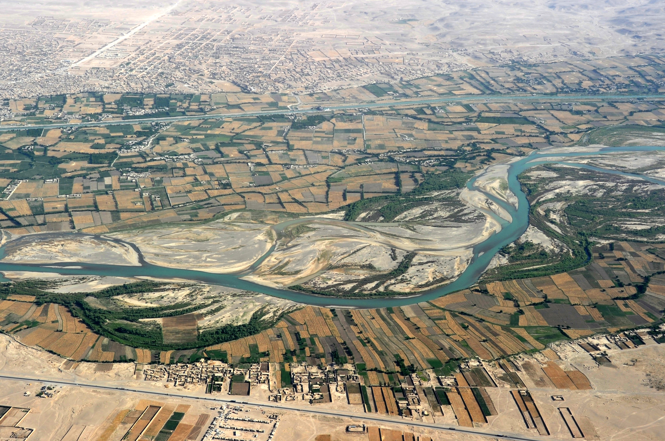
English: Traveling by helicopter enables us to see the beauty of Helmand River with the Boghra Irrigation Canal (Nahr-e Bughra) in the middle distance and the town of Gereshk (Grishk) in the far distance, Helmand Province. |
| તારીખ | |
| સ્રોત | https://www.flickr.com/photos/usace-tas/8713418682/in/photostream/ |
| લેખક | Karla Marshall |
| Camera location | | View this and other nearby images on: OpenStreetMap |
|---|
પરવાના
This image or file is a work of a U.S. Army Corps of Engineers soldier or employee, taken or made as part of that person's official duties. As a work of the U.S. federal government, the image is in the public domain.
|
ફાઇલનો ઇતિહાસ
તારીખ/સમય ઉપર ક્લિક કરવાથી તે સમયે ફાઇલ કેવી હતી તે જોવા મળશે.
| તારીખ/સમય | લઘુચિત્ર | પરિમાણો | સભ્ય | ટિપ્પણી | |
|---|---|---|---|---|---|
| વર્તમાન | ૧૯:૪૪, ૨૧ મે ૨૦૧૩ | | ૨,૭૮૪ × ૧,૮૪૮ (૩.૯૫ MB) | Officer | {{Information |Description={{en|Traveling by helicopter enables us to see the beauty of Kandahar province from the air. (USACE Photo by Karla Marshall)}} |Source=http://www.flickr.com/photos/usace-tas/8713418682/in/photostream/ |Date=2011-05-30 |Author... |
ફાઇલનો વપરાશ
આ ફાઇલ માં નીચેનું પાનું વપરાયેલું છે:
ફાઇલનો વ્યાપક ઉપયોગ
નીચેની બીજી વિકિઓ આ ફાઈલ વાપરે છે:
- ar.wikipedia.org પર વપરાશ
- azb.wikipedia.org પર વપરાશ
- bn.wikipedia.org પર વપરાશ
- bs.wikipedia.org પર વપરાશ
- ca.wikipedia.org પર વપરાશ
- ceb.wikipedia.org પર વપરાશ
- cs.wikipedia.org પર વપરાશ
- cy.wikipedia.org પર વપરાશ
- da.wikipedia.org પર વપરાશ
- el.wikipedia.org પર વપરાશ
- en.wikipedia.org પર વપરાશ
- en.wikivoyage.org પર વપરાશ
- en.wiktionary.org પર વપરાશ
- eo.wikipedia.org પર વપરાશ
- es.wikipedia.org પર વપરાશ
- eu.wikipedia.org પર વપરાશ
- fa.wikipedia.org પર વપરાશ
- fi.wikipedia.org પર વપરાશ
- fr.wikipedia.org પર વપરાશ
- he.wikipedia.org પર વપરાશ
- hu.wikipedia.org પર વપરાશ
- hy.wikipedia.org પર વપરાશ
- id.wikipedia.org પર વપરાશ
- incubator.wikimedia.org પર વપરાશ
- it.wikipedia.org પર વપરાશ
- kab.wikipedia.org પર વપરાશ
- ka.wikipedia.org પર વપરાશ
- kk.wikipedia.org પર વપરાશ
- ko.wikipedia.org પર વપરાશ
આ ફાઇલના વધુ વૈશ્વિક વપરાશ જુઓ.