
ચિત્ર:Africa relief location map.jpg

આ પૂર્વાવલોકનનું કદ: ૬૩૫ × ૬૦૦ પિક્સેલ. અન્ય આવર્તનો: ૨૫૪ × ૨૪૦ પિક્સેલ | ૫૦૮ × ૪૮૦ પિક્સેલ | ૮૧૩ × ૭૬૮ પિક્સેલ | ૧,૦૮૪ × ૧,૦૨૪ પિક્સેલ | ૧,૫૨૫ × ૧,૪૪૦ પિક્સેલ.
મૂળભુત ફાઇલ (૧,૫૨૫ × ૧,૪૪૦ પીક્સલ, ફાઇલનું કદ: ૫૨૨ KB, MIME પ્રકાર: image/jpeg)

|
This map image could be re-created using vector graphics as an SVG file. This has several advantages; see Commons:Media for cleanup for more information. If an SVG form of this image is available, please upload it and afterwards replace this template with
{{vector version available|new image name}}.
It is recommended to name the SVG file “Africa relief location map.svg”—then the template Vector version available (or Vva) does not need the new image name parameter. |


સારાંશ:
| વર્ણન |
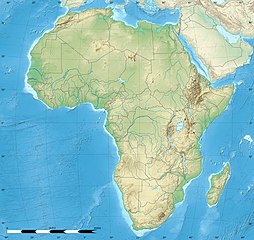
English: Blank physical map of political Africa, for geo-location purposes. Borders as in July 2011.
Français : Carte physique vierge de l'Afrique politique, destinée à la géolocalisation. Frontières telles qu'en juillet 2011. Lambert azimutal equal-area projection, WGS84 datum
|
||
| તારીખ | |||
| સ્રોત |
Based upon File:Africa_map_blank.svg created by myself
|
||
| લેખક | Eric Gaba (Sting - fr:Sting) | ||
| પરવાનગી (આ ફાઈલનો ફરી ઉપયોગ) |
|
||
| અન્ય આવૃત્તિઓ |
|


| Camera location | | View this and other nearby images on: OpenStreetMap |
|---|
પરવાના
Eric Gaba, Wikimedia Commons user Sting, આ કાર્યનો પ્રકાશનાધિકાર ધારક, તેને નીચેના પરવાનાઓ હેઠળ અહીં પ્રકાશીત કરે છે:

|
આ રચનાની નકલ કરવા, વિતરણ અને સુધારો કરવા માટે GNU Free Documentation License, આવૃત્તિ 1.2 કે અન્ય આગળની આવૃત્તિ Free Software Foundation હેઠળ પરવાનગી છે; જેમાં કોઈ Invariant Sections, no Front-Cover Texts, and no Back-Cover Texts નથી. આ પરવાનાની પ્રત GNU Free Documentation License વિભાગમાં છે. |
આ ફાઈલ વપરાશની પરવાનગી : Creative Commons Attribution-Share Alike 3.0 Unported license.
આરોપણ: Eric Gaba, Wikimedia Commons user Sting
- તમે મુક્ત છો:
- વહેંચવા – નકલ કરવા, વિતરણ કરવા અને રચનાઓ મોકલવા
- રીમિક્સ કરવા કે મઠારવા – રચના અપનાવવા
- નીચેની શરત હેઠળ:
- આરોપણ – તમારે આ રચનાનો ઉપયોગ કરવા માટે લેખક કે પ્રકાશન અધિકાર ધારકની યોગ્ય માહિતી, પરવાનગી (લાયસન્સ)ની કડી અને તેમાં ફેરફાર કર્યો હોય તો તેનો ઉલ્લેખ કરવો જ પડશે. તમે આ સત્તા અનુસાર જ આ રચનાનો પ્રયોગ થવો જોઈએ, પણ તેઓ તમને અથવા તમારા ઉપયોગ સાથે સંમત થાય છે તે રીતે નહીં.
- શેર- અલાઈક (બિન ભેદભાવ વહેંચણી) – તમે જો આ રચનાને બદલશો, તેમાં ફેરફાર કરશો અથવા તેના પર આધારિત કોઇ કાર્ય બનાવશો તો તમારે પરિણામી કાર્યને તે જ અથવા અનુરૂપ પરવાનગી હેઠળ જ પ્રકાશિત કરવું પડશે.
તમે તમારી પસંદગીનો પરવાનો પસંદ કરી શકો છો.
ફાઇલનો ઇતિહાસ
તારીખ/સમય ઉપર ક્લિક કરવાથી તે સમયે ફાઇલ કેવી હતી તે જોવા મળશે.
| તારીખ/સમય | લઘુચિત્ર | પરિમાણો | સભ્ય | ટિપ્પણી | |
|---|---|---|---|---|---|
| વર્તમાન | ૧૭:૫૭, ૧૮ જુલાઇ ૨૦૨૨ | | ૧,૫૨૫ × ૧,૪૪૦ (૫૨૨ KB) | M.Bitton | Reverted to version as of 21:54, 5 May 2022 (UTC): per COM:OVERWRITE |
| ૧૬:૫૯, ૧૮ જુલાઇ ૨૦૨૨ |  | ૧,૬૨૭ × ૧,૫૩૬ (૪૭૨ KB) | Jacob300 | Reverted to version as of 15:02, 5 May 2022 (UTC) | |
| ૦૩:૨૪, ૬ મે ૨૦૨૨ |  | ૧,૫૨૫ × ૧,૪૪૦ (૫૨૨ KB) | M.Bitton | Reverted to version as of 19:03, 14 July 2011 (UTC): per COM:OVERWRITE | |
| ૨૦:૩૨, ૫ મે ૨૦૨૨ |  | ૧,૬૨૭ × ૧,૫૩૬ (૪૭૨ KB) | Jacob300 | Reverted to version as of 17:16, 9 January 2022 (UTC) | |
| ૨૩:૫૩, ૯ જાન્યુઆરી ૨૦૨૨ |  | ૧,૫૨૫ × ૧,૪૪૦ (૫૨૨ KB) | M.Bitton | Reverted to version as of 19:03, 14 July 2011 (UTC): per COM:OVERWRITE | |
| ૨૨:૪૬, ૯ જાન્યુઆરી ૨૦૨૨ |  | ૧,૬૨૭ × ૧,૫૩૬ (૪૭૨ KB) | Jacob300 | Reverted to version as of 01:08, 19 October 2021 (UTC) | |
| ૦૪:૪૬, ૨૦ ઓક્ટોબર ૨૦૨૧ |  | ૧,૫૨૫ × ૧,૪૪૦ (૫૨૨ KB) | M.Bitton | Reverted to version as of 19:03, 14 July 2011 (UTC): per COM:OVERWRITE | |
| ૦૬:૩૮, ૧૯ ઓક્ટોબર ૨૦૨૧ |  | ૧,૬૨૭ × ૧,૫૩૬ (૪૭૨ KB) | Gebagebo | Added dotted line to indicate Somaliland | |
| ૦૦:૩૩, ૧૫ જુલાઇ ૨૦૧૧ |  | ૧,૫૨૫ × ૧,૪૪૦ (૫૨૨ KB) | Sting | Sudan/South Sudan 07-2011 border update | |
| ૧૯:૦૧, ૧૯ જુલાઇ ૨૦૧૦ |  | ૧,૫૨૫ × ૧,૪૪૦ (૪૨૪ KB) | Sting | Color profile |
ફાઇલનો વપરાશ
આ ફાઇલ માં 2 નીચેનાં પાનાઓ વપરાયેલાં છે:
ફાઇલનો વ્યાપક ઉપયોગ
નીચેની બીજી વિકિઓ આ ફાઈલ વાપરે છે:
- als.wikipedia.org પર વપરાશ
- ar.wikipedia.org પર વપરાશ
- ast.wikipedia.org પર વપરાશ
- av.wikipedia.org પર વપરાશ
- azb.wikipedia.org પર વપરાશ
- قاهیره
- مانروویا
- داکار
- بیسائو
- کینشاسا
- آنتاناناریوو
- آکرا
- موشی (شهر)
- تانقا، تانزانیا
- عنابه
- لوساکا
- اقصر
- کاکامقا، کنیا
- الجزیره
- موروقورو
- هرجیسا
- نیامی
- تونس (شهر)
- وهران، الجزاییر
- العیون
- آبوجا
- کامپالا
- یائونده
- دارالسلام (تانزانیا)
- رباط (مراکش)
- لوآندا
- انجامنا
- موقادیشو
- لیبرویل
- دودوما
- باقامویو
- امتوارا
- لیندی
- سانقی
આ ફાઇલના વધુ વૈશ્વિક વપરાશ જુઓ.