
ચિત્ર:Bhutan relief location map.jpg

મૂળભુત ફાઇલ (૮૭૪ × ૫૭૦ પીક્સલ, ફાઇલનું કદ: ૩૬૧ KB, MIME પ્રકાર: image/jpeg)
સારાંશ:
| વર્ણન |
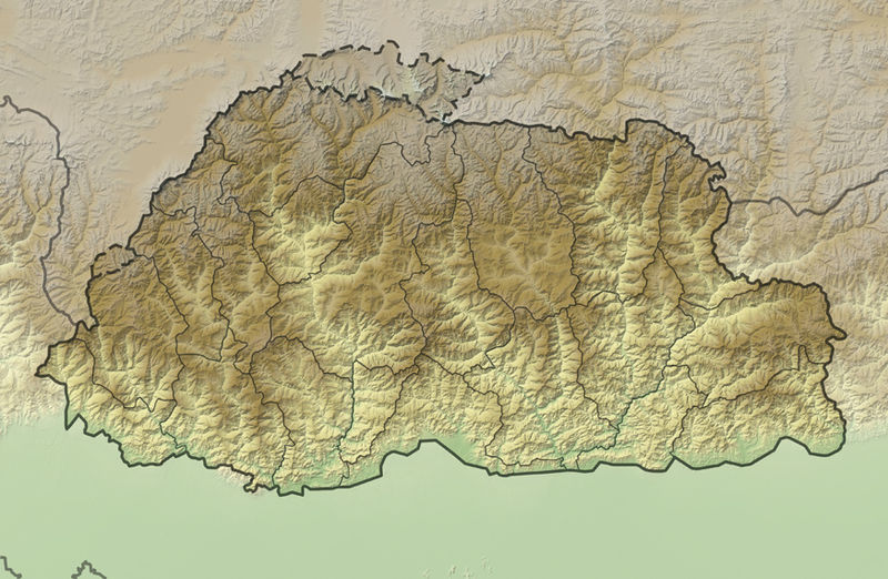
Deutsch: Positionskarte von Bhutan
Quadratische Plattkarte, N-S-Streckung 115 %. Geographische Begrenzung der Karte:
English: Location map of Bhutan
Equirectangular projection, N/S stretching 115 %. Geographic limits of the map:
|
|
| તારીખ | ||
| સ્રોત |
own work, using
|
|
| લેખક | NordNordWest | |
| પરવાનગી (આ ફાઈલનો ફરી ઉપયોગ) |
આ ફાઈલ વપરાશની પરવાનગી : Creative Commons Attribution-Share Alike 3.0 Germany license.
 આ ફાઈલ વપરાશની પરવાનગી : Creative Commons Attribution-Share Alike 3.0 Germany license.
|
|
| અન્ય આવૃત્તિઓ |
|


|
This map has been made or improved in the German Kartenwerkstatt (Map Lab). You can propose maps to improve as well.
|
ફાઇલનો ઇતિહાસ
તારીખ/સમય ઉપર ક્લિક કરવાથી તે સમયે ફાઇલ કેવી હતી તે જોવા મળશે.
| તારીખ/સમય | લઘુચિત્ર | પરિમાણો | સભ્ય | ટિપ્પણી | |
|---|---|---|---|---|---|
| વર્તમાન | ૦૦:૩૬, ૩ ડિસેમ્બર ૨૦૧૧ | | ૮૭૪ × ૫૭૦ (૩૬૧ KB) | NordNordWest | == {{int:filedesc}} == {{Information |Description= {{de|Positionskarte von Bhutan}} Quadratische Plattkarte, N-S-Streckung 115 %. Geographische Begrenzung der Karte: * N: 28.5° N * S: 26.4° N * W: 88.6° O * O: 92.3° O {{en|Location map |
ફાઇલનો વપરાશ
આ ફાઇલ માં નીચેનું પાનું વપરાયેલું છે:
ફાઇલનો વ્યાપક ઉપયોગ
નીચેની બીજી વિકિઓ આ ફાઈલ વાપરે છે:
- ar.wikipedia.org પર વપરાશ
- ast.wikipedia.org પર વપરાશ
- ba.wikipedia.org પર વપરાશ
- be.wikipedia.org પર વપરાશ
- bn.wikipedia.org પર વપરાશ
- bs.wikipedia.org પર વપરાશ
- ceb.wikipedia.org પર વપરાશ
- ce.wikipedia.org પર વપરાશ
- ckb.wikipedia.org પર વપરાશ
- cs.wikipedia.org પર વપરાશ
- de.wikivoyage.org પર વપરાશ
- dsb.wikipedia.org પર વપરાશ
- el.wikipedia.org પર વપરાશ
- en.wikipedia.org પર વપરાશ
- eo.wikipedia.org પર વપરાશ
- Gangkhar Puensum
- Ŝablono:Situo sur mapo Butano
- Distrikto Ĉuĥa
- Distrikto Haa
- Distrikto Paro
- Distrikto Samce
- Distrikto Timbuo
- Distrikto Lhunce
- Distrikto Mongar
- Distrikto Pemagatŝel
- Distrikto Samdrup Jongĥar
- Distrikto Traŝigang
- Distrikto Traŝijangste
- Distrikto Dagana
- Distrikto Gasa
- Distrikto Punaĥa
- Distrikto Cirang
- Distrikto Bumthang
- Distrikto Sarpang
- Distrikto Trongsa
આ ફાઇલના વધુ વૈશ્વિક વપરાશ જુઓ.