
ચિત્ર:Chennai.satmap.annotated.jpg
આ પૂર્વાવલોકનનું કદ: ૮૦૦ × ૫૬૬ પિક્સેલ. અન્ય આવર્તનો: ૩૨૦ × ૨૨૬ પિક્સેલ | ૬૪૦ × ૪૫૩ પિક્સેલ | ૧,૦૨૪ × ૭૨૪ પિક્સેલ.
મૂળભુત ફાઇલ (૧,૦૨૪ × ૭૨૪ પીક્સલ, ફાઇલનું કદ: ૧૬૯ KB, MIME પ્રકાર: image/jpeg)
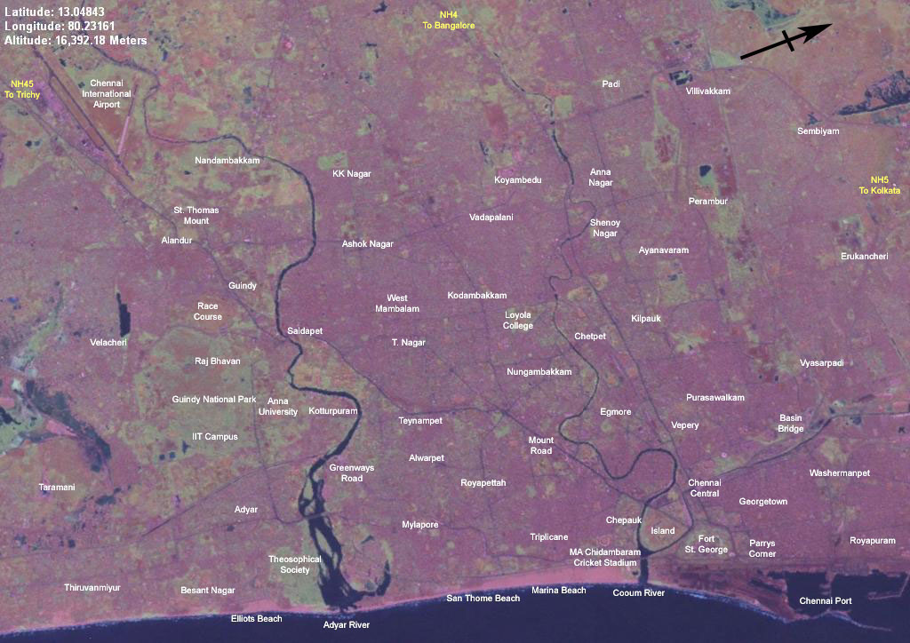
સારાંશ:
| વર્ણન |
English: Screenshot from NASA WorldWind. Photoshopped annotations by en:User:Brhaspati. |
| સ્રોત | |
| લેખક |
પરવાના
| This file is in the public domain in the United States because it was solely created by NASA. NASA copyright policy states that "NASA material is not protected by copyright unless noted". (See Template:PD-USGov, NASA copyright policy page or JPL Image Use Policy.) | ||
 |
Warnings:
|
અસલ - મૂળ અપલોડનો લોગ
The original description page was here. All following user names refer to en.wikipedia.
- 2005-02-11 20:29 Brhaspati 1024×724× (172604 bytes) Satellite map of Chennai, annotated.
ફાઇલનો ઇતિહાસ
તારીખ/સમય ઉપર ક્લિક કરવાથી તે સમયે ફાઇલ કેવી હતી તે જોવા મળશે.
| તારીખ/સમય | લઘુચિત્ર | પરિમાણો | સભ્ય | ટિપ્પણી | |
|---|---|---|---|---|---|
| વર્તમાન | ૦૨:૦૬, ૨ માર્ચ ૨૦૦૯ | | ૧,૦૨૪ × ૭૨૪ (૧૬૯ KB) | File Upload Bot (Magnus Manske) | {{BotMoveToCommons|en.wikipedia|year={{subst:CURRENTYEAR}}|month={{subst:CURRENTMONTHNAME}}|day={{subst:CURRENTDAY}}}} {{Information |Description={{en|Screenshot from NASA WorldWind. Photoshopped annotations by en:User:Brhaspati.}} |Source=Transferr |
ફાઇલનો વપરાશ
આ ફાઇલ માં નીચેનું પાનું વપરાયેલું છે:
ફાઇલનો વ્યાપક ઉપયોગ
નીચેની બીજી વિકિઓ આ ફાઈલ વાપરે છે:
- ba.wikipedia.org પર વપરાશ
- bn.wikipedia.org પર વપરાશ
- ca.wikipedia.org પર વપરાશ
- en.wikipedia.org પર વપરાશ
- ja.wikipedia.org પર વપરાશ
- mr.wikipedia.org પર વપરાશ
- ms.wikipedia.org પર વપરાશ
- pt.wikipedia.org પર વપરાશ
- ro.wikipedia.org પર વપરાશ
- ru.wikipedia.org પર વપરાશ