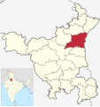
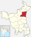
ચિત્ર:India - Haryana - Karnal.svg

Size of this PNG preview of this SVG file: ૫૬૪ × ૬૦૦ પિક્સેલ. અન્ય આવર્તનો: ૨૨૬ × ૨૪૦ પિક્સેલ | ૪૫૧ × ૪૮૦ પિક્સેલ | ૭૨૨ × ૭૬૮ પિક્સેલ | ૯૬૩ × ૧,૦૨૪ પિક્સેલ | ૧,૯૨૫ × ૨,૦૪૮ પિક્સેલ | ૬૭૬ × ૭૧૯ પિક્સેલ.
મૂળભુત ફાઇલ (SVG ફાઇલ, માત્ર ૬૭૬ × ૭૧૯ પીક્સલ, ફાઇલનું કદ: ૧.૬૫ MB)
ફાઇલનો ઇતિહાસ
તારીખ/સમય ઉપર ક્લિક કરવાથી તે સમયે ફાઇલ કેવી હતી તે જોવા મળશે.
| તારીખ/સમય | લઘુચિત્ર | પરિમાણો | સભ્ય | ટિપ્પણી | |
|---|---|---|---|---|---|
| વર્તમાન | ૨૦:૪૪, ૧૮ માર્ચ ૨૦૨૨ |  | ૬૭૬ × ૭૧૯ (૧.૬૫ MB) | C1MM | Reverted to version as of 08:00, 8 March 2022 (UTC) |
| ૧૧:૪૦, ૧૮ માર્ચ ૨૦૨૨ |  | ૮૪૫ × ૮૯૯ (૫૩૪ KB) | C1MM | updated bounds | |
| ૧૩:૩૦, ૮ માર્ચ ૨૦૨૨ |  | ૬૭૬ × ૭૧૯ (૧.૬૫ MB) | Furfur | corrected district borders | |
| ૧૦:૫૧, ૧૩ ઓગસ્ટ ૨૦૨૧ |  | ૮૪૫ × ૮૯૯ (૬૦૬ KB) | C1MM | c bounds | |
| ૧૦:૧૮, ૨૬ જુલાઇ ૨૦૧૮ |  | ૬૨૬ × ૭૫૦ (૪૨૩ KB) | Milenioscuro | corrected | |
| ૧૮:૩૦, ૫ જુલાઇ ૨૦૧૮ |  | ૫૭૯ × ૬૧૧ (૩૬૯ KB) | Ankit2 | Updated map with 22 districts. | |
| ૦૬:૨૭, ૬ નવેમ્બર ૨૦૧૬ |  | ૬૨૬ × ૭૫૦ (૨૯૨ KB) | Milenioscuro | User created page with UploadWizard |
ફાઇલનો વપરાશ
આ ફાઇલ માં નીચેનું પાનું વપરાયેલું છે:
ફાઇલનો વ્યાપક ઉપયોગ
નીચેની બીજી વિકિઓ આ ફાઈલ વાપરે છે:
- ar.wikipedia.org પર વપરાશ
- arz.wikipedia.org પર વપરાશ
- awa.wikipedia.org પર વપરાશ
- bh.wikipedia.org પર વપરાશ
- bn.wikipedia.org પર વપરાશ
- ca.wikipedia.org પર વપરાશ
- de.wikipedia.org પર વપરાશ
- en.wikipedia.org પર વપરાશ
- es.wikipedia.org પર વપરાશ
- eu.wikipedia.org પર વપરાશ
- fa.wikipedia.org પર વપરાશ
- fi.wikipedia.org પર વપરાશ
- fr.wikipedia.org પર વપરાશ
- hi.wikipedia.org પર વપરાશ
- incubator.wikimedia.org પર વપરાશ
- ml.wikipedia.org પર વપરાશ
- nl.wikipedia.org પર વપરાશ
- no.wikipedia.org પર વપરાશ
- pa.wikipedia.org પર વપરાશ
- pnb.wikipedia.org પર વપરાશ
- pt.wikipedia.org પર વપરાશ
- ru.wikipedia.org પર વપરાશ
- sat.wikipedia.org પર વપરાશ
- sa.wikipedia.org પર વપરાશ
- simple.wikipedia.org પર વપરાશ
- ta.wikipedia.org પર વપરાશ
- te.wikipedia.org પર વપરાશ
આ ફાઇલના વધુ વૈશ્વિક વપરાશ જુઓ.
