
ચિત્ર:India Andhra Pradesh location map (until 2014).svg

Size of this PNG preview of this SVG file: ૬૪૩ × ૫૯૯ પિક્સેલ. અન્ય આવર્તનો: ૨૫૮ × ૨૪૦ પિક્સેલ | ૫૧૫ × ૪૮૦ પિક્સેલ | ૮૨૪ × ૭૬૮ પિક્સેલ | ૧,૦૯૯ × ૧,૦૨૪ પિક્સેલ | ૨,૧૯૮ × ૨,૦૪૮ પિક્સેલ | ૨,૭૧૬ × ૨,૫૩૧ પિક્સેલ.
મૂળભુત ફાઇલ (SVG ફાઇલ, માત્ર ૨,૭૧૬ × ૨,૫૩૧ પીક્સલ, ફાઇલનું કદ: ૪૨૧ KB)
.svg)
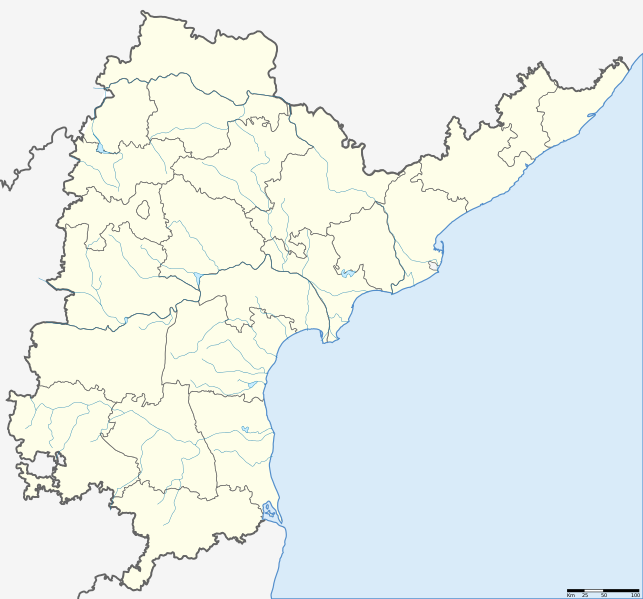
| વર્ણન | Location map of Andhra Pradesh. Coordinates: top=19.957, bottom=12.522, left=76.593, right=84.935. |
| તારીખ | (UTC) |
| સ્રોત | |
| લેખક |
|
.svg)
| This is a retouched picture, which means that it has been digitally altered from its original version. The original can be viewed here: Andhra Pradesh locator map.svg: File:Andhra Pradesh locator map.svg.
|
હું, આ કાર્યનો પ્રકાશનાધિકાર ધારક, તેને નીચેના પરવાના હેઠળ અહીં પ્રકાશીત કરૂં છું:
આ ફાઈલ વપરાશની પરવાનગી : Creative Commons Attribution-Share Alike 3.0 Unported license.
- તમે મુક્ત છો:
- વહેંચવા – નકલ કરવા, વિતરણ કરવા અને રચનાઓ મોકલવા
- રીમિક્સ કરવા કે મઠારવા – રચના અપનાવવા
- નીચેની શરત હેઠળ:
- આરોપણ – તમારે આ રચનાનો ઉપયોગ કરવા માટે લેખક કે પ્રકાશન અધિકાર ધારકની યોગ્ય માહિતી, પરવાનગી (લાયસન્સ)ની કડી અને તેમાં ફેરફાર કર્યો હોય તો તેનો ઉલ્લેખ કરવો જ પડશે. તમે આ સત્તા અનુસાર જ આ રચનાનો પ્રયોગ થવો જોઈએ, પણ તેઓ તમને અથવા તમારા ઉપયોગ સાથે સંમત થાય છે તે રીતે નહીં.
- શેર- અલાઈક (બિન ભેદભાવ વહેંચણી) – તમે જો આ રચનાને બદલશો, તેમાં ફેરફાર કરશો અથવા તેના પર આધારિત કોઇ કાર્ય બનાવશો તો તમારે પરિણામી કાર્યને તે જ અથવા અનુરૂપ પરવાનગી હેઠળ જ પ્રકાશિત કરવું પડશે.
અસલ - મૂળ અપલોડનો લોગ
This image is a derivative work of the following images:
- File:Andhra Pradesh locator map (1956-2014).svg licensed with Cc-by-sa-3.0
- 2007-05-05T10:40:49Z Planemad 2716x2531 (381105 Bytes) {{WikiProject_India_Maps |Title=Andhra Pradesh locator Map |Description=Map of [[w:Andhra Pradesh]] with road and rail lines |Source= [http://www.etctours.net/gifs/apmap.jpg ETC Tours - Andhra map], [http://www.indianrailways
Uploaded with derivativeFX
ફાઇલનો ઇતિહાસ
તારીખ/સમય ઉપર ક્લિક કરવાથી તે સમયે ફાઇલ કેવી હતી તે જોવા મળશે.
| તારીખ/સમય | લઘુચિત્ર | પરિમાણો | સભ્ય | ટિપ્પણી | |
|---|---|---|---|---|---|
| વર્તમાન | ૧૨:૪૩, ૨૭ મે ૨૦૧૩ | | ૨,૭૧૬ × ૨,૫૩૧ (૪૨૧ KB) | Milenioscuro | standard colors + rivers |
| ૧૮:૩૯, ૧૪ જૂન ૨૦૧૨ |  | ૨,૭૧૬ × ૨,૫૩૧ (૩૭૨ KB) | Arjunaraoc | Reverted to version as of 20:47, 12 August 2011 | |
| ૦૯:૩૨, ૧૧ જૂન ૨૦૧૨ |  | ૨,૭૧૬ × ૨,૫૩૧ (૩૬૬ KB) | Arjunaraoc | Removed other state boundaries, as the location map error could be due to this. | |
| ૦૨:૧૭, ૧૩ ઓગસ્ટ ૨૦૧૧ |  | ૨,૭૧૬ × ૨,૫૩૧ (૩૭૨ KB) | Abhijitsathe | {{Information |Description=Location map of Andhra Pradesh |Source=*File:Andhra_Pradesh_locator_map.svg |Date=2011-08-12 20:46 (UTC) |Author=*File:Andhra_Pradesh_locator_map.svg: '''Planemad''' *derivative work: ~~~ |Permission= |other_versions |
ફાઇલનો વપરાશ
આ ફાઇલને કોઇ પાનાં વાપરતા નથી.
ફાઇલનો વ્યાપક ઉપયોગ
નીચેની બીજી વિકિઓ આ ફાઈલ વાપરે છે:
- en.wikipedia.org પર વપરાશ
- kn.wikipedia.org પર વપરાશ
- new.wikipedia.org પર વપરાશ
- te.wikipedia.org પર વપરાશ
.svg)