
ચિત્ર:Kerala locator map.svg

Size of this PNG preview of this SVG file: ૪૯૪ × ૬૦૦ પિક્સેલ. અન્ય આવર્તનો: ૧૯૮ × ૨૪૦ પિક્સેલ | ૩૯૫ × ૪૮૦ પિક્સેલ | ૬૩૨ × ૭૬૮ પિક્સેલ | ૮૪૩ × ૧,૦૨૪ પિક્સેલ | ૧,૬૮૭ × ૨,૦૪૮ પિક્સેલ | ૧,૩૪૦ × ૧,૬૨૭ પિક્સેલ.
મૂળભુત ફાઇલ (SVG ફાઇલ, માત્ર ૧,૩૪૦ × ૧,૬૨૭ પીક્સલ, ફાઇલનું કદ: ૧૫૧ KB)
| શીર્ષક |
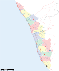
Kerala locator map |
||
| Description |
Locator map for the state of w:Kerala |
||
| તારીખ | |||
| સ્રોત |
પોતાની રચના |
||
| રચયિતા |
|
||
| પરવાનગી (આ ફાઈલનો ફરી ઉપયોગ) |
હું, આ કાર્યનો પ્રકાશનાધિકાર ધારક, તેને નીચેના પરવાના હેઠળ અહીં પ્રકાશીત કરૂં છું: આ ફાઈલ વપરાશની પરવાનગી : Creative Commons Attribution-Share Alike 3.0 Unported license.
|
||
| Geotemporal data | |||
| Date depicted | second half of 20 century અને 21 century | ||
| Georeferencing | If inappropriate please set warp_status = skip to hide. | ||
| Archival data | |||
| નોંધ | Part of WikiProject India Maps | ||
ફાઇલનો ઇતિહાસ
તારીખ/સમય ઉપર ક્લિક કરવાથી તે સમયે ફાઇલ કેવી હતી તે જોવા મળશે.
| તારીખ/સમય | લઘુચિત્ર | પરિમાણો | સભ્ય | ટિપ્પણી | |
|---|---|---|---|---|---|
| વર્તમાન | ૨૦:૨૩, ૧૩ એપ્રિલ ૨૦૦૭ | | ૧,૩૪૦ × ૧,૬૨૭ (૧૫૧ KB) | Planemad | correcting crop |
| ૨૦:૨૨, ૧૩ એપ્રિલ ૨૦૦૭ |  | ૧,૫૯૧ × ૧,૯૭૫ (૧૫૨ KB) | Planemad | ||
| ૨૩:૩૯, ૯ એપ્રિલ ૨૦૦૭ |  | ૧,૩૨૩ × ૧,૬૦૭ (૬૮ KB) | Planemad | {{WikiProject_India_Maps |Title=Kerala locator map |Description=Locator map for the state of [w:Kerala]] |Source= [http://keralapolice.org/map/keralamap.html Kerala Police - Map of Kerala], |Date=April 2007 |Author=w:user:Planemad }} [[Category:Wiki |
ફાઇલનો વપરાશ
આ ફાઇલ માં નીચેનું પાનું વપરાયેલું છે:
ફાઇલનો વ્યાપક ઉપયોગ
નીચેની બીજી વિકિઓ આ ફાઈલ વાપરે છે:
- awa.wikipedia.org પર વપરાશ
- bo.wikipedia.org પર વપરાશ
- de.wikipedia.org પર વપરાશ
- dv.wikipedia.org પર વપરાશ
- en.wikipedia.org પર વપરાશ
- es.wikipedia.org પર વપરાશ
- fa.wikipedia.org પર વપરાશ
- gd.wikipedia.org પર વપરાશ
- hi.wikipedia.org પર વપરાશ
- कोल्लम जिला
- मुन्नार
- मालाबार
- कोवलम
- पुथूर
- कुमारकोम
- साँचा:केरल के लोकसभा निर्वाचन क्षेत्र
- मलप्पुरम लोक सभा निर्वाचन क्षेत्र
- आलप्पुष़ा लोक सभा निर्वाचन क्षेत्र
- आलत्तूर लोक सभा निर्वाचन क्षेत्र
- आट्टिंगल लोक सभा निर्वाचन क्षेत्र
- चालकुडी लोक सभा निर्वाचन क्षेत्र
- एर्णाकुलम लोक सभा निर्वाचन क्षेत्र
- इदुक्की लोक सभा निर्वाचन क्षेत्र
- कन्नूर लोक सभा निर्वाचन क्षेत्र
- कासरगोड लोक सभा निर्वाचन क्षेत्र
- कोल्लम लोक सभा निर्वाचन क्षेत्र
- कोट्टयम लोक सभा निर्वाचन क्षेत्र
- कोष़िक्कोड लोक सभा निर्वाचन क्षेत्र
- मावेलिक्करा लोक सभा निर्वाचन क्षेत्र
- वयनाड लोक सभा निर्वाचन क्षेत्र
- पालक्काड लोक सभा निर्वाचन क्षेत्र
- पत्तनमतिट्टा लोक सभा निर्वाचन क्षेत्र
- पोन्नानी लोक सभा निर्वाचन क्षेत्र
- तिरुवनन्तपुरम लोक सभा निर्वाचन क्षेत्र
- त्रिश्शूर लोक सभा निर्वाचन क्षेत्र
- वडकरा लोक सभा निर्वाचन क्षेत्र
- केरल के मुख्यमंत्रियों की सूची
- incubator.wikimedia.org પર વપરાશ
- ka.wikipedia.org પર વપરાશ
- mai.wikipedia.org પર વપરાશ
- ml.wikipedia.org પર વપરાશ
આ ફાઇલના વધુ વૈશ્વિક વપરાશ જુઓ.