
ચિત્ર:Location Portugal EU Europe.png
આ પૂર્વાવલોકનનું કદ: ૭૧૪ × ૬૦૦ પિક્સેલ. અન્ય આવર્તનો: ૨૮૬ × ૨૪૦ પિક્સેલ | ૫૭૨ × ૪૮૦ પિક્સેલ | ૯૧૫ × ૭૬૮ પિક્સેલ | ૧,૨૧૯ × ૧,૦૨૪ પિક્સેલ | ૨,૦૪૮ × ૧,૭૨૦ પિક્સેલ.
મૂળભુત ફાઇલ (૨,૦૪૮ × ૧,૭૨૦ પીક્સલ, ફાઇલનું કદ: ૨૩૯ KB, MIME પ્રકાર: image/png)

|
File:EU-Portugal with islands circled.svg is a vector version of this file. It should be used in place of this PNG file when not inferior.
File:Location Portugal EU Europe.png → File:EU-Portugal with islands circled.svg
For more information, see Help:SVG. |
 |
સારાંશ:
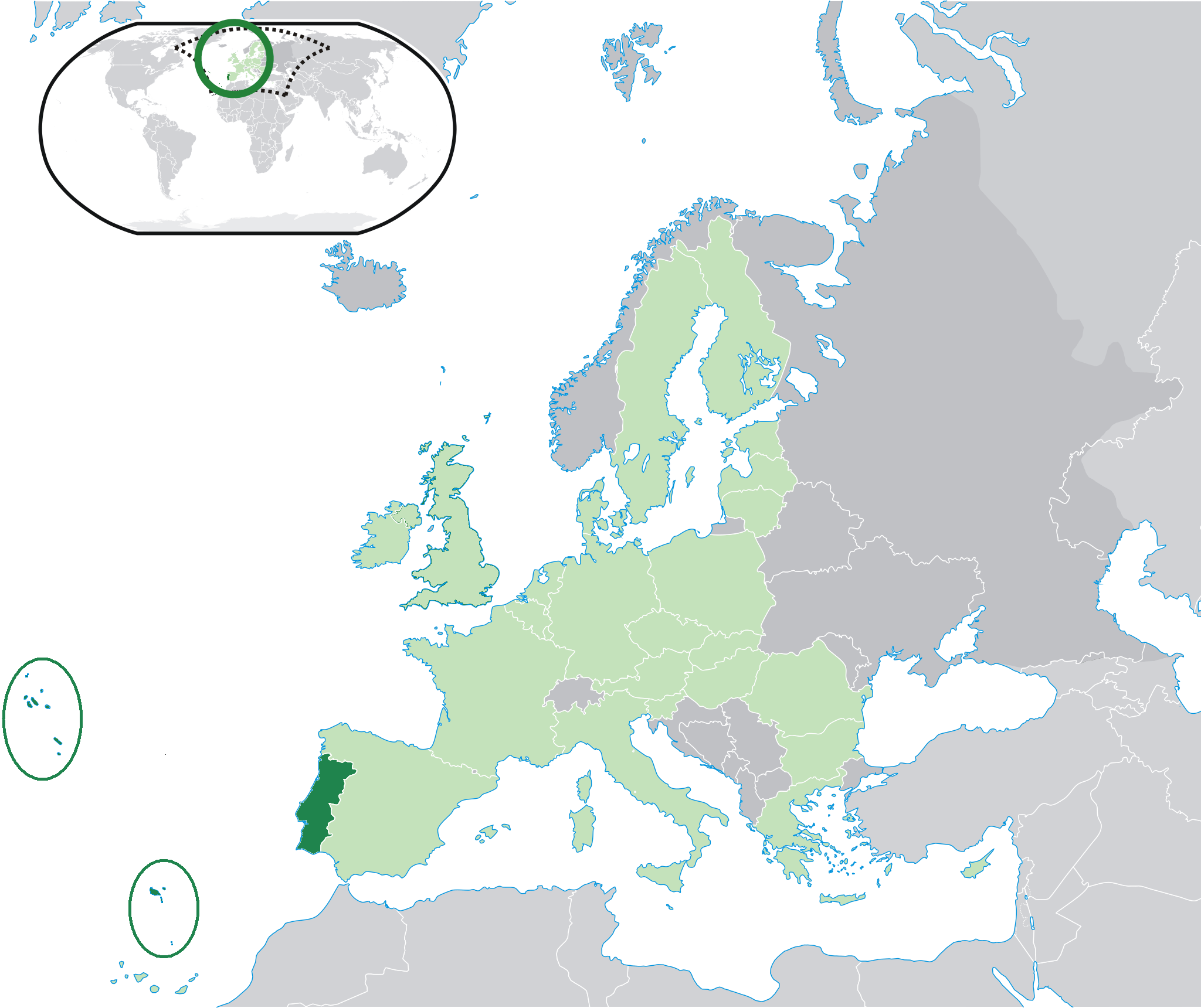
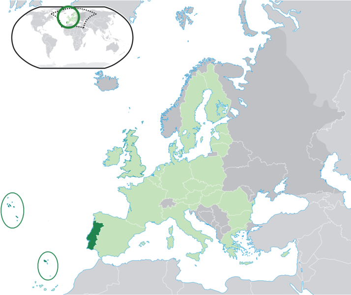
| વર્ણન | Location map: Portugal (dark green) / European Union (light green) / Europe (dark grey); inspired by and consistent with general country locator maps by User:Vardion, et al. |
| તારીખ | |
| સ્રોત | પોતાની રચના |
| લેખક | Quizimodo |
| અન્ય આવૃત્તિઓ |
|


પરવાના
| આ રચના ના લેખક I, Quizimodo દ્વારા આ રચનાને public domain હેઠળ પ્રકાશિત કરાઈ છે. આ સવલત વિશ્વવ્યપી છે અમુક દેશોમાં કાયદેસર રીતે તે શક્ય નથી, જો તેમ હોય તો : I, Quizimodo દ્વારા કોઈને પણ કોઈપણ વપરાશ, કોઇ પણ શરત વગર, માટે આ રચના વાપરવાની છૂટ આપાઈ છે સિવાયકે તે શરતો કાયદેસર જરૂરી હોય. |
ફાઇલનો ઇતિહાસ
તારીખ/સમય ઉપર ક્લિક કરવાથી તે સમયે ફાઇલ કેવી હતી તે જોવા મળશે.
| તારીખ/સમય | લઘુચિત્ર | પરિમાણો | સભ્ય | ટિપ્પણી | |
|---|---|---|---|---|---|
| વર્તમાન | ૦૧:૧૭, ૨૭ જુલાઇ ૨૦૦૯ | | ૨,૦૪૮ × ૧,૭૨૦ (૨૩૯ KB) | The Ogre | Small correction |
| ૨૦:૦૭, ૨૪ જુલાઇ ૨૦૦૯ |  | ૨,૦૪૮ × ૧,૭૨૦ (૨૪૧ KB) | The Ogre | Still better visivility of islans (in agreement with the fact that the Savage islands ar a part of the Madeira archipelago) | |
| ૨૦:૦૦, ૨૪ જુલાઇ ૨૦૦૯ |  | ૨,૦૪૮ × ૧,૭૨૦ (૨૪૧ KB) | The Ogre | Better visibility of islands in the Atlantic | |
| ૧૯:૪૩, ૨૪ જુલાઇ ૨૦૦૯ |  | ૨,૦૪૮ × ૧,૭૨૦ (૨૪૦ KB) | The Ogre | Small corrections - included the islands of Corvo and Flores in the Azores, and the Desertas and Savage islands in Madeira. | |
| ૦૬:૩૬, ૧૮ જૂન ૨૦૦૭ |  | ૨,૦૫૬ × ૧,૭૧૦ (૧૭૬ KB) | Quizimodo~commonswiki | image (updated) | |
| ૧૫:૪૩, ૧૭ જૂન ૨૦૦૭ |  | ૨,૦૫૬ × ૧,૭૧૦ (૨૨૭ KB) | Quizimodo~commonswiki | image (tweaked) | |
| ૧૫:૩૬, ૧૭ જૂન ૨૦૦૭ |  | ૨,૦૫૬ × ૧,૭૧૦ (૨૨૭ KB) | Quizimodo~commonswiki | image (tweaked) | |
| ૧૩:૨૩, ૧૭ જૂન ૨૦૦૭ |  | ૨,૦૫૬ × ૧,૭૧૦ (૨૨૭ KB) | Quizimodo~commonswiki | image (tweaked) | |
| ૧૨:૪૮, ૧૭ જૂન ૨૦૦૭ |  | ૨,૦૫૬ × ૧,૭૧૦ (૨૨૩ KB) | Quizimodo~commonswiki | image (tweaked) | |
| ૧૨:૧૫, ૧૭ જૂન ૨૦૦૭ |  | ૨,૦૫૬ × ૧,૭૧૦ (૨૨૭ KB) | Quizimodo~commonswiki | {{Information |Description=Location map: Portugal (dark green) / European Union (light green) / Europe (dark grey); inspired by and consistent with general country locator maps by User:Vardion, et al |Source=self-made |Date= |Author= [[User:Quizimodo|Quiz |
ફાઇલનો વપરાશ
આ ફાઇલ માં નીચેનું પાનું વપરાયેલું છે:
ફાઇલનો વ્યાપક ઉપયોગ
નીચેની બીજી વિકિઓ આ ફાઈલ વાપરે છે:
- bcl.wikipedia.org પર વપરાશ
- ceb.wikipedia.org પર વપરાશ
- de.wikinews.org પર વપરાશ
- dv.wikipedia.org પર વપરાશ
- dz.wikipedia.org પર વપરાશ
- es.wikipedia.org પર વપરાશ
- es.wikiquote.org પર વપરાશ
- eu.wiktionary.org પર વપરાશ
- fr.wikipedia.org પર વપરાશ
- gag.wikipedia.org પર વપરાશ
- got.wikipedia.org પર વપરાશ
- ka.wikipedia.org પર વપરાશ
- kn.wikipedia.org પર વપરાશ
- ku.wiktionary.org પર વપરાશ
- no.wikipedia.org પર વપરાશ
- pl.wiktionary.org પર વપરાશ
- pt.wikinews.org પર વપરાશ
- ro.wikipedia.org પર વપરાશ
- ro.wikibooks.org પર વપરાશ
- te.wikipedia.org પર વપરાશ
- ug.wikipedia.org પર વપરાશ
- zh-classical.wikipedia.org પર વપરાશ