
ચિત્ર:MESSENGER EN0108828359M.png
આ પૂર્વાવલોકનનું કદ: ૫૯૫ × ૬૦૦ પિક્સેલ. અન્ય આવર્તનો: ૨૩૮ × ૨૪૦ પિક્સેલ | ૪૭૬ × ૪૮૦ પિક્સેલ | ૧,૦૧૬ × ૧,૦૨૪ પિક્સેલ.
મૂળભુત ફાઇલ (૧,૦૧૬ × ૧,૦૨૪ પીક્સલ, ફાઇલનું કદ: ૬૯૨ KB, MIME પ્રકાર: image/png)
સારાંશ:
| વર્ણન |
Original caption:
|
| તારીખ | |
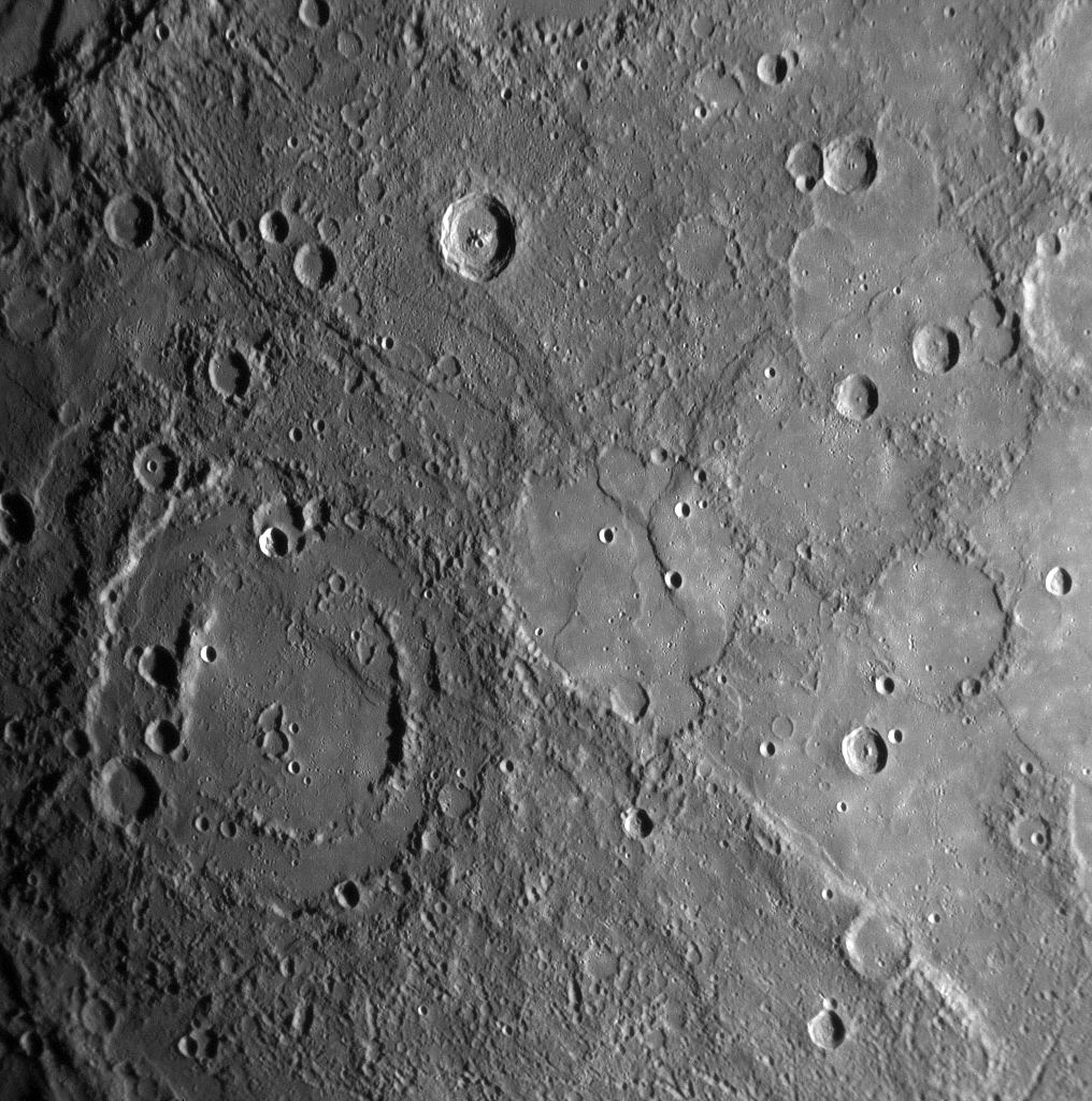
| સ્રોત | MESSENGER REVEALS MERCURY'S GEOLOGICAL HISTORY |
| લેખક | NASA/Johns Hopkins University Applied Physics Laboratory/Carnegie Institution of Washington |
પરવાના
| This file is in the public domain in the United States because it was solely created by NASA. NASA copyright policy states that "NASA material is not protected by copyright unless noted". (See Template:PD-USGov, NASA copyright policy page or JPL Image Use Policy.) | ||
 |
Warnings:
|
ફાઇલનો ઇતિહાસ
તારીખ/સમય ઉપર ક્લિક કરવાથી તે સમયે ફાઇલ કેવી હતી તે જોવા મળશે.
| તારીખ/સમય | લઘુચિત્ર | પરિમાણો | સભ્ય | ટિપ્પણી | |
|---|---|---|---|---|---|
| વર્તમાન | ૨૧:૩૧, ૧૦ ફેબ્રુઆરી ૨૦૨૦ | | ૧,૦૧૬ × ૧,૦૨૪ (૬૯૨ KB) | SteinsplitterBot | Bot: Image rotated by 180° |
| ૦૩:૩૦, ૧૮ જાન્યુઆરી ૨૦૦૮ |  | ૧,૦૧૬ × ૧,૦૨૪ (૬૯૧ KB) | Zginder | {{Information |Description=One of the photos released after the first flyby. |Source=http://messenger.jhuapl.edu/gallery/sciencePhotos/pics/EN0108828359M.png |Date= |Author= |Permission= |other_versions= }} |
ફાઇલનો વપરાશ
આ ફાઇલ માં નીચેનું પાનું વપરાયેલું છે:
ફાઇલનો વ્યાપક ઉપયોગ
નીચેની બીજી વિકિઓ આ ફાઈલ વાપરે છે:
- af.wikipedia.org પર વપરાશ
- ar.wikipedia.org પર વપરાશ
- az.wikipedia.org પર વપરાશ
- bg.wikipedia.org પર વપરાશ
- bn.wikipedia.org પર વપરાશ
- en.wikipedia.org પર વપરાશ
- en.wikibooks.org પર વપરાશ
- en.wikiquote.org પર વપરાશ
- es.wikipedia.org પર વપરાશ
- fr.wikipedia.org પર વપરાશ
- he.wikipedia.org પર વપરાશ
- ko.wikibooks.org પર વપરાશ
- mk.wikipedia.org પર વપરાશ
- ml.wikipedia.org પર વપરાશ
- ro.wikipedia.org પર વપરાશ
- ta.wikipedia.org પર વપરાશ
- tr.wikipedia.org પર વપરાશ
- zh.wikipedia.org પર વપરાશ