
ચિત્ર:Odisha locator map.svg

Size of this PNG preview of this SVG file: ૬૦૭ × ૬૦૦ પિક્સેલ. અન્ય આવર્તનો: ૨૪૩ × ૨૪૦ પિક્સેલ | ૪૮૬ × ૪૮૦ પિક્સેલ | ૭૭૮ × ૭૬૮ પિક્સેલ | ૧,૦૩૭ × ૧,૦૨૪ પિક્સેલ | ૨,૦૭૪ × ૨,૦૪૮ પિક્સેલ | ૨,૨૬૯ × ૨,૨૪૧ પિક્સેલ.
મૂળભુત ફાઇલ (SVG ફાઇલ, માત્ર ૨,૨૬૯ × ૨,૨૪૧ પીક્સલ, ફાઇલનું કદ: ૨૧૧ KB)
| શીર્ષક |
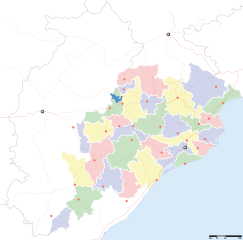
Orissa locator map |
||
| Description |
Locator map for the Indian state of w:Orissa. Equirectangular projection - Geographic limits of the map: top=24.27, bottom=17.691 |
||
| તારીખ | |||
| સ્રોત |
પોતાની રચના |
||
| રચયિતા |
|
||
| પરવાનગી (આ ફાઈલનો ફરી ઉપયોગ) |
હું, આ કાર્યનો પ્રકાશનાધિકાર ધારક, તેને નીચેના પરવાના હેઠળ અહીં પ્રકાશીત કરૂં છું: આ ફાઈલ વપરાશની પરવાનગી : Creative Commons Attribution-Share Alike 3.0 Unported license.
|
||
| Geotemporal data | |||
| Date depicted | second half of 20 century અને 21 century | ||
| Georeferencing | If inappropriate please set warp_status = skip to hide. | ||
| Archival data | |||
| નોંધ | Part of WikiProject India Maps | ||
ફાઇલનો ઇતિહાસ
તારીખ/સમય ઉપર ક્લિક કરવાથી તે સમયે ફાઇલ કેવી હતી તે જોવા મળશે.
| તારીખ/સમય | લઘુચિત્ર | પરિમાણો | સભ્ય | ટિપ્પણી | |
|---|---|---|---|---|---|
| વર્તમાન | ૨૨:૫૮, ૬ સપ્ટેમ્બર ૨૦૦૮ | | ૨,૨૬૯ × ૨,૨૪૧ (૨૧૧ KB) | Planemad | |
| ૧૮:૫૮, ૨૧ ફેબ્રુઆરી ૨૦૦૮ |  | ૬૪૭ × ૫૬૪ (૧૩૨ KB) | Mkeranat~commonswiki | {{Information |Description=Locator map for the state of [w:Orissa] updated to show white borders for districts |Source=self-made, based on India locator map by [w:User:Planemad] |Date=Feb 2008 |Author= Mkeranat |Permission= |other_versions= }} | |
| ૦૩:૦૨, ૧૫ ફેબ્રુઆરી ૨૦૦૮ |  | ૬૪૭ × ૫૬૪ (૧૩૦ KB) | Mkeranat~commonswiki | {{Information |Description=Locator map for the state of [w:Orissa] |Source=self-made, based on India locator map by [w:User:Planemad] |Date=Feb 2008 |Author= Mkeranat |Permission= |other_versions= }} |
ફાઇલનો વપરાશ
આ ફાઇલ માં 23 નીચેનાં પાનાઓ વપરાયેલાં છે:
ફાઇલનો વ્યાપક ઉપયોગ
નીચેની બીજી વિકિઓ આ ફાઈલ વાપરે છે:
- ar.wikipedia.org પર વપરાશ
- as.wikipedia.org પર વપરાશ
- awa.wikipedia.org પર વપરાશ
- ba.wikipedia.org પર વપરાશ
- ceb.wikipedia.org પર વપરાશ
- de.wikipedia.org પર વપરાશ
- en.wikipedia.org પર વપરાશ
- es.wikipedia.org પર વપરાશ
- fa.wikipedia.org પર વપરાશ
- hi.wikipedia.org પર વપરાશ
- नलबण पक्षी अभयारण्य
- साँचा:ओड़िशा के लोकसभा निर्वाचन क्षेत्र
- आस्का लोक सभा निर्वाचन क्षेत्र
- भुवनेश्वर लोक सभा निर्वाचन क्षेत्र
- बलांगिर लोक सभा निर्वाचन क्षेत्र
- कटक लोक सभा निर्वाचन क्षेत्र
- ढेंकानाल लोक सभा निर्वाचन क्षेत्र
- जगतसिंहपुर लोक सभा निर्वाचन क्षेत्र
- जाजपुर लोक सभा निर्वाचन क्षेत्र
- कलाहांडी लोक सभा निर्वाचन क्षेत्र
- कंधमाल लोक सभा निर्वाचन क्षेत्र
- भद्रक लोक सभा निर्वाचन क्षेत्र
- बालासोर लोक सभा निर्वाचन क्षेत्र
- बरगढ़ लोक सभा निर्वाचन क्षेत्र
- बरहमपुर लोक सभा निर्वाचन क्षेत्र
- incubator.wikimedia.org પર વપરાશ
- it.wikipedia.org પર વપરાશ
- kbd.wikipedia.org પર વપરાશ
- ml.wikipedia.org પર વપરાશ
- or.wikipedia.org પર વપરાશ
આ ફાઇલના વધુ વૈશ્વિક વપરાશ જુઓ.