
ચિત્ર:San Jose California aerial view south.jpg
આ પૂર્વાવલોકનનું કદ: ૮૦૦ × ૫૩૩ પિક્સેલ. અન્ય આવર્તનો: ૩૨૦ × ૨૧૩ પિક્સેલ | ૬૪૦ × ૪૨૭ પિક્સેલ | ૧,૦૨૪ × ૬૮૩ પિક્સેલ | ૧,૫૦૦ × ૧,૦૦૦ પિક્સેલ.
મૂળભુત ફાઇલ (૧,૫૦૦ × ૧,૦૦૦ પીક્સલ, ફાઇલનું કદ: ૭૮૫ KB, MIME પ્રકાર: image/jpeg)
| વર્ણન |
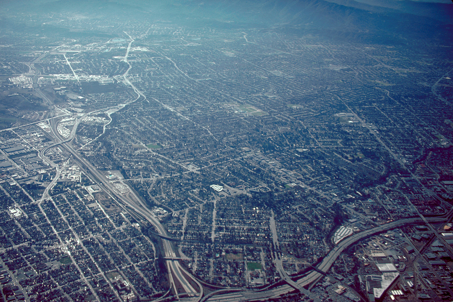
English: Aerial view of San José, California, USA. The intersection of Interstate-280 and California State Route 87 (Guadalupe Parkway) is visible at the bottom of the photograph. View is to the south.
Coordinates: 37°19′7.84″N 121°53′35.92″W / 37.3188444°N 121.8933111°W |
||
| તારીખ | not specified or unknown | ||
| સ્રોત |
U.S. Army Corps of Engineers Digital Visual Library Image page Image description page Digital Visual Library home page |
||
| લેખક | Robert Campbell | ||
| પરવાનગી (આ ફાઈલનો ફરી ઉપયોગ) |
આ ફાઈલ વપરાશની પરવાનગી : Creative Commons Attribution-Share Alike 3.0 Unported license.
|
||
| Location | San José, California, USA |

ફાઇલનો ઇતિહાસ
તારીખ/સમય ઉપર ક્લિક કરવાથી તે સમયે ફાઇલ કેવી હતી તે જોવા મળશે.
| તારીખ/સમય | લઘુચિત્ર | પરિમાણો | સભ્ય | ટિપ્પણી | |
|---|---|---|---|---|---|
| વર્તમાન | ૧૦:૩૪, ૩ મે ૨૦૦૭ | | ૧,૫૦૦ × ૧,૦૦૦ (૭૮૫ KB) | DanMS | {{Information | Description = {{en|Aerial view of San José, California, USA. The intersection of Interstate-280 and California State Route 87 (Guadalupe Parkway) is visible at the bottom of the photograph. View is to the south.}} Coordinates: {{Coor |
ફાઇલનો વપરાશ
આ ફાઇલ માં નીચેનું પાનું વપરાયેલું છે:
ફાઇલનો વ્યાપક ઉપયોગ
નીચેની બીજી વિકિઓ આ ફાઈલ વાપરે છે:
- af.wikipedia.org પર વપરાશ
- ar.wikipedia.org પર વપરાશ
- ckb.wikipedia.org પર વપરાશ
- en.wikibooks.org પર વપરાશ
- et.wikipedia.org પર વપરાશ
- fi.wikipedia.org પર વપરાશ
- hi.wikipedia.org પર વપરાશ
- hu.wikipedia.org પર વપરાશ
- ia.wikipedia.org પર વપરાશ
- id.wikipedia.org પર વપરાશ
- ja.wikipedia.org પર વપરાશ
- kn.wikipedia.org પર વપરાશ
- lmo.wikipedia.org પર વપરાશ
- ms.wikipedia.org પર વપરાશ
- pam.wikipedia.org પર વપરાશ
- pl.wikipedia.org પર વપરાશ
- simple.wikipedia.org પર વપરાશ
- sv.wikipedia.org પર વપરાશ
- vi.wikipedia.org પર વપરાશ