
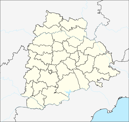
ચિત્ર:Telangana locator map.svg

મૂળભુત ફાઇલ (SVG ફાઇલ, માત્ર ૫૩૭ × ૫૦૮ પીક્સલ, ફાઇલનું કદ: ૧.૮૨ MB)
સારાંશ:
| વર્ણન |
English: Telangana place locator తెలుగు: తెలంగాణ ప్రదేశ సూచికా పటము |
| તારીખ | |
| સ્રોત |
પોતાની રચના, File updated to reflect border changes of Telangana. Projection: Equi Rectangular Plate Carree for TG Extent: -180.00, -90.00, 180.00, 90.00 Proj4: +proj=eqc +lat_ts=0 +lat_0=17.840669 +lon_0=79.048467E +x_0=0 +y_0=0 +datum=WGS84 +units=m +no_defs Extents Top 20.334882 Bottom: 15.346458 Left: 76.408599 Right:81.688339 Interior District borders are raster from http://tracgis.telangana.gov.in/districtformation/districtformation/default.aspx Processed using QGIS 3.6 and Inkscape 0.92 on Ubuntu 18.04 For the template used for locating, please see https://te.wikipedia.org/wiki/Template:Telangana_locator_map |
| લેખક | The original uploader was Arjunaraoc at તેલુગુ વિકિપીડિયા. |
| SVG genesis |
પરવાના
- તમે મુક્ત છો:
- વહેંચવા – નકલ કરવા, વિતરણ કરવા અને રચનાઓ મોકલવા
- રીમિક્સ કરવા કે મઠારવા – રચના અપનાવવા
- નીચેની શરત હેઠળ:
- આરોપણ – તમારે આ રચનાનો ઉપયોગ કરવા માટે લેખક કે પ્રકાશન અધિકાર ધારકની યોગ્ય માહિતી, પરવાનગી (લાયસન્સ)ની કડી અને તેમાં ફેરફાર કર્યો હોય તો તેનો ઉલ્લેખ કરવો જ પડશે. તમે આ સત્તા અનુસાર જ આ રચનાનો પ્રયોગ થવો જોઈએ, પણ તેઓ તમને અથવા તમારા ઉપયોગ સાથે સંમત થાય છે તે રીતે નહીં.
- શેર- અલાઈક (બિન ભેદભાવ વહેંચણી) – તમે જો આ રચનાને બદલશો, તેમાં ફેરફાર કરશો અથવા તેના પર આધારિત કોઇ કાર્ય બનાવશો તો તમારે પરિણામી કાર્યને તે જ અથવા અનુરૂપ પરવાનગી હેઠળ જ પ્રકાશિત કરવું પડશે.
અસલ - મૂળ અપલોડનો લોગ
| તારીખ/સમય | પરિમાણો | સભ્ય | ટિપ્પણી |
|---|---|---|---|
| 2015-05-05 05:53 | 512×450× (581780 bytes) | Arjunaraoc | Equi rectangular projection of Telangana based on 1) India State and District maps from http://mnre.gov.in/sec/solar-assmnt.htm, [http://mnre.gov.in/copyright-policy copyright policy free for any use with attribution] accessed 2015-03-19) 3)River shape... |
| 2015-03-18 11:34 | 1070×740× (434459 bytes) | Arjunaraoc | [[వికీపీడియా:ఫైల్_ఎక్కింపు_విజర్డు|ఫైల్ ఎక్కింపు విజర్డు-]] ముద్రితమైన ఉచిత మూలంనుండి ఒక ఫైల్ |
ફાઇલનો ઇતિહાસ
તારીખ/સમય ઉપર ક્લિક કરવાથી તે સમયે ફાઇલ કેવી હતી તે જોવા મળશે.
| તારીખ/સમય | લઘુચિત્ર | પરિમાણો | સભ્ય | ટિપ્પણી | |
|---|---|---|---|---|---|
| વર્તમાન | ૧૦:૪૬, ૬ જુલાઇ ૨૦૨૦ | | ૫૩૭ × ૫૦૮ (૧.૮૨ MB) | Arjunaraoc | Reverted to version as of 11:00, 17 April 2019 (UTC) |
| ૧૧:૧૧, ૨૮ જૂન ૨૦૨૦ |  | ૪૪૩ × ૪૪૩ (૨૨૭ KB) | C1MM | Fixed Krishna river delta | |
| ૦૧:૧૯, ૪ જૂન ૨૦૨૦ |  | ૪૪૩ × ૪૪૩ (૨૨૭ KB) | C1MM | Increased district boundary size, fixed unjoined district boundary | |
| ૦૯:૧૯, ૫ મે ૨૦૨૦ |  | ૪૪૩ × ૪૪૩ (૨૨૯ KB) | C1MM | Fixed colors | |
| ૦૦:૪૦, ૨૩ એપ્રિલ ૨૦૨૦ |  | ૪૪૩ × ૪૪૩ (૨૨૯ KB) | C1MM | Fixed border colors | |
| ૨૨:૪૦, ૧૬ એપ્રિલ ૨૦૨૦ |  | ૪૪૩ × ૪૪૩ (૨૨૯ KB) | C1MM | Changed colors and boundaries to be smaller | |
| ૦૩:૩૪, ૧૫ એપ્રિલ ૨૦૨૦ |  | ૫૩૭ × ૫૦૮ (૨૪૨ KB) | C1MM | Made lake standard | |
| ૧૧:૧૪, ૧૨ એપ્રિલ ૨૦૨૦ |  | ૫૩૭ × ૫૦૮ (૨૪૨ KB) | C1MM | Changed district boundaries and re-did layering | |
| ૨૦:૦૪, ૨૨ માર્ચ ૨૦૨૦ |  | ૫૩૭ × ૫૦૮ (૧.૮૧ MB) | C1MM | Added standard colors and made borders prominent | |
| ૧૬:૩૦, ૧૭ એપ્રિલ ૨૦૧૯ |  | ૫૩૭ × ૫૦૮ (૧.૮૨ MB) | Arjunaraoc | Updated with Telangana districts as vector layer |
ફાઇલનો વપરાશ
આ ફાઇલ માં 4 નીચેનાં પાનાઓ વપરાયેલાં છે:
ફાઇલનો વ્યાપક ઉપયોગ
નીચેની બીજી વિકિઓ આ ફાઈલ વાપરે છે:
- azb.wikipedia.org પર વપરાશ
- حئیدرآباد (هیندوستان)
- علیآباد، رنقا ردی
- عبداللهپور
- عالمپور، محبوبنقار
- معینآباد، مندال
- ونوقوپالپورام
- وانام واری کریشناپورام
- ساتیانارایاناپورام
- ساروپالی, نالقوندا دیستریکت
- ساروارام
- سارانقاپور, جاقتیال دیستریکت
- مدارام
- سانقام, وارانقال دیستریکت
- کالشوارام
- مارور, نالقوندا دیستریکت
- ونکپالی
- ماریقودم
- ماریقودا
- مارپال
- مارکوک, تلانقانا
- ماریپدا
- ولولا (هیندوستان)
- کایسارام
- ولماکان
- ولقاتور
- ولپور (هیندوستان)
- واسانتاپورام
- وارشاکوندا
- سایداپور
- مانواریپامپو
- کادتال
- موست آباد
- کاداورقو
- شامش آباد
- سولیپور
- کاداپارتی
- رودرارام
- مانقاپت
- مانقالپالی, نالقوندا دیستریکت
- مانقالاقودم
- کئی. آر. پورام (تلانقانا)
- جوکال, ایندیا
- ماندالاپورام
- آنانتارام, نالقوندا ماندال
- آنانتارام, مداک دیستریکت
- آنانتارام, شامیرپت ماندال
- آنانتارام, بونجیر ماندال
- رمیدیچرلا
- آناجپور
- جینارام
આ ફાઇલના વધુ વૈશ્વિક વપરાશ જુઓ.