
ચિત્ર:Uttar Pradesh administrative divisions.svg

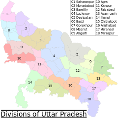
Size of this PNG preview of this SVG file: ૬૦૦ × ૬૦૦ પિક્સેલ. અન્ય આવર્તનો: ૨૪૦ × ૨૪૦ પિક્સેલ | ૪૮૦ × ૪૮૦ પિક્સેલ | ૭૬૮ × ૭૬૮ પિક્સેલ | ૧,૦૨૪ × ૧,૦૨૪ પિક્સેલ | ૨,૦૪૮ × ૨,૦૪૮ પિક્સેલ | ૧,૫૦૦ × ૧,૫૦૦ પિક્સેલ.
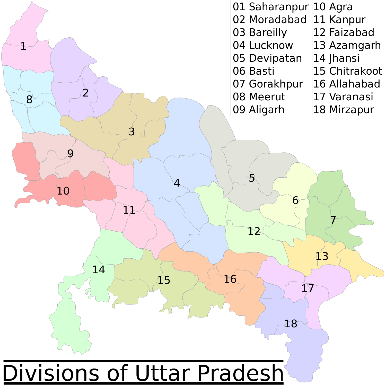
મૂળભુત ફાઇલ (SVG ફાઇલ, માત્ર ૧,૫૦૦ × ૧,૫૦૦ પીક્સલ, ફાઇલનું કદ: ૧૨૧ KB)
સારાંશ:
| વર્ણન |
English: This map has been created by Faiz Haider, it is based on Map of Uttar Pradesh on National Portal of India. |
| તારીખ | ૭ ફેબ્રુઆરી ૨૦૦૯ (original upload date) |
| સ્રોત | Transferred from en.wikipedia to Commons by Jeroen using CommonsHelper. |
| લેખક | Faizhaider at અંગ્રેજી વિકિપીડિયા |
| અન્ય આવૃત્તિઓ |
[]
|


પરવાના
| આ રચના ના લેખક Faizhaider at અંગ્રેજી વિકિપીડિયા દ્વારા આ રચનાને public domain હેઠળ પ્રકાશિત કરાઈ છે. આ સવલત વિશ્વવ્યપી છે અમુક દેશોમાં કાયદેસર રીતે તે શક્ય નથી, જો તેમ હોય તો : Faizhaider દ્વારા કોઈને પણ કોઈપણ વપરાશ, કોઇ પણ શરત વગર, માટે આ રચના વાપરવાની છૂટ આપાઈ છે સિવાયકે તે શરતો કાયદેસર જરૂરી હોય. |
અસલ - મૂળ અપલોડનો લોગ
The original description page was here. All following user names refer to en.wikipedia.
- 2009-02-07 07:05 Faizhaider 1500×1500× (123417 bytes) This map has been created by [[User:Faizhaider|me]], it is based on [http://india.gov.in/maps/up.php Map of Uttar Pradesh on National Portal of India].
ફાઇલનો ઇતિહાસ
તારીખ/સમય ઉપર ક્લિક કરવાથી તે સમયે ફાઇલ કેવી હતી તે જોવા મળશે.
| તારીખ/સમય | લઘુચિત્ર | પરિમાણો | સભ્ય | ટિપ્પણી | |
|---|---|---|---|---|---|
| વર્તમાન | ૦૩:૪૫, ૩૧ જુલાઇ ૨૦૦૯ | | ૧,૫૦૦ × ૧,૫૦૦ (૧૨૧ KB) | File Upload Bot (Magnus Manske) | {{BotMoveToCommons|en.wikipedia|year={{subst:CURRENTYEAR}}|month={{subst:CURRENTMONTHNAME}}|day={{subst:CURRENTDAY}}}} {{Information |Description={{en|This map has been created by Faiz Haider, it is based on [http://india.gov.in/m |
ફાઇલનો વપરાશ
આ ફાઇલને કોઇ પાનાં વાપરતા નથી.
ફાઇલનો વ્યાપક ઉપયોગ
નીચેની બીજી વિકિઓ આ ફાઈલ વાપરે છે:
- as.wikipedia.org પર વપરાશ
- bh.wikipedia.org પર વપરાશ
- de.wikipedia.org પર વપરાશ
- en.wikipedia.org પર વપરાશ
- es.wikipedia.org પર વપરાશ
- fr.wikipedia.org પર વપરાશ
- ha.wikipedia.org પર વપરાશ
- hr.wikipedia.org પર વપરાશ
- it.wikipedia.org પર વપરાશ
- ml.wikipedia.org પર વપરાશ
- mr.wikipedia.org પર વપરાશ
- ne.wikipedia.org પર વપરાશ
- nl.wikipedia.org પર વપરાશ
- pnb.wikipedia.org પર વપરાશ
- ru.wikipedia.org પર વપરાશ
- sa.wikipedia.org પર વપરાશ
- sd.wikipedia.org પર વપરાશ
- sh.wikipedia.org પર વપરાશ
- sr.wikipedia.org પર વપરાશ
- ta.wikipedia.org પર વપરાશ
- th.wikipedia.org પર વપરાશ
- ur.wikipedia.org પર વપરાશ
- zh.wikipedia.org પર વપરાશ