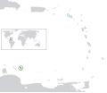
ચિત્ર:BES islands location map.svg

Size of this PNG preview of this SVG file: ૬૯૮ × ૫૯૯ પિક્સેલ. અન્ય આવર્તનો: ૨૮૦ × ૨૪૦ પિક્સેલ | ૫૫૯ × ૪૮૦ પિક્સેલ | ૮૯૪ × ૭૬૮ પિક્સેલ | ૧,૧૯૨ × ૧,૦૨૪ પિક્સેલ | ૨,૩૮૫ × ૨,૦૪૮ પિક્સેલ | ૧,૩૪૬ × ૧,૧૫૬ પિક્સેલ.
મૂળભુત ફાઇલ (SVG ફાઇલ, માત્ર ૧,૩૪૬ × ૧,૧૫૬ પીક્સલ, ફાઇલનું કદ: ૧૭૭ KB)
ફાઇલનો ઇતિહાસ
તારીખ/સમય ઉપર ક્લિક કરવાથી તે સમયે ફાઇલ કેવી હતી તે જોવા મળશે.
| તારીખ/સમય | લઘુચિત્ર | પરિમાણો | સભ્ય | ટિપ્પણી | |
|---|---|---|---|---|---|
| વર્તમાન | ૨૧:૫૧, ૨૭ જૂન ૨૦૧૧ |  | ૧,૩૪૬ × ૧,૧૫૬ (૧૭૭ KB) | Thayts | Strokes tweak |
| ૦૧:૦૨, ૮ માર્ચ ૨૦૧૧ |  | ૧,૩૪૬ × ૧,૧૫૬ (૧૭૭ KB) | Thayts | Strokes tweak | |
| ૨૧:૨૮, ૬ માર્ચ ૨૦૧૧ |  | ૧,૩૪૬ × ૧,૧૫૬ (૧૭૭ KB) | Thayts | Strokes tweak | |
| ૨૧:૦૧, ૬ માર્ચ ૨૦૧૧ |  | ૧,૩૪૬ × ૧,૧૫૬ (૧૭૭ KB) | Thayts | Darker gray | |
| ૧૮:૨૪, ૬ માર્ચ ૨૦૧૧ |  | ૧,૩૪૬ × ૧,૧૫૬ (૧૭૭ KB) | Thayts | Minor changes | |
| ૦૨:૨૫, ૬ માર્ચ ૨૦૧૧ |  | ૧,૩૪૬ × ૧,૧૫૬ (૨૧૪ KB) | Thayts | Minor changes | |
| ૦૨:૧૦, ૬ માર્ચ ૨૦૧૧ |  | ૧,૩૪૬ × ૧,૧૫૬ (૨૧૫ KB) | Thayts | Made circles darker for better visibility | |
| ૦૨:૦૨, ૬ માર્ચ ૨૦૧૧ |  | ૧,૩૪૬ × ૧,૧૫૬ (૨૧૫ KB) | Thayts | {{Information |Description={{en|Location map of the BES islands in the Lesser Antilles}} Equirectangular projection, N/S stretching 103 %. Geographic limits of the map: * N: 19.2° N * S: 9.7° N * W: 70.5° W * |
ફાઇલનો વપરાશ
આ ફાઇલને કોઇ પાનાં વાપરતા નથી.
ફાઇલનો વ્યાપક ઉપયોગ
નીચેની બીજી વિકિઓ આ ફાઈલ વાપરે છે:
- af.wikipedia.org પર વપરાશ
- ar.wikipedia.org પર વપરાશ
- arz.wikipedia.org પર વપરાશ
- awa.wikipedia.org પર વપરાશ
- azb.wikipedia.org પર વપરાશ
- az.wikipedia.org પર વપરાશ
- ban.wikipedia.org પર વપરાશ
- be.wikipedia.org પર વપરાશ
- bh.wikipedia.org પર વપરાશ
- blk.wikipedia.org પર વપરાશ
- bs.wikipedia.org પર વપરાશ
- ca.wikipedia.org પર વપરાશ
- ceb.wikipedia.org પર વપરાશ
- chy.wikipedia.org પર વપરાશ
- cs.wikipedia.org પર વપરાશ
- da.wikipedia.org પર વપરાશ
- de.wikipedia.org પર વપરાશ
- diq.wikipedia.org પર વપરાશ
- el.wikipedia.org પર વપરાશ
- en.wikipedia.org પર વપરાશ
- en.wiktionary.org પર વપરાશ
- eo.wikipedia.org પર વપરાશ
- es.wikipedia.org પર વપરાશ
- fa.wikipedia.org પર વપરાશ
- fi.wikipedia.org પર વપરાશ
- fr.wikipedia.org પર વપરાશ
- fy.wikipedia.org પર વપરાશ
- ga.wikipedia.org પર વપરાશ
- gd.wiktionary.org પર વપરાશ
- gl.wikipedia.org પર વપરાશ
- he.wikipedia.org પર વપરાશ
- hi.wikipedia.org પર વપરાશ
- hr.wikipedia.org પર વપરાશ
- hu.wikipedia.org પર વપરાશ
- hy.wikipedia.org પર વપરાશ
- ia.wikipedia.org પર વપરાશ
- id.wikipedia.org પર વપરાશ
આ ફાઇલના વધુ વૈશ્વિક વપરાશ જુઓ.
