
ચિત્ર:England locator map with North East England highlighted.svg

Size of this PNG preview of this SVG file: ૪૯૪ × ૬૦૦ પિક્સેલ. અન્ય આવર્તનો: ૧૯૮ × ૨૪૦ પિક્સેલ | ૩૯૫ × ૪૮૦ પિક્સેલ | ૬૩૨ × ૭૬૮ પિક્સેલ | ૮૪૩ × ૧,૦૨૪ પિક્સેલ | ૧,૬૮૬ × ૨,૦૪૮ પિક્સેલ | ૮૧૬ × ૯૯૧ પિક્સેલ.
મૂળભુત ફાઇલ (SVG ફાઇલ, માત્ર ૮૧૬ × ૯૯૧ પીક્સલ, ફાઇલનું કદ: ૪૬૯ KB)
| વર્ણન |
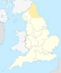
English: Equirectangular projection of England; North East England is highlighted. |
| તારીખ | |
| સ્રોત | File:England location map.svg |
| લેખક | |
| પરવાનગી (આ ફાઈલનો ફરી ઉપયોગ) |
આ ફાઈલ વપરાશની પરવાનગી : Creative Commons Attribution-Share Alike 3.0 Unported license.
|
ફાઇલનો ઇતિહાસ
તારીખ/સમય ઉપર ક્લિક કરવાથી તે સમયે ફાઇલ કેવી હતી તે જોવા મળશે.
| તારીખ/સમય | લઘુચિત્ર | પરિમાણો | સભ્ય | ટિપ્પણી | |
|---|---|---|---|---|---|
| વર્તમાન | ૧૫:૦૪, ૮ એપ્રિલ ૨૦૧૦ | | ૮૧૬ × ૯૯૧ (૪૬૯ KB) | Jappalang | {{Information |Description=Equirectangular projection of England; Northumberland is highlighted |Source=File:England location map.svg |Date=2010-04-08 |Author=* File:England location map.svg: Spischot * author: [[User:Jappalang |
ફાઇલનો વપરાશ
આ ફાઇલ માં 2 નીચેનાં પાનાઓ વપરાયેલાં છે:
ફાઇલનો વ્યાપક ઉપયોગ
નીચેની બીજી વિકિઓ આ ફાઈલ વાપરે છે:
- am.wikipedia.org પર વપરાશ
- ar.wikipedia.org પર વપરાશ
- as.wikipedia.org પર વપરાશ
- bh.wikipedia.org પર વપરાશ
- blk.wikipedia.org પર વપરાશ
- bn.wikipedia.org પર વપરાશ
- bs.wikipedia.org પર વપરાશ
- ca.wikipedia.org પર વપરાશ
- cy.wikipedia.org પર વપરાશ
- da.wikipedia.org પર વપરાશ
- diq.wikipedia.org પર વપરાશ
- dty.wikipedia.org પર વપરાશ
- dv.wikipedia.org પર વપરાશ
- en.wikipedia.org પર વપરાશ
- Template:Location map+
- Template:Location map~
- Template:Location map+/doc
- Template:Location map+/sandbox
- Template:Location map+/testcases
- Template:Location map~/sandbox
- Template:Location map+/AlternativeMap
- User:Arjunaraoc/sandbox/SampleMap1
- User:Arjunaraoc/sandbox/SampleMap2
- User:Arjunaraoc/sandbox/SampleMap3
- en.wikibooks.org પર વપરાશ
- en.wikiversity.org પર વપરાશ
- fa.wikipedia.org પર વપરાશ
આ ફાઇલના વધુ વૈશ્વિક વપરાશ જુઓ.