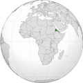
ચિત્ર:Eritrea (Africa orthographic projection).svg

Size of this PNG preview of this SVG file: ૫૫૦ × ૫૫૦ પિક્સેલ. અન્ય આવર્તનો: ૨૪૦ × ૨૪૦ પિક્સેલ | ૪૮૦ × ૪૮૦ પિક્સેલ | ૭૬૮ × ૭૬૮ પિક્સેલ | ૧,૦૨૪ × ૧,૦૨૪ પિક્સેલ | ૨,૦૪૮ × ૨,૦૪૮ પિક્સેલ.
મૂળભુત ફાઇલ (SVG ફાઇલ, માત્ર ૫૫૦ × ૫૫૦ પીક્સલ, ફાઇલનું કદ: ૧૪૧ KB)
ફાઇલનો ઇતિહાસ
તારીખ/સમય ઉપર ક્લિક કરવાથી તે સમયે ફાઇલ કેવી હતી તે જોવા મળશે.
| તારીખ/સમય | લઘુચિત્ર | પરિમાણો | સભ્ય | ટિપ્પણી | |
|---|---|---|---|---|---|
| વર્તમાન | ૧૪:૨૫, ૯ એપ્રિલ ૨૦૧૮ |  | ૫૫૦ × ૫૫૦ (૧૪૧ KB) | Nikki070 | Reverted to version as of 20:28, 16 December 2012 (UTC); unification |
| ૦૧:૦૭, ૧૮ માર્ચ ૨૦૧૭ |  | ૫૫૦ × ૫૫૦ (૧૮૫ KB) | Esmu Igors | Colors from the locator map of France don't seem to have enough contrast; I therefore made Africa on the map darker. | |
| ૦૧:૦૪, ૧૮ માર્ચ ૨૦૧૭ |  | ૫૫૦ × ૫૫૦ (૧૮૫ KB) | Esmu Igors | Description, at least on the en.wikipedia.org article "Eritrea" has description about Africa dark grey and the rest of the world gray. I didn't see any of this, so changed the colours as were in an analogous map for France. | |
| ૧૪:૦૭, ૧૫ મે ૨૦૧૬ |  | ૫૫૦ × ૫૫૦ (૧૮૬ KB) | Richard0048 | Reverted to version as of 20:52, 14 May 2016 (UTC) | |
| ૧૩:૪૫, ૧૫ મે ૨૦૧૬ |  | ૫૫૦ × ૫૫૦ (૧૮૬ KB) | Richard0048 | Col | |
| ૦૨:૨૨, ૧૫ મે ૨૦૧૬ |  | ૫૫૦ × ૫૫૦ (૧૮૬ KB) | Richard0048 | clearer borders | |
| ૦૨:૧૯, ૧૫ મે ૨૦૧૬ |  | ૫૫૦ × ૫૫૦ (૧૮૬ KB) | Richard0048 | Reverted to version as of 16:51, 13 December 2012 (UTC) | |
| ૦૧:૫૮, ૧૭ ડિસેમ્બર ૨૦૧૨ |  | ૫૫૦ × ૫૫૦ (૧૪૧ KB) | Sémhur | Light grey version ; prominent Congo river removed | |
| ૨૨:૨૧, ૧૩ ડિસેમ્બર ૨૦૧૨ |  | ૫૫૦ × ૫૫૦ (૧૮૬ KB) | Chipmunkdavis | Version with colours that greatly contrast, with South Sudan border and other fixes | |
| ૧૫:૦૪, ૧૩ ડિસેમ્બર ૨૦૧૨ |  | ૫૫૦ × ૫૫૦ (૧૪૨ KB) | Sémhur | That's your pov, not mine, but please do not destroy informations! (south sudan border and few corrections) |
ફાઇલનો વપરાશ
આ ફાઇલને કોઇ પાનાં વાપરતા નથી.
ફાઇલનો વ્યાપક ઉપયોગ
નીચેની બીજી વિકિઓ આ ફાઈલ વાપરે છે:
- ami.wikipedia.org પર વપરાશ
- ar.wikipedia.org પર વપરાશ
- arz.wikipedia.org પર વપરાશ
- avk.wikipedia.org પર વપરાશ
- azb.wikipedia.org પર વપરાશ
- az.wiktionary.org પર વપરાશ
- be-tarask.wikipedia.org પર વપરાશ
- bew.wikipedia.org પર વપરાશ
- bg.wikipedia.org પર વપરાશ
- bh.wikipedia.org પર વપરાશ
- bi.wikipedia.org પર વપરાશ
- ca.wikipedia.org પર વપરાશ
- ceb.wikipedia.org પર વપરાશ
- ckb.wikipedia.org પર વપરાશ
- cs.wikipedia.org પર વપરાશ
- cu.wikipedia.org પર વપરાશ
- da.wikipedia.org પર વપરાશ
- de.wikivoyage.org પર વપરાશ
- din.wikipedia.org પર વપરાશ
- dv.wikipedia.org પર વપરાશ
- el.wikipedia.org પર વપરાશ
- en.wikipedia.org પર વપરાશ
- en.wikinews.org પર વપરાશ
- en.wikivoyage.org પર વપરાશ
- eo.wikipedia.org પર વપરાશ
- es.wikipedia.org પર વપરાશ
- eu.wikipedia.org પર વપરાશ
- fa.wikipedia.org પર વપરાશ
- ff.wikipedia.org પર વપરાશ
- fi.wikipedia.org પર વપરાશ
- fr.wikipedia.org પર વપરાશ
- fr.wikinews.org પર વપરાશ
- gl.wikipedia.org પર વપરાશ
- ha.wikipedia.org પર વપરાશ
- he.wikipedia.org પર વપરાશ
આ ફાઇલના વધુ વૈશ્વિક વપરાશ જુઓ.
