
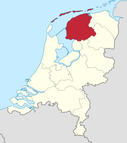
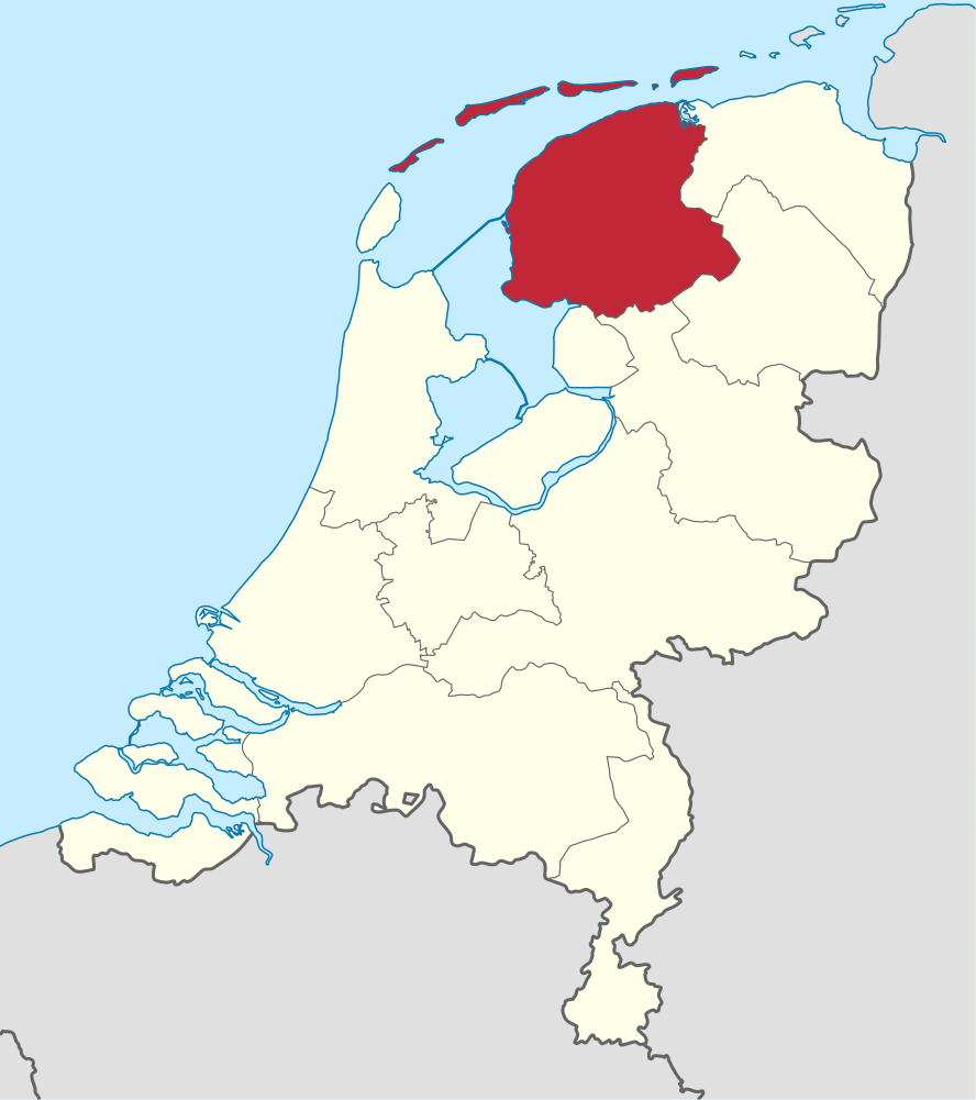
ચિત્ર:Friesland in the Netherlands.svg

Size of this PNG preview of this SVG file: ૫૩૨ × ૬૦૦ પિક્સેલ. અન્ય આવર્તનો: ૨૧૩ × ૨૪૦ પિક્સેલ | ૪૨૬ × ૪૮૦ પિક્સેલ | ૬૮૧ × ૭૬૮ પિક્સેલ | ૯૦૮ × ૧,૦૨૪ પિક્સેલ | ૧,૮૧૭ × ૨,૦૪૮ પિક્સેલ | ૮૮૮ × ૧,૦૦૧ પિક્સેલ.
મૂળભુત ફાઇલ (SVG ફાઇલ, માત્ર ૮૮૮ × ૧,૦૦૧ પીક્સલ, ફાઇલનું કદ: ૧૪૭ KB)
સારાંશ:
.svg)
.svg)
.svg)
.svg)
.svg)
.svg)
.svg)

-en.svg)

.svg)
.svg)
.svg)

_(US48).svg)
_(small_islands_magnified)_(-mini_map_-rivers).svg)
.svg)
_(extra_close)_(US48).svg)
.svg)
_(zoom).svg)

.svg)


_(UNMIK).svg)
.svg)
_(disputed_hatched).svg)
_(claimed_and_disputed_hatched).svg)
.svg)
.svg)
_(%2Ball_claims_hatched).svg)

.svg)
_(shade).svg)
_(shade)_(special_marker).svg)
_(-mini_map).svg)
_(-mini_map).svg)
_(-mini_map).svg)


.svg)

.svg)
પરવાના
હું, આ કાર્યનો પ્રકાશનાધિકાર ધારક, તેને નીચેના પરવાનાઓ હેઠળ અહીં પ્રકાશીત કરૂં છું:

|
આ રચનાની નકલ કરવા, વિતરણ અને સુધારો કરવા માટે GNU Free Documentation License, આવૃત્તિ 1.2 કે અન્ય આગળની આવૃત્તિ Free Software Foundation હેઠળ પરવાનગી છે; જેમાં કોઈ Invariant Sections, no Front-Cover Texts, and no Back-Cover Texts નથી. આ પરવાનાની પ્રત GNU Free Documentation License વિભાગમાં છે. |
આ ફાઈલ વપરાશની પરવાનગી : Creative Commons Attribution-Share Alike 3.0 Unported license.
- તમે મુક્ત છો:
- વહેંચવા – નકલ કરવા, વિતરણ કરવા અને રચનાઓ મોકલવા
- રીમિક્સ કરવા કે મઠારવા – રચના અપનાવવા
- નીચેની શરત હેઠળ:
- આરોપણ – તમારે આ રચનાનો ઉપયોગ કરવા માટે લેખક કે પ્રકાશન અધિકાર ધારકની યોગ્ય માહિતી, પરવાનગી (લાયસન્સ)ની કડી અને તેમાં ફેરફાર કર્યો હોય તો તેનો ઉલ્લેખ કરવો જ પડશે. તમે આ સત્તા અનુસાર જ આ રચનાનો પ્રયોગ થવો જોઈએ, પણ તેઓ તમને અથવા તમારા ઉપયોગ સાથે સંમત થાય છે તે રીતે નહીં.
- શેર- અલાઈક (બિન ભેદભાવ વહેંચણી) – તમે જો આ રચનાને બદલશો, તેમાં ફેરફાર કરશો અથવા તેના પર આધારિત કોઇ કાર્ય બનાવશો તો તમારે પરિણામી કાર્યને તે જ અથવા અનુરૂપ પરવાનગી હેઠળ જ પ્રકાશિત કરવું પડશે.
તમે તમારી પસંદગીનો પરવાનો પસંદ કરી શકો છો.

|
I'd greatly appreciate, that you attribute this media file to Wikimedia Commons, if used outside Wikipedia or Commons. For use in publications such as books, newspapers, blogs, websites, please insert here the following line:
|
ફાઇલનો ઇતિહાસ
તારીખ/સમય ઉપર ક્લિક કરવાથી તે સમયે ફાઇલ કેવી હતી તે જોવા મળશે.
| તારીખ/સમય | લઘુચિત્ર | પરિમાણો | સભ્ય | ટિપ્પણી | |
|---|---|---|---|---|---|
| વર્તમાન | ૧૬:૫૮, ૫ જાન્યુઆરી ૨૦૧૯ | | ૮૮૮ × ૧,૦૦૧ (૧૪૭ KB) | Thayts | small border corrections |
| ૧૭:૫૭, ૨ જાન્યુઆરી ૨૦૧૯ |  | ૮૮૮ × ૧,૦૦૧ (૧૪૭ KB) | Thayts | update | |
| ૧૩:૨૮, ૨૧ એપ્રિલ ૨૦૧૧ |  | ૮૮૮ × ૧,૦૦૧ (૪૭૦ KB) | TUBS | upd wegen Grenze zu Zealand und belgische Exklave im Süden | |
| ૦૫:૪૪, ૪ માર્ચ ૨૦૧૧ |  | ૮૮૮ × ૧,૦૦૧ (૪૫૯ KB) | TUBS |
ફાઇલનો વપરાશ
આ ફાઇલને કોઇ પાનાં વાપરતા નથી.
ફાઇલનો વ્યાપક ઉપયોગ
નીચેની બીજી વિકિઓ આ ફાઈલ વાપરે છે:
- af.wikipedia.org પર વપરાશ
- Friesland
- Leeuwarden
- Heerenveen
- Kategorie:Munisipaliteite in Friesland
- Vlieland
- Terschelling
- Friese
- Sjabloon:Munisipaliteite in Friesland
- Achtkarspelen
- Noardeast-Fryslân
- Schiermonnikoog
- Smallingerland
- Opsterland
- Ooststellingwerf
- Weststellingwerf
- De Fryske Marren
- Súdwest-Fryslân
- Ameland
- Dantumadiel
- Tytsjerksteradiel
- Waadhoeke
- Harlingen
- ar.wikipedia.org પર વપરાશ
- arz.wikipedia.org પર વપરાશ
- ast.wikipedia.org પર વપરાશ
- ban.wikipedia.org પર વપરાશ
- bg.wikipedia.org પર વપરાશ
- br.wikipedia.org પર વપરાશ
- ca.wikipedia.org પર વપરાશ
- ceb.wikipedia.org પર વપરાશ
- ckb.wikipedia.org પર વપરાશ
- cs.wikipedia.org પર વપરાશ
- cv.wikipedia.org પર વપરાશ
- da.wikipedia.org પર વપરાશ
- de.wikivoyage.org પર વપરાશ
- el.wikipedia.org પર વપરાશ
- el.wikivoyage.org પર વપરાશ
- en.wikipedia.org પર વપરાશ
- en.wiktionary.org પર વપરાશ
- eo.wikipedia.org પર વપરાશ
આ ફાઇલના વધુ વૈશ્વિક વપરાશ જુઓ.