
ચિત્ર:Indochina map 1886.jpg

મૂળભુત ફાઇલ (૧,૬૨૬ × ૨,૧૧૪ પીક્સલ, ફાઇલનું કદ: ૫૩૩ KB, MIME પ્રકાર: image/jpeg)
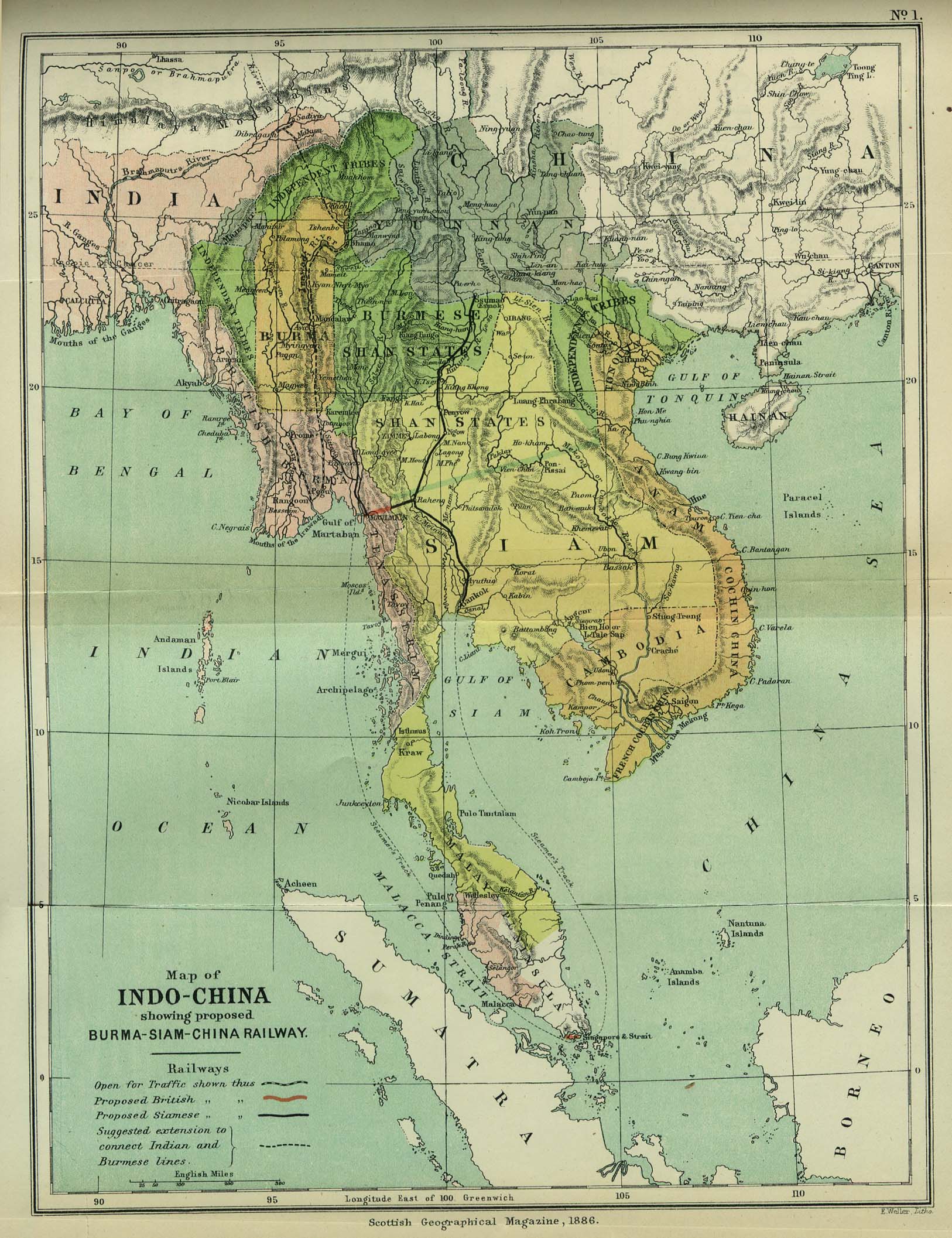
| વર્ણન | Map of Indochina | ||||
| તારીખ | |||||
| સ્રોત | http://www.lib.utexas.edu/maps/cambodia.html (http://www.lib.utexas.edu/maps/historical/indo_china_1886.jpg); Scottish Geographical Magazine (Volume II) | ||||
| લેખક | Scottish Geographical Magazine and edited by Hugh A. Webster and Arthur Silva White | ||||
| પરવાનગી (આ ફાઈલનો ફરી ઉપયોગ) |
|
||||
| અન્ય આવૃત્તિઓ | File:IndoChina1886.jpg | ||||
ફાઇલનો ઇતિહાસ
તારીખ/સમય ઉપર ક્લિક કરવાથી તે સમયે ફાઇલ કેવી હતી તે જોવા મળશે.
| તારીખ/સમય | લઘુચિત્ર | પરિમાણો | સભ્ય | ટિપ્પણી | |
|---|---|---|---|---|---|
| વર્તમાન | ૦૮:૨૬, ૨ મે ૨૦૦૮ | | ૧,૬૨૬ × ૨,૧૧૪ (૫૩૩ KB) | Calliopejen1 | {{Information |Description=Map of French Indochina |Source=http://www.lib.utexas.edu/maps/cambodia.html (http://www.lib.utexas.edu/maps/historical/indo_china_1886.jpg) |Date=1886 |Author=Scottish Geographical Magazine |Permission={{PD-old}} |other_version |
ફાઇલનો વપરાશ
આ ફાઇલને કોઇ પાનાં વાપરતા નથી.
ફાઇલનો વ્યાપક ઉપયોગ
નીચેની બીજી વિકિઓ આ ફાઈલ વાપરે છે:
- bcl.wikipedia.org પર વપરાશ
- el.wikipedia.org પર વપરાશ
- en.wikipedia.org પર વપરાશ
- en.wikiversity.org પર વપરાશ
- fi.wikipedia.org પર વપરાશ
- got.wikipedia.org પર વપરાશ
- kn.wikipedia.org પર વપરાશ
- ms.wikipedia.org પર વપરાશ
- pa.wikipedia.org પર વપરાશ
- sl.wikipedia.org પર વપરાશ
- uz.wikipedia.org પર વપરાશ