
ચિત્ર:LA County Incorporated Areas Beverly Hills highlighted.svg

Size of this PNG preview of this SVG file: ૭૩૦ × ૫૯૯ પિક્સેલ. અન્ય આવર્તનો: ૨૯૨ × ૨૪૦ પિક્સેલ | ૫૮૫ × ૪૮૦ પિક્સેલ | ૯૩૫ × ૭૬૮ પિક્સેલ | ૧,૨૪૭ × ૧,૦૨૪ પિક્સેલ | ૨,૪૯૪ × ૨,૦૪૮ પિક્સેલ | ૯૫૦ × ૭૮૦ પિક્સેલ.
મૂળભુત ફાઇલ (SVG ફાઇલ, માત્ર ૯૫૦ × ૭૮૦ પીક્સલ, ફાઇલનું કદ: ૧૫૬ KB)
સારાંશ:
| વર્ણન |
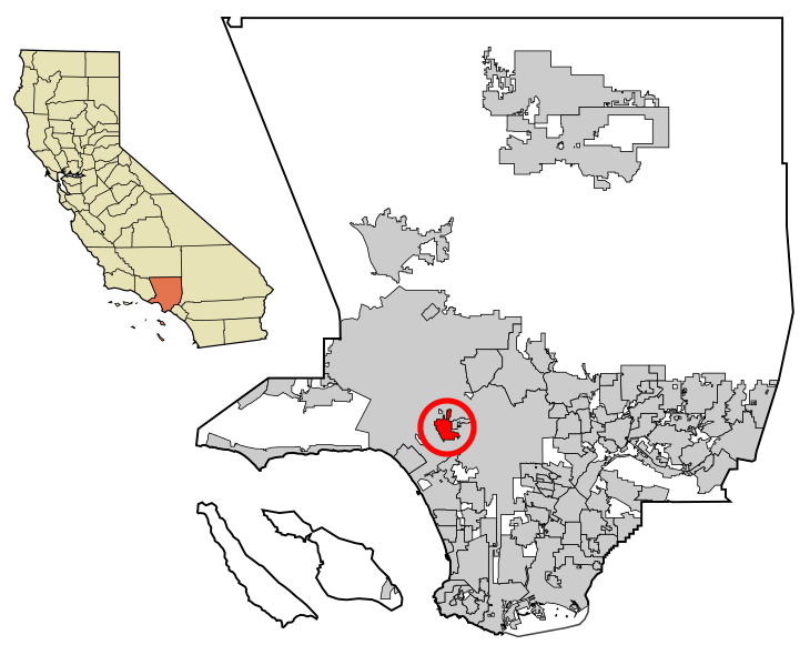
Beverly Hills is highlighted in red.
|
| તારીખ | |
| સ્રોત | My own work, based on public domain information. Though I strove to be as accurate in the detail as possible, the information shown is not guaranteed to be completely accurate. |
| લેખક | Ixnayonthetimmay |
| પરવાનગી (આ ફાઈલનો ફરી ઉપયોગ) |
Public Domain |
| અન્ય આવૃત્તિઓ | See Category:Maps of Los Angeles County for other versions of this image. |
W3C-validity not checked.
પરવાના
| હું, આ રચનાઓ પ્રકાશન અધિકાર ધારક, આ રચનાને public domain પર પ્રકાશિત કરું છું. આ સમગ્ર વિશ્વમઆં કાર્યરત રહેશે. અમુક દેશોમાં કાયદેસર રીતે તે શક્ય નથી, જો તેમ હોય તો : કો કોઈને પણ કોઈપણ વપરાશ, કોઇ પણ શરત વગર, માટે આ રચના વાપરવાની છૂટ આપું છું સિવાયકે તે શરતો કાયદેસર જરૂરી હોય. |
ફાઇલનો ઇતિહાસ
તારીખ/સમય ઉપર ક્લિક કરવાથી તે સમયે ફાઇલ કેવી હતી તે જોવા મળશે.
| તારીખ/સમય | લઘુચિત્ર | પરિમાણો | સભ્ય | ટિપ્પણી | |
|---|---|---|---|---|---|
| વર્તમાન | ૧૬:૨૩, ૭ એપ્રિલ ૨૦૧૩ | | ૯૫૦ × ૭૮૦ (૧૫૬ KB) | Citypeek | another try |
| ૧૪:૫૦, ૭ એપ્રિલ ૨૦૧૩ |  | ૯૫૦ × ૭૮૦ (૧૫૬ KB) | Citypeek | Another try | |
| ૧૪:૪૩, ૭ એપ્રિલ ૨૦૧૩ |  | ૯૫૦ × ૭૮૦ (૧૫૬ KB) | Citypeek | Cleanup of file. Valid SVG now. | |
| ૧૦:૨૨, ૨૯ જૂન ૨૦૦૭ |  | ૯૫૦ × ૭૮૦ (૨૬૨ KB) | Ixnayonthetimmay | == Summary == {{Information |Description=This map shows the incorporated areas in Los Angeles County, California. Beverly Hills is highlighted |
ફાઇલનો વપરાશ
આ ફાઇલને કોઇ પાનાં વાપરતા નથી.
ફાઇલનો વ્યાપક ઉપયોગ
નીચેની બીજી વિકિઓ આ ફાઈલ વાપરે છે:
- af.wikipedia.org પર વપરાશ
- ang.wikipedia.org પર વપરાશ
- ar.wikipedia.org પર વપરાશ
- arz.wikipedia.org પર વપરાશ
- ast.wikipedia.org પર વપરાશ
- ca.wikipedia.org પર વપરાશ
- ceb.wikipedia.org પર વપરાશ
- cs.wikipedia.org પર વપરાશ
- cy.wikipedia.org પર વપરાશ
- de.wikipedia.org પર વપરાશ
- el.wikipedia.org પર વપરાશ
- eo.wikipedia.org પર વપરાશ
- es.wikipedia.org પર વપરાશ
- eu.wikipedia.org પર વપરાશ
- fa.wikipedia.org પર વપરાશ
- fi.wikipedia.org પર વપરાશ
- fr.wikipedia.org પર વપરાશ
- fy.wikipedia.org પર વપરાશ
- gd.wikipedia.org પર વપરાશ
- gl.wikipedia.org પર વપરાશ
- he.wikipedia.org પર વપરાશ
- hr.wikipedia.org પર વપરાશ
- ht.wikipedia.org પર વપરાશ
- hu.wikipedia.org પર વપરાશ
- id.wikipedia.org પર વપરાશ
- io.wikipedia.org પર વપરાશ
- it.wikipedia.org પર વપરાશ
- it.wikivoyage.org પર વપરાશ
- mk.wikipedia.org પર વપરાશ
- ml.wikipedia.org પર વપરાશ
- no.wikipedia.org પર વપરાશ
- pnb.wikipedia.org પર વપરાશ
- pt.wikipedia.org પર વપરાશ
- ro.wikipedia.org પર વપરાશ
- ru.wikipedia.org પર વપરાશ
- sco.wikipedia.org પર વપરાશ
- sh.wikipedia.org પર વપરાશ
- si.wikipedia.org પર વપરાશ
- sr.wikipedia.org પર વપરાશ
- th.wikipedia.org પર વપરાશ
- tr.wikipedia.org પર વપરાશ
- tt.wikipedia.org પર વપરાશ
- ur.wikipedia.org પર વપરાશ
- vi.wikipedia.org પર વપરાશ
- vo.wikipedia.org પર વપરાશ
- www.wikidata.org પર વપરાશ
- zh-min-nan.wikipedia.org પર વપરાશ
- zh.wikipedia.org પર વપરાશ