
ચિત્ર:Ladakh locator map.svg

Size of this PNG preview of this SVG file: ૭૬૪ × ૬૦૦ પિક્સેલ. અન્ય આવર્તનો: ૩૦૬ × ૨૪૦ પિક્સેલ | ૬૧૧ × ૪૮૦ પિક્સેલ | ૯૭૮ × ૭૬૮ પિક્સેલ | ૧,૨૮૦ × ૧,૦૦૫ પિક્સેલ | ૨,૫૬૦ × ૨,૦૧૦ પિક્સેલ | ૨,૧૬૦ × ૧,૬૯૬ પિક્સેલ.
મૂળભુત ફાઇલ (SVG ફાઇલ, માત્ર ૨,૧૬૦ × ૧,૬૯૬ પીક્સલ, ફાઇલનું કદ: ૨૦૨ KB)
| શીર્ષક |
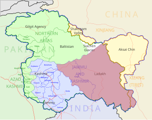
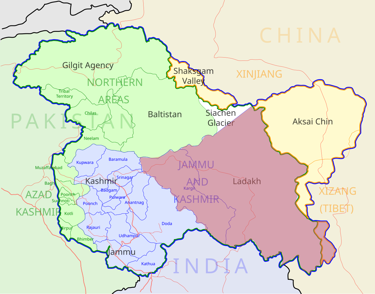
Ladakh locator map |
| Description |
Locator map for the region of w:Ladakh (higlighted in red) in the w:Indian state of w:Jammu and Kashmir |
| તારીખ | |
| સ્રોત |
પોતાની રચના |
| રચયિતા | |
| પરવાનગી (આ ફાઈલનો ફરી ઉપયોગ) |
હું, આ કાર્યનો પ્રકાશનાધિકાર ધારક, તેને નીચેના પરવાના હેઠળ અહીં પ્રકાશીત કરૂં છું: આ ફાઈલ વપરાશની પરવાનગી : Creative Commons Attribution-Share Alike 3.0 Unported license.
|
| Geotemporal data | |
| Date depicted | second half of 20 century અને 21 century |
| Georeferencing | If inappropriate please set warp_status = skip to hide. |
| Archival data | |
| નોંધ | Part of WikiProject India Maps |
ફાઇલનો ઇતિહાસ
તારીખ/સમય ઉપર ક્લિક કરવાથી તે સમયે ફાઇલ કેવી હતી તે જોવા મળશે.
| તારીખ/સમય | લઘુચિત્ર | પરિમાણો | સભ્ય | ટિપ્પણી | |
|---|---|---|---|---|---|
| વર્તમાન | ૧૧:૨૦, ૨ ડિસેમ્બર ૨૦૧૨ | | ૨,૧૬૦ × ૧,૬૯૬ (૨૦૨ KB) | Baomi | 改“XIJANG”为“XIZANG” |
| ૦૫:૫૪, ૧૦ મે ૨૦૦૭ |  | ૨,૧૬૦ × ૧,૬૯૬ (૨૬૦ KB) | Saravask | {{WikiProject_India_Maps |Title=Ladakh locator map |Description=Locator map for the region of w:Ladakh (higlighted in red) in the w:Indian state of [w:Jammu and Kashmir]] |Source= [http://www.koausa.org/Nature/maps.html Map of Kashmir], |Date=May |
ફાઇલનો વપરાશ
આ ફાઇલને કોઇ પાનાં વાપરતા નથી.
ફાઇલનો વ્યાપક ઉપયોગ
નીચેની બીજી વિકિઓ આ ફાઈલ વાપરે છે:
- as.wikipedia.org પર વપરાશ
- awa.wikipedia.org પર વપરાશ
- bpy.wikipedia.org પર વપરાશ
- ceb.wikipedia.org પર વપરાશ
- en.wikipedia.org પર વપરાશ
- fa.wikipedia.org પર વપરાશ
- he.wikipedia.org પર વપરાશ
- hi.wikipedia.org પર વપરાશ
- hu.wikipedia.org પર વપરાશ
- incubator.wikimedia.org પર વપરાશ
- it.wikipedia.org પર વપરાશ
- it.wikivoyage.org પર વપરાશ
- ja.wikipedia.org પર વપરાશ
- ko.wikipedia.org પર વપરાશ
- mai.wikipedia.org પર વપરાશ
- ml.wikipedia.org પર વપરાશ
- nn.wikipedia.org પર વપરાશ
- no.wikipedia.org પર વપરાશ
- or.wikipedia.org પર વપરાશ
- pam.wikipedia.org પર વપરાશ
આ ફાઇલના વધુ વૈશ્વિક વપરાશ જુઓ.