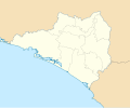
ચિત્ર:Mexico Colima location map.svg

Size of this PNG preview of this SVG file: ૫૧૨ × ૩૮૯ પિક્સેલ. અન્ય આવર્તનો: ૩૧૬ × ૨૪૦ પિક્સેલ | ૬૩૨ × ૪૮૦ પિક્સેલ | ૧,૦૧૧ × ૭૬૮ પિક્સેલ | ૧,૨૮૦ × ૯૭૩ પિક્સેલ | ૨,૫૬૦ × ૧,૯૪૫ પિક્સેલ.
મૂળભુત ફાઇલ (SVG ફાઇલ, માત્ર ૫૧૨ × ૩૮૯ પીક્સલ, ફાઇલનું કદ: ૭૫૫ KB)
ફાઇલનો ઇતિહાસ
તારીખ/સમય ઉપર ક્લિક કરવાથી તે સમયે ફાઇલ કેવી હતી તે જોવા મળશે.
| તારીખ/સમય | લઘુચિત્ર | પરિમાણો | સભ્ય | ટિપ્પણી | |
|---|---|---|---|---|---|
| વર્તમાન | ૨૦:૧૬, ૫ જૂન ૨૦૧૬ |  | ૫૧૨ × ૩૮૯ (૭૫૫ KB) | Addicted04 | Borders |
| ૧૯:૧૩, ૫ જૂન ૨૦૧૬ |  | ૫૧૨ × ૩૮૯ (૭૫૬ KB) | Addicted04 | New map. N:19.6, S:18.6, E:-103.4, W:-104.8 | |
| ૦૦:૫૫, ૮ ઓગસ્ટ ૨૦૧૧ |  | ૭૯૯ × ૬૬૪ (૨૧૨ KB) | Battroid | {{Information |Description={{es|1=Trabajo propio a partir del mapa de municipios del INEGI y costas tomadas de OpenStreetMap.org (bajo licencia Creative Commons Attribution-Share Alike 2.0 Generic). Límites del mapa: * Oeste : 104º 7' O * Este : 103� | |
| ૦૩:૪૫, ૫ જાન્યુઆરી ૨૦૧૧ |  | ૭૯૯ × ૬૬૪ (૨૧૨ KB) | Addicted04 | Costa oeste | |
| ૦૨:૪૫, ૨૮ ઓક્ટોબર ૨૦૦૯ |  | ૭૯૯ × ૬૬૪ (૨૨૨ KB) | Spischot | {{Information |Description={{es|1=Trabajo propio a partir del mapa de municipios del INEGI y costas tomadas de OpenStreetMap.org (bajo licencia Creative Commons Attribution-Share Alike 2.0 Generic). Límites del mapa: * Oeste : 104º 7' O * Este : 103� |
ફાઇલનો વપરાશ
આ ફાઇલને કોઇ પાનાં વાપરતા નથી.
ફાઇલનો વ્યાપક ઉપયોગ
નીચેની બીજી વિકિઓ આ ફાઈલ વાપરે છે:
- ar.wikipedia.org પર વપરાશ
- ba.wikipedia.org પર વપરાશ
- bg.wikipedia.org પર વપરાશ
- ceb.wikipedia.org પર વપરાશ
- ce.wikipedia.org પર વપરાશ
- cs.wikipedia.org પર વપરાશ
- de.wikipedia.org પર વપરાશ
- en.wikipedia.org પર વપરાશ
- Colima (city)
- Manzanillo, Colima
- Tecomán
- Comala
- Playa de Oro International Airport
- Colima Airport
- Villa de Álvarez
- Ixtlahuacán
- Minatitlán, Colima
- Coquimatlán
- Module:Location map/data/Mexico Colima/doc
- User:Ty654/List of earthquakes exceeding magnitude 8+
- User:Ty654/List of earthquakes from 1900-1949 exceeding magnitude 7+
- Module:Location map/data/Mexico Colima
- User:Ty654/List of earthquakes from 2000-present exceeding magnitude 7+
- User:Ty654/List of earthquakes from 1930-1939 exceeding magnitude 6+
- User:Ty654/List of earthquakes from 1995-1999 exceeding magnitude 6+
- User:Ty654/List of earthquakes from 2000-2004 exceeding magnitude 6+
- eo.wikipedia.org પર વપરાશ
- es.wikipedia.org પર વપરાશ
- fa.wikipedia.org પર વપરાશ
- fr.wikipedia.org પર વપરાશ
- he.wikipedia.org પર વપરાશ
આ ફાઇલના વધુ વૈશ્વિક વપરાશ જુઓ.

