
ચિત્ર:North Atlantic Ocean laea relief location map.jpg

આ પૂર્વાવલોકનનું કદ: ૭૩૯ × ૫૯૯ પિક્સેલ. અન્ય આવર્તનો: ૨૯૬ × ૨૪૦ પિક્સેલ | ૫૯૨ × ૪૮૦ પિક્સેલ | ૯૪૭ × ૭૬૮ પિક્સેલ | ૧,૧૮૧ × ૯૫૮ પિક્સેલ.
મૂળભુત ફાઇલ (૧,૧૮૧ × ૯૫૮ પીક્સલ, ફાઇલનું કદ: ૧.૧૩ MB, MIME પ્રકાર: image/jpeg)
સારાંશ:
| વર્ણન |
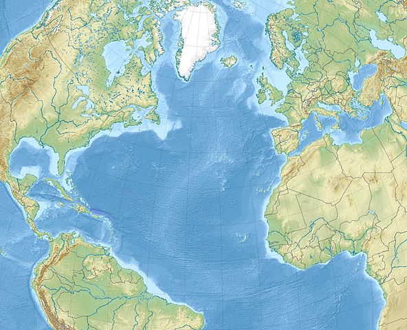
English: Relief location map of North_Atlantic_Ocean.
|
| તારીખ | |
| સ્રોત | પોતાની રચના |
| લેખક | Uwe Dedering |
પરવાના
હું, આ કાર્યનો પ્રકાશનાધિકાર ધારક, તેને નીચેના પરવાનાઓ હેઠળ અહીં પ્રકાશીત કરૂં છું:
આ ફાઈલ વપરાશની પરવાનગી : Creative Commons Attribution-Share Alike 3.0 Unported license.
- તમે મુક્ત છો:
- વહેંચવા – નકલ કરવા, વિતરણ કરવા અને રચનાઓ મોકલવા
- રીમિક્સ કરવા કે મઠારવા – રચના અપનાવવા
- નીચેની શરત હેઠળ:
- આરોપણ – તમારે આ રચનાનો ઉપયોગ કરવા માટે લેખક કે પ્રકાશન અધિકાર ધારકની યોગ્ય માહિતી, પરવાનગી (લાયસન્સ)ની કડી અને તેમાં ફેરફાર કર્યો હોય તો તેનો ઉલ્લેખ કરવો જ પડશે. તમે આ સત્તા અનુસાર જ આ રચનાનો પ્રયોગ થવો જોઈએ, પણ તેઓ તમને અથવા તમારા ઉપયોગ સાથે સંમત થાય છે તે રીતે નહીં.
- શેર- અલાઈક (બિન ભેદભાવ વહેંચણી) – તમે જો આ રચનાને બદલશો, તેમાં ફેરફાર કરશો અથવા તેના પર આધારિત કોઇ કાર્ય બનાવશો તો તમારે પરિણામી કાર્યને તે જ અથવા અનુરૂપ પરવાનગી હેઠળ જ પ્રકાશિત કરવું પડશે.

|
આ રચનાની નકલ કરવા, વિતરણ અને સુધારો કરવા માટે GNU Free Documentation License, આવૃત્તિ 1.2 કે અન્ય આગળની આવૃત્તિ Free Software Foundation હેઠળ પરવાનગી છે; જેમાં કોઈ Invariant Sections, no Front-Cover Texts, and no Back-Cover Texts નથી. આ પરવાનાની પ્રત GNU Free Documentation License વિભાગમાં છે. |
તમે તમારી પસંદગીનો પરવાનો પસંદ કરી શકો છો.
ફાઇલનો ઇતિહાસ
તારીખ/સમય ઉપર ક્લિક કરવાથી તે સમયે ફાઇલ કેવી હતી તે જોવા મળશે.
| તારીખ/સમય | લઘુચિત્ર | પરિમાણો | સભ્ય | ટિપ્પણી | |
|---|---|---|---|---|---|
| વર્તમાન | ૧૬:૫૦, ૪ ડિસેમ્બર ૨૦૧૦ | | ૧,૧૮૧ × ૯૫૮ (૧.૧૩ MB) | Uwe Dedering | {{Information |Description={{en|1= Relief location map of North_Atlantic_Ocean. * Projection: Lambert azimuthal equal-area projection. * Area of interest: :* N: 80.0° N :* S: -10.0° N :* W: -90.0° E :* E: 20.0° E * Projection center: :* NS: 35.0° N : |
ફાઇલનો વપરાશ
આ ફાઇલને કોઇ પાનાં વાપરતા નથી.
ફાઇલનો વ્યાપક ઉપયોગ
નીચેની બીજી વિકિઓ આ ફાઈલ વાપરે છે:
- ar.wikipedia.org પર વપરાશ
- ast.wikipedia.org પર વપરાશ
- az.wikipedia.org પર વપરાશ
- be-tarask.wikipedia.org પર વપરાશ
- be.wikipedia.org પર વપરાશ
- ceb.wikipedia.org પર વપરાશ
- ce.wikipedia.org પર વપરાશ
- ckb.wikipedia.org પર વપરાશ
- de.wikipedia.org પર વપરાશ
- el.wikipedia.org પર વપરાશ
- en.wikipedia.org પર વપરાશ
આ ફાઇલના વધુ વૈશ્વિક વપરાશ જુઓ.