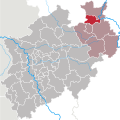
ચિત્ર:North rhine w HF.svg
Appearance

Size of this PNG preview of this SVG file: ૬૦૦ × ૬૦૦ પિક્સેલ. અન્ય આવર્તનો: ૨૪૦ × ૨૪૦ પિક્સેલ | ૪૮૦ × ૪૮૦ પિક્સેલ | ૭૬૮ × ૭૬૮ પિક્સેલ | ૧,૦૨૪ × ૧,૦૨૪ પિક્સેલ | ૨,૦૪૮ × ૨,૦૪૮ પિક્સેલ | ૬૬૦ × ૬૬૦ પિક્સેલ.
મૂળભુત ફાઇલ (SVG ફાઇલ, માત્ર ૬૬૦ × ૬૬૦ પીક્સલ, ફાઇલનું કદ: ૨૨૧ KB)
ફાઇલનો ઇતિહાસ
તારીખ/સમય ઉપર ક્લિક કરવાથી તે સમયે ફાઇલ કેવી હતી તે જોવા મળશે.
| તારીખ/સમય | લઘુચિત્ર | પરિમાણો | સભ્ય | ટિપ્પણી | |
|---|---|---|---|---|---|
| વર્તમાન | ૧૮:૨૩, ૨૦ ઓક્ટોબર ૨૦૦૯ |  | ૬૬૦ × ૬૬૦ (૨૨૧ KB) | TUBS | -ac |
| ૧૪:૫૨, ૪ નવેમ્બર ૨૦૦૮ |  | ૬૬૦ × ૬૬૦ (૨૨૩ KB) | TUBS | {{Information |Description= |Source= |Date= |Author= |Permission= |other_versions= }} | |
| ૧૮:૩૮, ૨૫ સપ્ટેમ્બર ૨૦૦૮ |  | ૬૬૦ × ૬૬૦ (૨૨૧ KB) | TUBS | == Summary == {{Information |Description=Map of Kreis Herford, a District of Northrhine-Westphalia (NRW), Germany. |Source=Based upon template: <imagemap> image:North rhine w template 2.png|100px| default [[:Image:North rhine w template 2.svg | |
| ૧૮:૩૩, ૨૫ સપ્ટેમ્બર ૨૦૦૮ |  | ૬૫૫ × ૬૫૭ (૨૨૩ KB) | TUBS | == Summary == {{Information |Description=Map of Kreis Herford, a District of Northrhine-Westphalia (NRW), Germany. |Source=Based upon template: <imagemap> image:North rhine w template 2.png|100px| default [[:Image:North rhine w template 2.svg | |
| ૧૮:૨૫, ૨૫ સપ્ટેમ્બર ૨૦૦૮ |  | ૬૫૫ × ૬૫૭ (૨૧૭ KB) | TUBS | == Summary == {{Information |Description=Map of Kreis Herford, a District of Northrhine-Westphalia (NRW), Germany. |Source=Based upon template: <imagemap> image:North rhine w template 2.png|100px| default [[:Image:North rhine w template 2.svg | |
| ૧૮:૨૧, ૨૫ સપ્ટેમ્બર ૨૦૦૮ |  | ૬૫૫ × ૬૫૭ (૨૧૭ KB) | TUBS | == Summary == {{Information |Description=Map of Kreis Herford, a District of Northrhine-Westphalia (NRW), Germany. |Source=Based upon template: <imagemap> image:North rhine w template 2.png|100px| default [[:Image:North rhine w template 2.svg |
ફાઇલનો વપરાશ
આ ફાઇલને કોઇ પાનાં વાપરતા નથી.
ફાઇલનો વ્યાપક ઉપયોગ
નીચેની બીજી વિકિઓ આ ફાઈલ વાપરે છે:
- ca.wikipedia.org પર વપરાશ
- cs.wikipedia.org પર વપરાશ
- da.wikipedia.org પર વપરાશ
- de.wikipedia.org પર વપરાશ
- Liste der Landkreise in Deutschland
- Kreis Herford
- Liste der Wappen im Kreis Herford
- Liste der Flaggen in Nordrhein-Westfalen
- Wappen der deutschen Stadt- und Landkreise
- Liste der Kreise und kreisfreien Städte in Nordrhein-Westfalen
- Diskussion:Liste der Landkreise in Deutschland/Archiv/1
- Benutzer:Thomas021071/Liste der Landkreise Baustelle
- es.wikipedia.org પર વપરાશ
- et.wikipedia.org પર વપરાશ
- frr.wikipedia.org પર વપરાશ
- ja.wikipedia.org પર વપરાશ
- li.wikipedia.org પર વપરાશ
- lld.wikipedia.org પર વપરાશ
- nl.wikipedia.org પર વપરાશ
- no.wikipedia.org પર વપરાશ
- pl.wikipedia.org પર વપરાશ
- ro.wikipedia.org પર વપરાશ
- sk.wikipedia.org પર વપરાશ
- www.wikidata.org પર વપરાશ


