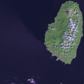
ચિત્ર:Saint Vincent OnEarth WMS.png
Appearance

આ પૂર્વાવલોકનનું કદ: ૬૦૦ × ૬૦૦ પિક્સેલ. અન્ય આવર્તનો: ૨૪૦ × ૨૪૦ પિક્સેલ | ૪૮૦ × ૪૮૦ પિક્સેલ | ૭૬૮ × ૭૬૮ પિક્સેલ | ૧,૨૧૫ × ૧,૨૧૫ પિક્સેલ.
મૂળભુત ફાઇલ (૧,૨૧૫ × ૧,૨૧૫ પીક્સલ, ફાઇલનું કદ: ૨.૨૨ MB, MIME પ્રકાર: image/png)
ફાઇલનો ઇતિહાસ
તારીખ/સમય ઉપર ક્લિક કરવાથી તે સમયે ફાઇલ કેવી હતી તે જોવા મળશે.
| તારીખ/સમય | લઘુચિત્ર | પરિમાણો | સભ્ય | ટિપ્પણી | |
|---|---|---|---|---|---|
| વર્તમાન | ૨૨:૧૭, ૧૯ જાન્યુઆરી ૨૦૦૯ |  | ૧,૨૧૫ × ૧,૨૧૫ (૨.૨૨ MB) | Xfigpower | {{Information |Description=Satellite image of Saint Vincent Screenshot from NASA World Wind, OnEarth WMS global mosaic pseudocolor layer. |Source=*File:Saint_Vincent_and_the_Grenadines_OnEarth_WMS.png |Date=2009-01-19 16:46 (UTC) |Author=*derivative |
ફાઇલનો વપરાશ
આ ફાઇલને કોઇ પાનાં વાપરતા નથી.
ફાઇલનો વ્યાપક ઉપયોગ
નીચેની બીજી વિકિઓ આ ફાઈલ વાપરે છે:
- ar.wikipedia.org પર વપરાશ
- az.wikipedia.org પર વપરાશ
- be.wikipedia.org પર વપરાશ
- br.wikipedia.org પર વપરાશ
- ca.wikipedia.org પર વપરાશ
- da.wikipedia.org પર વપરાશ
- de.wikipedia.org પર વપરાશ
- de.wikivoyage.org પર વપરાશ
- es.wikipedia.org પર વપરાશ
- fi.wikipedia.org પર વપરાશ
- fi.wiktionary.org પર વપરાશ
- frr.wikipedia.org પર વપરાશ
- fr.wikipedia.org પર વપરાશ
- gl.wikipedia.org પર વપરાશ
- he.wikipedia.org પર વપરાશ
- ja.wikipedia.org પર વપરાશ
- lb.wikipedia.org પર વપરાશ
- lt.wikipedia.org પર વપરાશ
- pap.wikipedia.org પર વપરાશ
- tr.wikipedia.org પર વપરાશ
- ur.wikipedia.org પર વપરાશ
- www.wikidata.org પર વપરાશ

