
ચિત્ર:Sri Lanka relief location map.jpg

આ પૂર્વાવલોકનનું કદ: ૩૯૧ × ૫૯૯ પિક્સેલ. અન્ય આવર્તનો: ૧૫૭ × ૨૪૦ પિક્સેલ | ૩૧૩ × ૪૮૦ પિક્સેલ | ૫૦૧ × ૭૬૮ પિક્સેલ | ૧,૨૦૦ × ૧,૮૩૮ પિક્સેલ.
મૂળભુત ફાઇલ (૧,૨૦૦ × ૧,૮૩૮ પીક્સલ, ફાઇલનું કદ: ૯૩૫ KB, MIME પ્રકાર: image/jpeg)
સારાંશ:
| વર્ણન |
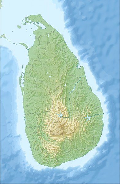
English: Location map of Sri Lanka.
Equirectangular projection. Strechted by 101.0%. Geographic limits of the map: * N: 10.2° N * S: 5.5° N * W: 79.2° E * E: 82.3° EMade with Natural Earth. Free vector and raster map data @ naturalearthdata.com. |
| તારીખ | |
| સ્રોત | પોતાની રચના |
| લેખક | Uwe Dedering |
| અન્ય આવૃત્તિઓ |
|

પરવાના
હું, આ કાર્યનો પ્રકાશનાધિકાર ધારક, તેને નીચેના પરવાનાઓ હેઠળ અહીં પ્રકાશીત કરૂં છું:
આ ફાઈલ વપરાશની પરવાનગી : Creative Commons Attribution-Share Alike 3.0 Unported license.
- તમે મુક્ત છો:
- વહેંચવા – નકલ કરવા, વિતરણ કરવા અને રચનાઓ મોકલવા
- રીમિક્સ કરવા કે મઠારવા – રચના અપનાવવા
- નીચેની શરત હેઠળ:
- આરોપણ – તમારે આ રચનાનો ઉપયોગ કરવા માટે લેખક કે પ્રકાશન અધિકાર ધારકની યોગ્ય માહિતી, પરવાનગી (લાયસન્સ)ની કડી અને તેમાં ફેરફાર કર્યો હોય તો તેનો ઉલ્લેખ કરવો જ પડશે. તમે આ સત્તા અનુસાર જ આ રચનાનો પ્રયોગ થવો જોઈએ, પણ તેઓ તમને અથવા તમારા ઉપયોગ સાથે સંમત થાય છે તે રીતે નહીં.
- શેર- અલાઈક (બિન ભેદભાવ વહેંચણી) – તમે જો આ રચનાને બદલશો, તેમાં ફેરફાર કરશો અથવા તેના પર આધારિત કોઇ કાર્ય બનાવશો તો તમારે પરિણામી કાર્યને તે જ અથવા અનુરૂપ પરવાનગી હેઠળ જ પ્રકાશિત કરવું પડશે.

|
આ રચનાની નકલ કરવા, વિતરણ અને સુધારો કરવા માટે GNU Free Documentation License, આવૃત્તિ 1.2 કે અન્ય આગળની આવૃત્તિ Free Software Foundation હેઠળ પરવાનગી છે; જેમાં કોઈ Invariant Sections, no Front-Cover Texts, and no Back-Cover Texts નથી. આ પરવાનાની પ્રત GNU Free Documentation License વિભાગમાં છે. |
તમે તમારી પસંદગીનો પરવાનો પસંદ કરી શકો છો.
ફાઇલનો ઇતિહાસ
તારીખ/સમય ઉપર ક્લિક કરવાથી તે સમયે ફાઇલ કેવી હતી તે જોવા મળશે.
| તારીખ/સમય | લઘુચિત્ર | પરિમાણો | સભ્ય | ટિપ્પણી | |
|---|---|---|---|---|---|
| વર્તમાન | ૨૨:૧૪, ૩ જુલાઇ ૨૦૨૦ | | ૧,૨૦૦ × ૧,૮૩૮ (૯૩૫ KB) | C1MM | Reverted to version as of 10:24, 24 April 2010 (UTC) |
| ૧૧:૧૩, ૨૧ એપ્રિલ ૨૦૨૦ |  | ૧,૨૦૦ × ૧,૮૩૮ (૧૫૫ KB) | C1MM | More accurate STRM data | |
| ૧૫:૫૪, ૨૪ એપ્રિલ ૨૦૧૦ |  | ૧,૨૦૦ × ૧,૮૩૮ (૯૩૫ KB) | Uwe Dedering | fixed opacity | |
| ૧૫:૩૭, ૨૪ એપ્રિલ ૨૦૧૦ |  | ૧,૨૦૦ × ૧,૮૩૮ (૯૧૩ KB) | Uwe Dedering | {{Information |Description={{en|1=Location map of Sri Lanka. Equirectangular projection. Strechted by 101.0%. Geographic limits of the map: * N: 10.2° N * S: 5.5° N * W: 79.2° E * E: 82.3° E Made with Natural Earth. Free vector and raster map da |
ફાઇલનો વપરાશ
આ ફાઇલ માં નીચેનું પાનું વપરાયેલું છે:
ફાઇલનો વ્યાપક ઉપયોગ
નીચેની બીજી વિકિઓ આ ફાઈલ વાપરે છે:
- ar.wikipedia.org પર વપરાશ
- av.wikipedia.org પર વપરાશ
- az.wikipedia.org પર વપરાશ
- be.wikipedia.org પર વપરાશ
- bg.wikipedia.org પર વપરાશ
- bn.wikipedia.org પર વપરાશ
- bs.wikipedia.org પર વપરાશ
- ceb.wikipedia.org પર વપરાશ
- ce.wikipedia.org પર વપરાશ
- ckb.wikipedia.org પર વપરાશ
- cs.wikipedia.org પર વપરાશ
- de.wikipedia.org પર વપરાશ
- de.wikivoyage.org પર વપરાશ
આ ફાઇલના વધુ વૈશ્વિક વપરાશ જુઓ.