
ચિત્ર:Wfm area 51 landsat geocover 2000.jpg
આ પૂર્વાવલોકનનું કદ: ૪૭૫ × ૫૯૯ પિક્સેલ. અન્ય આવર્તનો: ૧૯૦ × ૨૪૦ પિક્સેલ | ૩૮૧ × ૪૮૦ પિક્સેલ | ૭૫૨ × ૯૪૮ પિક્સેલ.
મૂળભુત ફાઇલ (૭૫૨ × ૯૪૮ પીક્સલ, ફાઇલનું કદ: ૩૮૩ KB, MIME પ્રકાર: image/jpeg)
| વર્ણન |
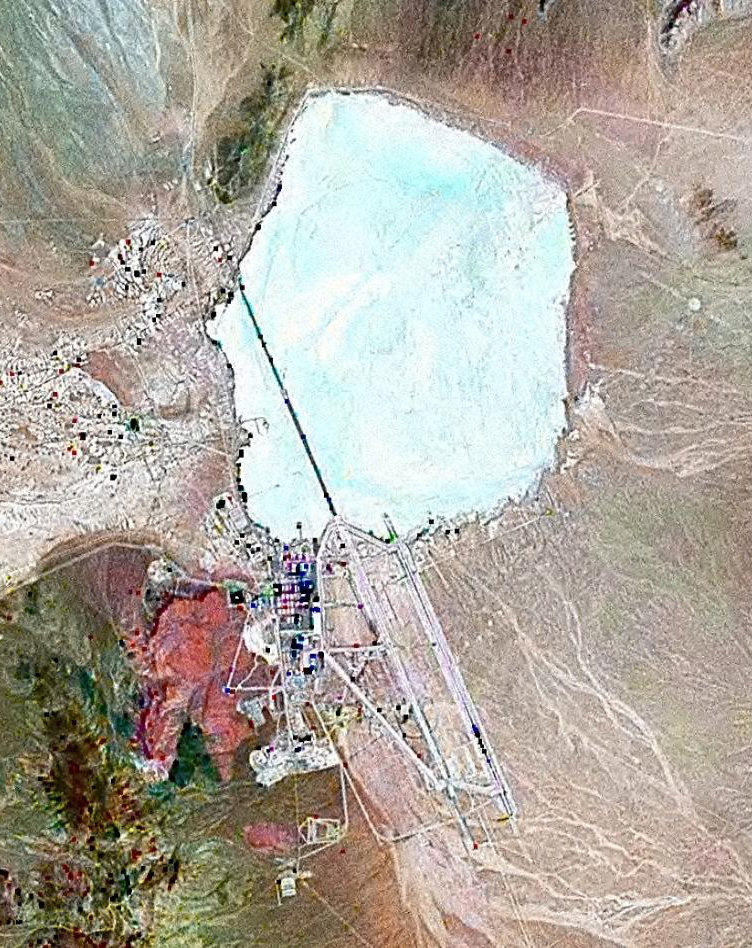
English: Landsat GeoCover 2000 pseudocolour imagery of Area 51 at Groom Lake, Nevada Test and Training Range, Nevada, USA
|
||||
| તારીખ | circa ૨૦૦૦ | ||||
| સ્રોત | NASA Landsat | ||||
| લેખક | NASA | ||||
| પરવાનગી (આ ફાઈલનો ફરી ઉપયોગ) |
|

ફાઇલનો ઇતિહાસ
તારીખ/સમય ઉપર ક્લિક કરવાથી તે સમયે ફાઇલ કેવી હતી તે જોવા મળશે.
| તારીખ/સમય | લઘુચિત્ર | પરિમાણો | સભ્ય | ટિપ્પણી | |
|---|---|---|---|---|---|
| વર્તમાન | ૧૮:૧૨, ૧૮ ફેબ્રુઆરી ૨૦૧૦ | | ૭૫૨ × ૯૪૮ (૩૮૩ KB) | Finlay McWalter | rv, that's not a landsat image; it looks very much like a copyright GeoEye/Google Earth image, which is inelligible for use on Commons. If you diagree, upload the image under another name, don't contaminate this one with false information |
| ૧૬:૩૫, ૭ ફેબ્રુઆરી ૨૦૧૦ |  | ૪૫૬ × ૬૧૭ (૪૫ KB) | Vajotwo | Best quality | |
| ૧૮:૨૧, ૧૬ જુલાઇ ૨૦૦૬ |  | ૭૫૨ × ૯૪૮ (૩૮૩ KB) | Finlay McWalter | {{Information |Description=Landsat geocover 2000 pseudocolour imagery of Area 51 at Groom Lake, Nevada, USA |Source=NASA Landsat |Date=around 2000 |Author=NASA |Permission= {{PD-WorldWind}} |other_versions= }} Category:Area 51 |
ફાઇલનો વપરાશ
આ ફાઇલ માં નીચેનું પાનું વપરાયેલું છે:
ફાઇલનો વ્યાપક ઉપયોગ
નીચેની બીજી વિકિઓ આ ફાઈલ વાપરે છે:
- ar.wikipedia.org પર વપરાશ
- az.wikipedia.org પર વપરાશ
- be.wikipedia.org પર વપરાશ
- bg.wikipedia.org પર વપરાશ
- bn.wikipedia.org પર વપરાશ
- cs.wikipedia.org પર વપરાશ
- cy.wikipedia.org પર વપરાશ
- el.wikipedia.org પર વપરાશ
- en.wikipedia.org પર વપરાશ
- es.wikipedia.org પર વપરાશ
- fi.wikipedia.org પર વપરાશ
- fr.wikipedia.org પર વપરાશ
- Zone 51
- Wikipédia:Le Bistro/14 février 2009
- Area 51 (jeu vidéo, 2005)
- Wikipédia:Wikimag/2019/28/Rapport de trafic
- Wikipédia:Wikimag/2019/29/Rapport de trafic
- Wikipédia:Wikimag/2019/29
- Wikipédia:Wikimag/2019/30/Rapport de trafic
- Wikipédia:Wikimag/2019/31/Rapport de trafic
- Wikipédia:Wikimag/2019/38
- Wikipédia:Wikimag/2019/39/Rapport de trafic
- he.wikipedia.org પર વપરાશ
- hi.wikipedia.org પર વપરાશ
- hr.wikipedia.org પર વપરાશ
- hu.wikipedia.org પર વપરાશ
- hy.wikipedia.org પર વપરાશ
- id.wikipedia.org પર વપરાશ
- it.wikipedia.org પર વપરાશ
- kk.wikipedia.org પર વપરાશ
- kn.wikipedia.org પર વપરાશ
- mk.wikipedia.org પર વપરાશ
- my.wikipedia.org પર વપરાશ
- pnb.wikipedia.org પર વપરાશ
- ro.wikipedia.org પર વપરાશ
- ru.wikipedia.org પર વપરાશ
- sh.wikipedia.org પર વપરાશ
- si.wikipedia.org પર વપરાશ
- sk.wikipedia.org પર વપરાશ
આ ફાઇલના વધુ વૈશ્વિક વપરાશ જુઓ.