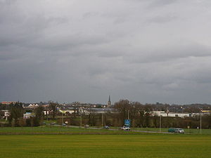
Chantepie
commune in Ille-et-Vilaine, France
ઉદાહરણ
commune of France
સત્તાવાર નામ
Chantepie[૬]
પ્રશાસન વિભાગમાં આવેલ છે
arrondissement of Rennes
ઈલે-એટ-વિલૈન
Rennes Métropole
સમય વિભાગ
UTC+01:00
valid in period: standard time
UTC+02:00
valid in period: daylight saving time
located in statistical territorial entity
Q108921718
Q3551120
સ્થળના અક્ષાંસ રેખાંશ
કાર્યાલયમાં સરકારના પ્રમુખ
Mayor of Chantepie
વસ્તી / જનસંખ્યા
પુરુષોની સંખ્યા
સ્ત્રીઓની વસ્તી
સમુદ્ર સપાટીથી ઉંચાઇ
૫૮ મીટર
જોડકું શહેર
Verrayes
Obrigheim
શરૂઆતની તારીખ: મે 1998
ક્રસ્કો
સરહદ દ્વારા જોડાયેલ
રેનેસ
Domloup
Noyal-Châtillon-sur-Seiche
Vern-sur-Seiche
Cesson-Sévigné
ક્ષેત્રફળ
૧૧.૯૮ square kilometre[૧૦]
પોસ્ટલ કોડ
35135[૧૩]
phone number
+33-2-99-41-42-33[૧૪]
fax number
+33-2-99-41-48-69[૧૪]
email address
અધિકૃત વેબસાઇટ
કોમન્સ શ્રેણી
Chantepie
વિષયની મુખ્ય શ્રેણી
Category:Chantepie
category for maps
Category:Maps of Chantepie
સંદર્ભ
- ↑ Freebase Data Dumps, ૨૮ ઓક્ટોબર 2013
- ↑ GeoNames
- ↑ BnF authorities, ૨૬ ઓગસ્ટ 2015
- ↑ ૧૦ મે 2018
- ↑ 238801690
- ↑ Code officiel géographique, https://www.insee.fr/fr/information/3363419, ૬ જાન્યુઆરી 2019
- ↑ Geographic Names Server, ૧૧ જૂન 2018, -1418504
- ↑ Code officiel géographique, ૨૬ ફેબ્રુઆરી 2020, https://www.data.gouv.fr/fr/datasets/r/8442dfae-a878-49c6-be4c-20689b1c337c
- ↑ Code officiel géographique, ૨૨ સપ્ટેમ્બર 2017, https://www.insee.fr/fr/information/2560698
- ↑ ૧૦.૦ ૧૦.૧ répertoire géographique des communes, ૨૬ ઓક્ટોબર 2015
- ↑ Populations légales 2021
- ↑ ૧૨.૦ ૧૨.૧ The National Institute of Statistics and Economic Studies
- ↑ dataset of postal codes in France, ૧ ઓક્ટોબર 2018
- ↑ ૧૪.૦ ૧૪.૧ ૧૪.૨ ૧૪.૩ Annuaire de service-public.fr, ૨૩ સપ્ટેમ્બર 2023


