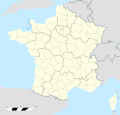
ચિત્ર:France location map-Departements 1997-2014.svg
Appearance

Size of this PNG preview of this SVG file: ૬૨૪ × ૬૦૦ પિક્સેલ. અન્ય આવર્તનો: ૨૫૦ × ૨૪૦ પિક્સેલ | ૪૯૯ × ૪૮૦ પિક્સેલ | ૭૯૯ × ૭૬૮ પિક્સેલ | ૧,૦૬૬ × ૧,૦૨૪ પિક્સેલ | ૨,૧૩૧ × ૨,૦૪૮ પિક્સેલ | ૨,૦૦૦ × ૧,૯૨૨ પિક્સેલ.
મૂળભુત ફાઇલ (SVG ફાઇલ, માત્ર ૨,૦૦૦ × ૧,૯૨૨ પીક્સલ, ફાઇલનું કદ: ૭૮૩ KB)
ફાઇલનો ઇતિહાસ
તારીખ/સમય ઉપર ક્લિક કરવાથી તે સમયે ફાઇલ કેવી હતી તે જોવા મળશે.
| તારીખ/સમય | લઘુચિત્ર | પરિમાણો | સભ્ય | ટિપ્પણી | |
|---|---|---|---|---|---|
| વર્તમાન | ૧૯:૨૩, ૧૯ ઓક્ટોબર ૨૦૧૭ |  | ૨,૦૦૦ × ૧,૯૨૨ (૭૮૩ KB) | Sting | No borders over the Lake of Constance |
| ૧૮:૪૯, ૭ નવેમ્બર ૨૦૦૮ |  | ૨,૦૦૦ × ૧,૯૨૨ (૭૮૪ KB) | Sting | + boundary for Channel Islands | |
| ૨૨:૦૭, ૨૩ ઓગસ્ટ ૨૦૦૮ |  | ૨,૦૦૦ × ૧,૯૨૨ (૭૮૨ KB) | Sting | Larger strokes for boundaries | |
| ૨૩:૨૩, ૨૫ જુલાઇ ૨૦૦૮ |  | ૨,૦૦૦ × ૧,૯૨૨ (૭૮૨ KB) | Sting | Variable scale | |
| ૨૦:૦૮, ૨૫ જુલાઇ ૨૦૦૮ |  | ૨,૦૦૦ × ૧,૯૨૨ (૭૮૫ KB) | Sting | Other countries' color ; - border | |
| ૦૧:૫૬, ૫ જુલાઇ ૨૦૦૮ |  | ૨,૦૦૦ × ૧,૯૨૨ (૭૮૫ KB) | Sting | == Summary == {{Location|46|15|00|N|02|06|00|E|scale:10000000}} <br/> {{Information |Description={{en|Blank administrative map of France for geo-location purpose, with departements.<br/>Approximate scale : 1:3,000,000}} {{fr|Carte administr |
ફાઇલનો વપરાશ
આ ફાઇલને કોઇ પાનાં વાપરતા નથી.
ફાઇલનો વ્યાપક ઉપયોગ
નીચેની બીજી વિકિઓ આ ફાઈલ વાપરે છે:
- fr.wikipedia.org પર વપરાશ
- fr.wikinews.org પર વપરાશ
- pt.wikipedia.org પર વપરાશ


