
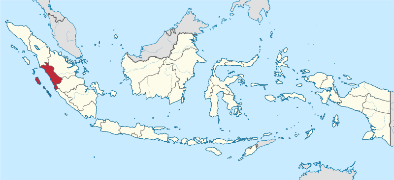
ચિત્ર:West Sumatra in Indonesia.svg

Size of this PNG preview of this SVG file: ૮૦૦ × ૩૬૭ પિક્સેલ. અન્ય આવર્તનો: ૩૨૦ × ૧૪૭ પિક્સેલ | ૬૪૦ × ૨૯૩ પિક્સેલ | ૧,૦૨૪ × ૪૬૯ પિક્સેલ | ૧,૨૮૦ × ૫૮૭ પિક્સેલ | ૨,૫૬૦ × ૧,૧૭૩ પિક્સેલ | ૯૮૨ × ૪૫૦ પિક્સેલ.
મૂળભુત ફાઇલ (SVG ફાઇલ, માત્ર ૯૮૨ × ૪૫૦ પીક્સલ, ફાઇલનું કદ: ૭૯૩ KB)
સારાંશ:
.svg)
.svg)
.svg)
.svg)
.svg)
.svg)
.svg)

-en.svg)

.svg)
.svg)
.svg)

_(US48).svg)
_(small_islands_magnified)_(-mini_map_-rivers).svg)
.svg)
_(extra_close)_(US48).svg)
.svg)
_(zoom).svg)

.svg)


_(UNMIK).svg)
.svg)
_(disputed_hatched).svg)
_(claimed_and_disputed_hatched).svg)
.svg)
.svg)
_(%2Ball_claims_hatched).svg)

.svg)
_(shade).svg)
_(shade)_(special_marker).svg)
_(-mini_map).svg)
_(-mini_map).svg)
_(-mini_map).svg)


.svg)

.svg)
પરવાના
હું, આ કાર્યનો પ્રકાશનાધિકાર ધારક, તેને નીચેના પરવાનાઓ હેઠળ અહીં પ્રકાશીત કરૂં છું:

|
આ રચનાની નકલ કરવા, વિતરણ અને સુધારો કરવા માટે GNU Free Documentation License, આવૃત્તિ 1.2 કે અન્ય આગળની આવૃત્તિ Free Software Foundation હેઠળ પરવાનગી છે; જેમાં કોઈ Invariant Sections, no Front-Cover Texts, and no Back-Cover Texts નથી. આ પરવાનાની પ્રત GNU Free Documentation License વિભાગમાં છે. |
આ ફાઈલ વપરાશની પરવાનગી : Creative Commons Attribution-Share Alike 3.0 Unported license.
- તમે મુક્ત છો:
- વહેંચવા – નકલ કરવા, વિતરણ કરવા અને રચનાઓ મોકલવા
- રીમિક્સ કરવા કે મઠારવા – રચના અપનાવવા
- નીચેની શરત હેઠળ:
- આરોપણ – તમારે આ રચનાનો ઉપયોગ કરવા માટે લેખક કે પ્રકાશન અધિકાર ધારકની યોગ્ય માહિતી, પરવાનગી (લાયસન્સ)ની કડી અને તેમાં ફેરફાર કર્યો હોય તો તેનો ઉલ્લેખ કરવો જ પડશે. તમે આ સત્તા અનુસાર જ આ રચનાનો પ્રયોગ થવો જોઈએ, પણ તેઓ તમને અથવા તમારા ઉપયોગ સાથે સંમત થાય છે તે રીતે નહીં.
- શેર- અલાઈક (બિન ભેદભાવ વહેંચણી) – તમે જો આ રચનાને બદલશો, તેમાં ફેરફાર કરશો અથવા તેના પર આધારિત કોઇ કાર્ય બનાવશો તો તમારે પરિણામી કાર્યને તે જ અથવા અનુરૂપ પરવાનગી હેઠળ જ પ્રકાશિત કરવું પડશે.
તમે તમારી પસંદગીનો પરવાનો પસંદ કરી શકો છો.

|
I'd greatly appreciate, that you attribute this media file to Wikimedia Commons, if used outside Wikipedia or Commons. For use in publications such as books, newspapers, blogs, websites, please insert here the following line:
|
ફાઇલનો ઇતિહાસ
તારીખ/સમય ઉપર ક્લિક કરવાથી તે સમયે ફાઇલ કેવી હતી તે જોવા મળશે.
| તારીખ/સમય | લઘુચિત્ર | પરિમાણો | સભ્ય | ટિપ્પણી | |
|---|---|---|---|---|---|
| વર્તમાન | ૨૨:૫૯, ૫ ડિસેમ્બર ૨૦૨૨ | | ૯૮૨ × ૪૫૦ (૭૯૩ KB) | NordNordWest | upd 2022 |
| ૧૫:૪૮, ૮ ઓગસ્ટ ૨૦૨૧ |  | ૯૮૨ × ૪૫૦ (૯૧૨ KB) | Afrogindahood | Fix on Papua-West Papua border | |
| ૧૩:૩૦, ૩ સપ્ટેમ્બર ૨૦૧૩ | ૧,૨૦૦ × ૪૬૦ (૮૭૫ KB) | TUBS | |||
| ૧૫:૧૭, ૨૯ સપ્ટેમ્બર ૨૦૧૧ | ૧,૨૦૦ × ૪૬૦ (૧.૩૪ MB) | TUBS |
ફાઇલનો વપરાશ
આ ફાઇલને કોઇ પાનાં વાપરતા નથી.
ફાઇલનો વ્યાપક ઉપયોગ
નીચેની બીજી વિકિઓ આ ફાઈલ વાપરે છે:
- ar.wikipedia.org પર વપરાશ
- ast.wikipedia.org પર વપરાશ
- az.wikipedia.org પર વપરાશ
- ban.wikipedia.org પર વપરાશ
- ca.wikipedia.org પર વપરાશ
- cdo.wikipedia.org પર વપરાશ
- cs.wikipedia.org પર વપરાશ
- de.wikipedia.org પર વપરાશ
- de.wikivoyage.org પર વપરાશ
- diq.wikipedia.org પર વપરાશ
- en.wikipedia.org પર વપરાશ
- West Sumatra
- Bayua
- Mount Talang
- Pasumpahan
- Mentawai Strait
- Padang Panjang
- Sijunjung Regency
- Sipora
- Mount Tandikat
- Mount Talakmau
- Mount Singgalang
- Lake Singkarak
- Mount Sago
- Solok
- Tanah Datar Regency
- Batusangkar
- Lake Diatas
- Lake Dibawah
- Dharmasraya Regency
- Lima Puluh Kota Regency
- Pasaman Regency
- Solok Regency
- West Pasaman Regency
- South Solok Regency
- North Pagai
- Template:WSumatra-geo-stub
- South Pagai
- Baso (village)
- Batuhampar
- Sikuai
- Sikakap
- Padang Barat
- Lubuk Basung
- Pulau Punjung
- Sarilamak
આ ફાઇલના વધુ વૈશ્વિક વપરાશ જુઓ.