
ચિત્ર:Europe location FRS.png

આ પૂર્વાવલોકનનું કદ: ૮૦૦ × ૬૦૦ પિક્સેલ. અન્ય આવર્તનો: ૩૨૦ × ૨૪૦ પિક્સેલ | ૬૪૦ × ૪૮૦ પિક્સેલ | ૧,૦૨૪ × ૭૬૮ પિક્સેલ | ૧,૨૮૦ × ૯૬૦ પિક્સેલ | ૧,૬૦૦ × ૧,૨૦૦ પિક્સેલ.
મૂળભુત ફાઇલ (૧,૬૦૦ × ૧,૨૦૦ પીક્સલ, ફાઇલનું કદ: ૭૧૬ KB, MIME પ્રકાર: image/png)
સારાંશ:
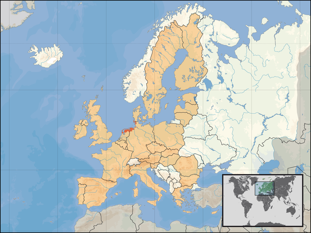
| વર્ણન | Location of the regions of Frisia in Europe; based on the other maps of Europe_location_... |
| સ્રોત | પોતાની રચના |
| લેખક | Gruna 1 |
પરવાના
| હું, આ રચનાઓ પ્રકાશન અધિકાર ધારક, આ રચનાને public domain પર પ્રકાશિત કરું છું. આ સમગ્ર વિશ્વમઆં કાર્યરત રહેશે. અમુક દેશોમાં કાયદેસર રીતે તે શક્ય નથી, જો તેમ હોય તો : કો કોઈને પણ કોઈપણ વપરાશ, કોઇ પણ શરત વગર, માટે આ રચના વાપરવાની છૂટ આપું છું સિવાયકે તે શરતો કાયદેસર જરૂરી હોય. |
ફાઇલનો ઇતિહાસ
તારીખ/સમય ઉપર ક્લિક કરવાથી તે સમયે ફાઇલ કેવી હતી તે જોવા મળશે.
| તારીખ/સમય | લઘુચિત્ર | પરિમાણો | સભ્ય | ટિપ્પણી | |
|---|---|---|---|---|---|
| વર્તમાન | ૦૨:૫૩, ૧૯ ડિસેમ્બર ૨૦૧૦ | | ૧,૬૦૦ × ૧,૨૦૦ (૭૧૬ KB) | Gruna 1~commonswiki | Without Dithmarschen and Cuxhaven |
| ૧૭:૨૪, ૧૧ જાન્યુઆરી ૨૦૦૮ |  | ૧,૬૦૦ × ૧,૨૦૦ (૫૬૬ KB) | Gruna 1~commonswiki | {{Information |Description=Location of the regions of Frisia in Europe; based on the other maps of Europe_location_... |Source=self-made |Date= |Author= Gruna 1 |Permission= |other_versions= }} |
ફાઇલનો વપરાશ
આ ફાઇલને કોઇ પાનાં વાપરતા નથી.
ફાઇલનો વ્યાપક ઉપયોગ
નીચેની બીજી વિકિઓ આ ફાઈલ વાપરે છે:
- ar.wikipedia.org પર વપરાશ
- bg.wikipedia.org પર વપરાશ
- ca.wikipedia.org પર વપરાશ
- de.wikipedia.org પર વપરાશ
- en.wikipedia.org પર વપરાશ
- fr.wikipedia.org પર વપરાશ
- gl.wikipedia.org પર વપરાશ
- nds-nl.wikipedia.org પર વપરાશ
- ru.wikipedia.org પર વપરાશ
- www.wikidata.org પર વપરાશ