
ચિત્ર:Hernando de Soto Bridge Memphis.jpg

આ પૂર્વાવલોકનનું કદ: ૬૨૫ × ૫૯૯ પિક્સેલ. અન્ય આવર્તનો: ૨૫૦ × ૨૪૦ પિક્સેલ | ૫૦૧ × ૪૮૦ પિક્સેલ | ૮૦૧ × ૭૬૮ પિક્સેલ | ૧,૦૬૮ × ૧,૦૨૪ પિક્સેલ | ૧,૫૦૦ × ૧,૪૩૮ પિક્સેલ.
મૂળભુત ફાઇલ (૧,૫૦૦ × ૧,૪૩૮ પીક્સલ, ફાઇલનું કદ: ૩૯૧ KB, MIME પ્રકાર: image/jpeg)
| વર્ણન |
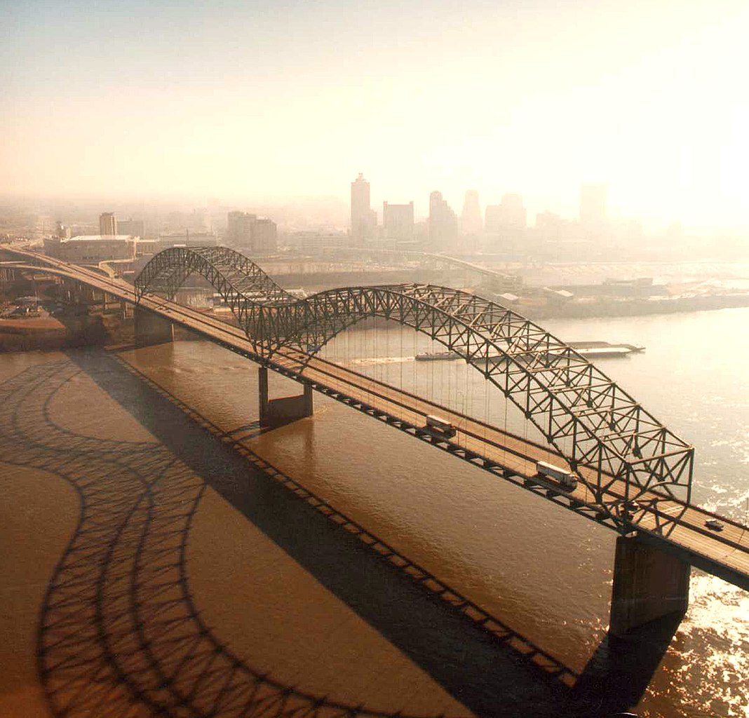
English: Aerial view of the Hernando de Soto Bridge across the Mississippi River between Memphis, Tennessee and West Memphis, Arkansas, USA. The bridge was opened in 1973 and carries six lanes of Interstate-40 across the river. View is from the Arkansas side to the east-southeast across the river to Memphis.
At thumbnail size, image appears clear, at the size on the image page small artifacts can be seen, but at 100% (actual size) the image is heavily artifacted with JPG compression blocks over the entire photograph. |
|||
| તારીખ | ||||
| સ્રોત |
U.S. Army Corps of Engineers Digital Visual Library Image page Image description page Digital Visual Library home page |
|||
| લેખક | Larry Donald, U.S. Army Corps of Engineers | |||
| પરવાનગી (આ ફાઈલનો ફરી ઉપયોગ) |
|
|||
| Location | Memphis, Tennessee, USA |
| Camera location | | View this and other nearby images on: OpenStreetMap |
|---|
ફાઇલનો ઇતિહાસ
તારીખ/સમય ઉપર ક્લિક કરવાથી તે સમયે ફાઇલ કેવી હતી તે જોવા મળશે.
| તારીખ/સમય | લઘુચિત્ર | પરિમાણો | સભ્ય | ટિપ્પણી | |
|---|---|---|---|---|---|
| વર્તમાન | ૦૭:૦૪, ૬ એપ્રિલ ૨૦૦૭ | | ૧,૫૦૦ × ૧,૪૩૮ (૩૯૧ KB) | DanMS | {{Information | Description = {{en|Aerial view of the Hernando de Soto Bridge across the Mississippi River between Memphis, Tennessee and West Memphis, Arkansas, USA. The bridge was opened in 1973 and carries six lanes of Interstate-40 across the river |
ફાઇલનો વપરાશ
આ ફાઇલ માં નીચેનું પાનું વપરાયેલું છે:
ફાઇલનો વ્યાપક ઉપયોગ
નીચેની બીજી વિકિઓ આ ફાઈલ વાપરે છે:
- ar.wikipedia.org પર વપરાશ
- arz.wikipedia.org પર વપરાશ
- ast.wikipedia.org પર વપરાશ
- bo.wikipedia.org પર વપરાશ
- cs.wikipedia.org પર વપરાશ
- de.wikipedia.org પર વપરાશ
- en.wikipedia.org પર વપરાશ
- Interstate 40
- Talk:List of longest arch bridge spans
- Wikipedia:What is a featured picture?/Examples of technical problems
- Image quality
- Interstate 40 in Tennessee
- Wikipedia:Featured picture candidates/January-2008
- Wikipedia:Featured picture candidates/Image:Hernando de Soto Bridge Memphis.jpg
- Culture of Memphis, Tennessee
- en.wikivoyage.org પર વપરાશ
- eo.wikipedia.org પર વપરાશ
- es.wikipedia.org પર વપરાશ
- fa.wikipedia.org પર વપરાશ
- fr.wikipedia.org પર વપરાશ
- fr.wikibooks.org પર વપરાશ
- fy.wikipedia.org પર વપરાશ
- gl.wikipedia.org પર વપરાશ
- hi.wikipedia.org પર વપરાશ
- hu.wikipedia.org પર વપરાશ
- id.wikipedia.org પર વપરાશ
- io.wikipedia.org પર વપરાશ
- ja.wikipedia.org પર વપરાશ
- la.wikipedia.org પર વપરાશ
- mr.wikipedia.org પર વપરાશ
- pl.wikipedia.org પર વપરાશ
- ru.wikipedia.org પર વપરાશ
- sh.wikipedia.org પર વપરાશ
- ta.wikipedia.org પર વપરાશ
આ ફાઇલના વધુ વૈશ્વિક વપરાશ જુઓ.