
ચિત્ર:LocationEurope.png

આ પૂર્વાવલોકનનું કદ: ૮૦૦ × ૪૦૭ પિક્સેલ. અન્ય આવર્તનો: ૩૨૦ × ૧૬૩ પિક્સેલ | ૬૪૦ × ૩૨૬ પિક્સેલ | ૧,૦૨૪ × ૫૨૧ પિક્સેલ | ૧,૨૮૦ × ૬૫૧ પિક્સેલ | ૨,૭૫૯ × ૧,૪૦૪ પિક્સેલ.
મૂળભુત ફાઇલ (૨,૭૫૯ × ૧,૪૦૪ પીક્સલ, ફાઇલનું કદ: ૯૯ KB, MIME પ્રકાર: image/png)

|
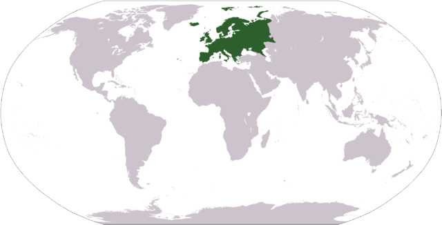
File:LocationEuropeGreen.svg is a vector version of this file. It should be used in place of this PNG file when not inferior.
File:LocationEurope.png → File:LocationEuropeGreen.svg
For more information, see Help:SVG. |
 |
| વર્ણન |
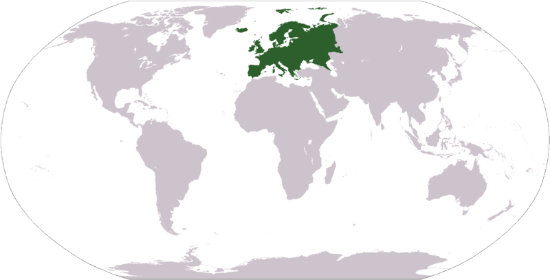
Deutsch: Weltkarte mit Fokus auf Europa.
English: World map depicting Europe.
Esperanto: Mondmapo bildiganta Eŭropon.
Español: Ubicación de Europa.
Українська: Карта світу, на якій виділена Європа.
Bahasa Indonesia: Peta dunia yang menyoroti Eropa. |
| તારીખ | |
| સ્રોત | own work - map adapted from PDF world map at CIA World Fact Book |
| લેખક | user:Cumhur |
| અન્ય આવૃત્તિઓ |
Derivative works of this file: Wikinews Europa mapa.png - |
This image is in the public domain because it contains materials that originally came from the United States Central Intelligence Agency's World Factbook.
|
 |
ફાઇલનો ઇતિહાસ
તારીખ/સમય ઉપર ક્લિક કરવાથી તે સમયે ફાઇલ કેવી હતી તે જોવા મળશે.
| તારીખ/સમય | લઘુચિત્ર | પરિમાણો | સભ્ય | ટિપ્પણી | |
|---|---|---|---|---|---|
| વર્તમાન | ૧૭:૧૨, ૨૮ સપ્ટેમ્બર ૨૦૦૮ | | ૨,૭૫૯ × ૧,૪૦૪ (૯૯ KB) | Aaker | Reverted to version as of 12:40, 19 January 2008 |
| ૦૦:૫૯, ૨૮ સપ્ટેમ્બર ૨૦૦૮ |  | ૨,૭૫૯ × ૧,૪૦૪ (૮૫ KB) | Octane | eurosocialist revisionism GTFO the definition of the continent | |
| ૧૮:૧૦, ૧૯ જાન્યુઆરી ૨૦૦૮ |  | ૨,૭૫૯ × ૧,૪૦૪ (૯૯ KB) | F l a n k e r | Transparency | |
| ૧૬:૦૬, ૩૧ જાન્યુઆરી ૨૦૦૭ |  | ૨,૭૫૯ × ૧,૪૦૪ (૫૬ KB) | FrancisTyers~commonswiki | Please do not change a widely used image without discussion beforehand. | |
| ૧૩:૫૦, ૩૧ જાન્યુઆરી ૨૦૦૭ |  | ૨,૭૫૯ × ૧,૪૦૪ (૮૪ KB) | Der Eberswalder | {{Information |Description= |Source= |Date= |Author=Der Eberswalder |Permission=Public Domain |other_versions= }} | |
| ૧૪:૨૮, ૮ એપ્રિલ ૨૦૦૬ |  | ૨,૭૫૯ × ૧,૪૦૪ (૫૬ KB) | E Pluribus Anthony~commonswiki | World map: Europe (location) | |
| ૦૪:૧૨, ૧૮ ડિસેમ્બર ૨૦૦૫ |  | ૨,૭૫૯ × ૧,૪૦૪ (૫૬ KB) | E Pluribus Anthony~commonswiki | World map: Europe (location) | |
| ૦૩:૫૯, ૧૮ ડિસેમ્બર ૨૦૦૫ |  | ૨,૭૫૯ × ૧,૪૦૪ (૫૬ KB) | E Pluribus Anthony~commonswiki | World map: Europe (location) | |
| ૦૨:૨૪, ૧૮ ડિસેમ્બર ૨૦૦૫ |  | ૨,૭૫૯ × ૧,૪૦૪ (૫૬ KB) | E Pluribus Anthony~commonswiki | World map: Europe (location) | |
| ૦૦:૫૬, ૪ નવેમ્બર ૨૦૦૫ |  | ૨,૭૫૯ × ૧,૪૦૪ (૫૬ KB) | E Pluribus Anthony~commonswiki | World map: Europe (location) |
ફાઇલનો વપરાશ
આ ફાઇલને કોઇ પાનાં વાપરતા નથી.
ફાઇલનો વ્યાપક ઉપયોગ
નીચેની બીજી વિકિઓ આ ફાઈલ વાપરે છે:
- am.wikipedia.org પર વપરાશ
- arc.wikipedia.org પર વપરાશ
- ar.wikipedia.org પર વપરાશ
- البحر الأبيض المتوسط
- آسيا
- أوروبا
- قارة
- المحيط الهندي
- المحيط الهادئ
- القارة القطبية الجنوبية
- أوقيانوسيا
- أمريكا الشمالية
- أمريكا الجنوبية
- لسانيات أوروبا
- أوروبا الشرقية
- القطب الشمالي
- أوروبا الوسطى
- أوروبا الشمالية
- القوقاز
- شمال إفريقيا
- بحر
- أغسطس 2005
- المنطقة القطبية الجنوبية
- المحيط المتجمد الشمالي
- القرن الإفريقي
- يوروبوب
- غرب آسيا
- آسيا الوسطى
- جنوب آسيا
- شرق آسيا
- جنوب شرق آسيا
- المحيط الجنوبي
આ ફાઇલના વધુ વૈશ્વિક વપરાશ જુઓ.